File:OSIRIS-REx expected landing area map.jpg
Jump to navigation
Jump to search

Size of this preview: 800 × 450 pixels. Other resolutions: 320 × 180 pixels | 640 × 360 pixels | 1,024 × 576 pixels | 1,280 × 720 pixels | 2,560 × 1,440 pixels | 3,840 × 2,160 pixels.
Original file (3,840 × 2,160 pixels, file size: 814 KB, MIME type: image/jpeg)
Captions
Captions
Add a one-line explanation of what this file represents
Summary
[edit]
| Description |
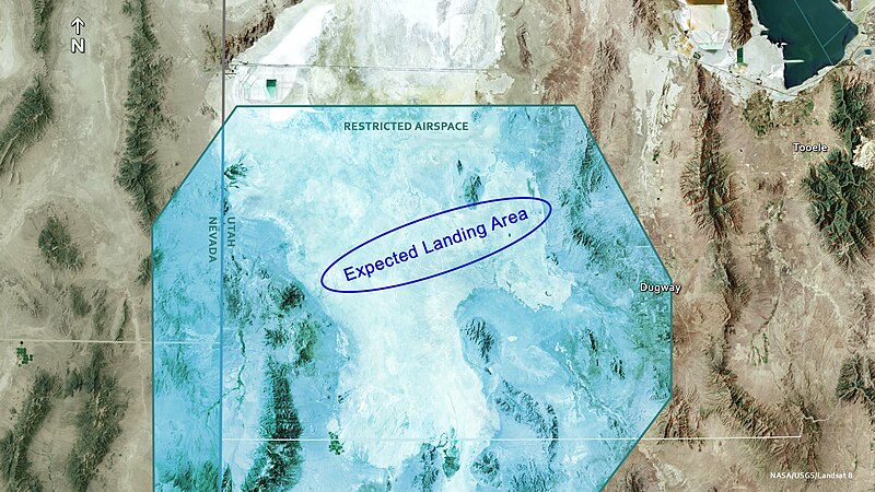
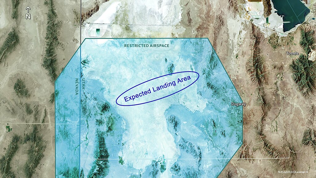
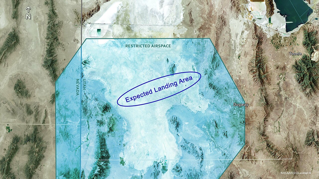
English: Map of Utah's West Desert and the expected landing area for the OSIRIS-REx sample return capsule. The capsule is expected to touch down in restricted airspace, on a vast salt flat stretching from Gold Hill in the west to Wig Mountain in the east. |
| Date | |
| Source | https://svs.gsfc.nasa.gov/cgi-bin/details.cgi?aid=14384 |
| Author | NASA/USGS/Landsat 8 |
Licensing
[edit]
| This file is in the public domain in the United States because it was solely created by NASA. NASA copyright policy states that "NASA material is not protected by copyright unless noted". (See Template:PD-USGov, NASA copyright policy page or JPL Image Use Policy.) | ||
 |
Warnings:
|
This image is in the public domain in the United States because it only contains materials that originally came from the United States Geological Survey, an agency of the United States Department of the Interior. For more information, see the official USGS copyright policy.
|
File history
Click on a date/time to view the file as it appeared at that time.
| Date/Time | Thumbnail | Dimensions | User | Comment | |
|---|---|---|---|---|---|
| current | 19:43, 24 September 2023 | | 3,840 × 2,160 (814 KB) | Isochrone (talk | contribs) | Uploaded a work by NASA/USGS/Landsat 8 from https://svs.gsfc.nasa.gov/cgi-bin/details.cgi?aid=14384 with UploadWizard |
You cannot overwrite this file.
File usage on Commons
There are no pages that use this file.
File usage on other wikis
The following other wikis use this file:
- Usage on ar.wikipedia.org
- Usage on en.wikipedia.org
- Usage on fa.wikipedia.org