File:Nuria--Coll-Finestrelles.jpg

Original file (4,624 × 3,472 pixels, file size: 4.51 MB, MIME type: image/jpeg)
Captions
Captions
Summary
[edit]
| Description |
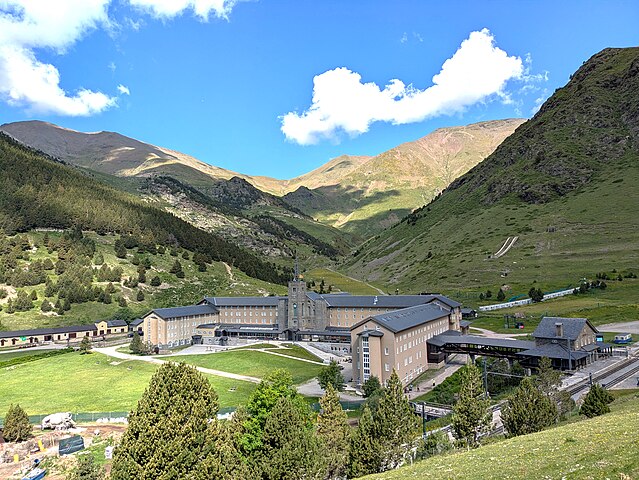
English: Núria is at an altitude of about 2000 metres; the col above, which is on the frontier with France, is at an altitude of about 2600 metres.
The valley between the col and Núria follows the line of the "Faille de Nuria" (a Neogene normal fault which is a continuation of the Finestrelles fault on the French side). |
| Date | |
| Source | Own work |
| Author | Alan Mattingly |
| Camera location | | View this and other nearby images on: OpenStreetMap |
|---|
Licensing
[edit]
| This file is made available under the Creative Commons CC0 1.0 Universal Public Domain Dedication. | |
| The person who associated a work with this deed has dedicated the work to the public domain by waiving all of their rights to the work worldwide under copyright law, including all related and neighboring rights, to the extent allowed by law. You can copy, modify, distribute and perform the work, even for commercial purposes, all without asking permission.
|
File history
Click on a date/time to view the file as it appeared at that time.
| Date/Time | Thumbnail | Dimensions | User | Comment | |
|---|---|---|---|---|---|
| current | 20:45, 14 July 2024 | | 4,624 × 3,472 (4.51 MB) | Alan Mattingly (talk | contribs) | Uploaded own work with UploadWizard |
You cannot overwrite this file.
File usage on Commons
There are no pages that use this file.
File usage on other wikis
The following other wikis use this file:
- Usage on en.wikipedia.org