File:Nunavut Kivalliq Region.png
Jump to navigation
Jump to search
No higher resolution available.
Nunavut_Kivalliq_Region.png (320 × 425 pixels, file size: 11 KB, MIME type: image/png)
Captions
Captions
Add a one-line explanation of what this file represents
Summary
[edit]
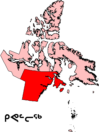
| Description | Map of Kivalliq Region in Nunavut, Canada |
| Date | |
| Source | English Wikipedia |
| Author | en:User:Keith Edkins |
| Permission (Reusing this file) |
GFDL content from English Wikipedia |
Licensing
[edit]
| This file is licensed under the Creative Commons Attribution-Share Alike 3.0 Unported license. Subject to disclaimers. | ||
| ||
| This licensing tag was added to this file as part of the GFDL licensing update. |

|
Permission is granted to copy, distribute and/or modify this document under the terms of the GNU Free Documentation License, Version 1.2 or any later version published by the Free Software Foundation; with no Invariant Sections, no Front-Cover Texts, and no Back-Cover Texts. A copy of the license is included in the section entitled GNU Free Documentation License. Subject to disclaimers. |
File history
Click on a date/time to view the file as it appeared at that time.
| Date/Time | Thumbnail | Dimensions | User | Comment | |
|---|---|---|---|---|---|
| current | 19:58, 16 August 2006 | | 320 × 425 (11 KB) | TeVe (talk | contribs) | {{Information |Description=Map of Kivalliq Region in Nunavut, Canada |Source=[http://en.wikipedia.org/wiki/Image:Nunavut_Kivalliq_Region.png English Wikipedia] |Date=2 August 2004 |Author=en:User:Keith Edkins |Permission=GFDL content from English Wik |
You cannot overwrite this file.
File usage on Commons
The following page uses this file:
File usage on other wikis
The following other wikis use this file:
- Usage on ar.wikipedia.org
- Usage on ast.wikipedia.org
- Usage on ca.wikipedia.org
- Usage on de.wikipedia.org
- Usage on en.wikipedia.org
- Kasba Lake
- Qikiqtaaluk (Foxe Basin)
- Nagjuttuuq
- Baker Lake (Nunavut)
- Wager Bay
- Aberdeen Lake (Nunavut)
- Keewatin Region
- Chesterfield Inlet
- Iqalugaarjuup Nunanga Territorial Park
- Cape Fullerton
- McConnell River Migratory Bird Sanctuary
- Beverly Lake (Nunavut)
- Yathkyed Lake
- Kaminak Lake
- Tavani, Nunavut
- Ferguson River (Nunavut)
- Comer Strait
- Frozen Strait
- Roes Welcome Sound
- Pitsiulartok
- Promise Island
- McConnell River
- Aiqqujat Islands
- Ascension Islands
- Inuujarvik Territorial Park
- Bell Peninsula
- Back Peninsula
- Mount Minto (Nunavut)
- Deer Island (Kivalliq Region)
- Boulder Island
- Centre Island (Nunavut)
- Camp Cove Island
- Iripajuk Island
- South Imilit Island
- North Imilit Island
- Moor Island
- Apqusiurniq Island
- Hanbury Island
- Rockhouse Island
- Akreavenek Island
- Pintail Island
- Reference Island
- South Midway Island
View more global usage of this file.