File:Nowy Dwór (gmina) location map.png
Jump to navigation
Jump to search

Size of this preview: 656 × 599 pixels. Other resolutions: 263 × 240 pixels | 525 × 480 pixels | 833 × 761 pixels.
Original file (833 × 761 pixels, file size: 158 KB, MIME type: image/png)
Captions
Captions
Add a one-line explanation of what this file represents
| Description |
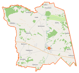
Polski: Mapa gminy Nowy Dwór, Polska
English: Map of Gmina Nowy Dwór, Poland |
|||||||||
| Date | ||||||||||
| Source | You may find a page on the OpenStreetMap wiki page for Nowy Dwór (gmina) | |||||||||
| Creator |
OpenStreetMap contributors OpenStreetMap contributors |
|||||||||
| Permission (Reusing this file) |
OpenStreetMap data is available under the Open Database License (details). Map tiles are licensed under the Creative Commons Attribution-ShareAlike 2.0 license (CC-BY-SA 2.0).
This file is licensed under the Creative Commons Attribution-Share Alike 2.0 Generic license.
|
|||||||||
| Geotemporal data | ||||||||||
| Bounding box |
|
|||||||||
| Georeferencing | If inappropriate please set warp_status = skip to hide. | |||||||||
File history
Click on a date/time to view the file as it appeared at that time.
| Date/Time | Thumbnail | Dimensions | User | Comment | |
|---|---|---|---|---|---|
| current | 10:12, 16 September 2014 | | 833 × 761 (158 KB) | VanWiel (talk | contribs) | {{Information |Description= |Source= |Date= |Author= |Permission= |other_versions= }} |
| 08:01, 26 June 2014 |  | 833 × 761 (164 KB) | VanWiel (talk | contribs) | {{OpenStreetMap | name = Nowy Dwór (gmina) | location = Nowy Dwór (gmina) | description = {{pl|Mapa gminy Nowy Dwór, Polska}} {{en|Map of Gmina Nowy Dwór, Poland}} | top = 53.7136 | left = 23.... |
You cannot overwrite this file.
File usage on Commons
There are no pages that use this file.
File usage on other wikis
The following other wikis use this file:
- Usage on nl.wikipedia.org
- Usage on pl.wikipedia.org
- Nowy Dwór (gmina)
- Bobra Wielka
- Bieniowce
- Bieniowce-Kolonia
- Butrymowce
- Chilmony
- Chorużowce
- Chworościany
- Dubaśno
- Grzebienie-Kolonia
- Jaginty
- Kudrawka
- Ponarlica
- Rogacze (powiat sokólski)
- Sieruciowce
- Synkowce
- Koniuszki (województwo podlaskie)
- Nowy Dwór (województwo podlaskie)
- Plebanowce (gmina Nowy Dwór)
- Chwojnowszczyzna
- Leśnica (województwo podlaskie)
- Talki (województwo podlaskie)
- Przejście graniczne Chworościany-Dubnica
- Parafia św. Mikołaja w Nowym Dworze
- Cerkiew św. Mikołaja w Nowym Dworze
- Parafia św. Jana Chrzciciela w Nowym Dworze
- Cmentarz żydowski w Nowym Dworze
- Cmentarz żydowski w Bieniowcach
- Chilmony-Kolonia
- Kościół św. Jana Chrzciciela w Nowym Dworze
- Bielany Białostockie
- Placówka Straży Granicznej w Nowym Dworze
- Moduł:Mapa/dane/Nowy Dwór (gmina)
- Ogrodniki (Nowy Dwór)
- Usage on pl.wikibooks.org
_location_map.png&oldid=519985861)