File:Nova Scotia DGJ 5583 (3830611365).jpg
Original file (2,886 × 4,313 pixels, file size: 7.92 MB, MIME type: image/jpeg)
Captions
Captions
Summary
[edit]| Description |
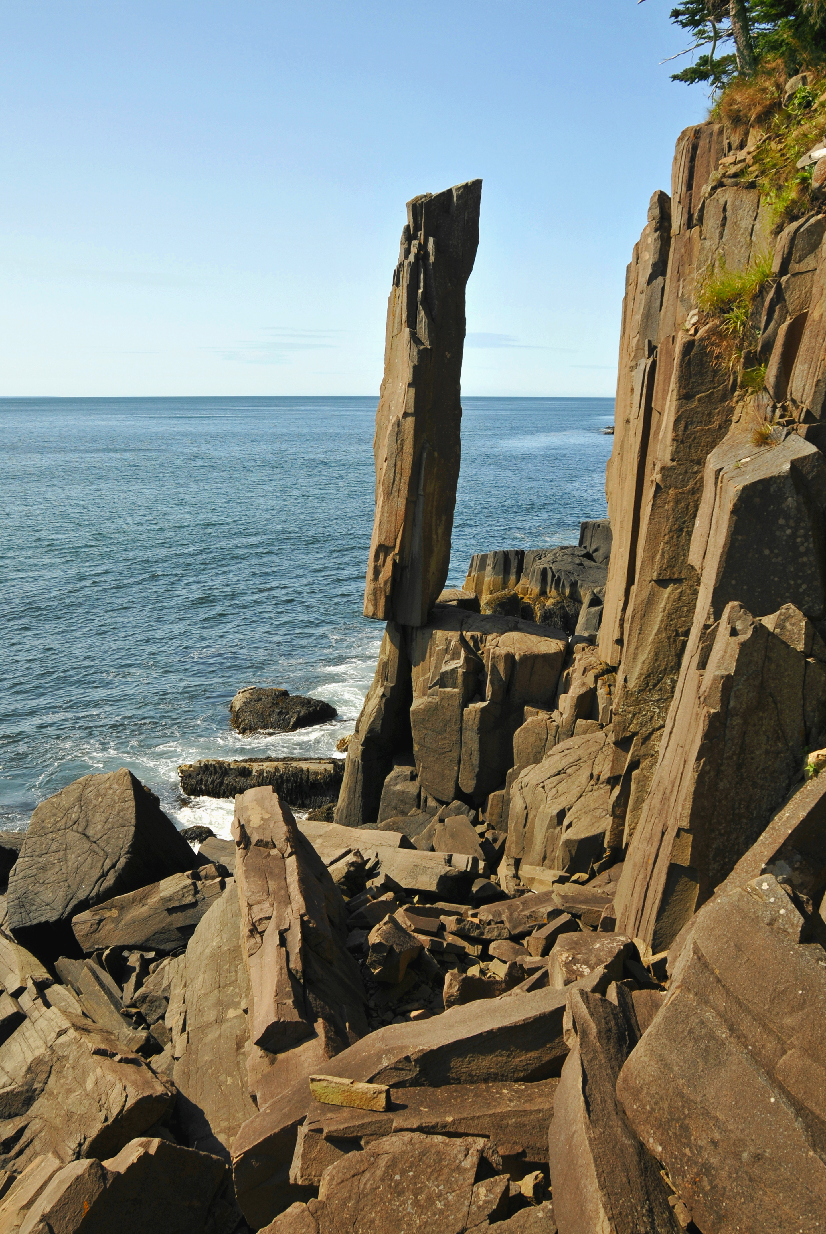
English: The phenomenal Balancing Rock is approximately four feet wide and twenty feet tall. A wonderful quirk of nature, this immense basalt column stands alone after many like it have dropped into the sea and the earth.
Roughly 200 million years ago Nova Scotia was located in the interior of the super-continent, Pangaea. Movements that began during the Triassic Period were so dramatic they eventually resulted in the break up of Pangaea into North and South America, Africa and the Atlantic Ocean. Today, when the earth's crust moves and shifts, we often witness changes of a similar magnitude caused by the devastating and destructive results of immense earthquakes and tsunamis. Deep beneath the Earth's crust (the lithosphere: a solid array of plates) is a layer of heated rock known as the asthenosphere. It is heated by the radioactive decay of elements such as uranium, thorium and potassium. This heat causes the ocean floors to continually move, shifting and separating from the center in different directions. The crustal portions of oceanic plates primarily consist of basalt. As the continents shifted, lava forced to the surface cooled and formed into columnar basalt sea stacks. These columns are usually six-sided, but can feature as few as three or as many as twelve (or more) sides. |
||||||||||||||
| Date | Taken on 8 August 2009, 10:40 | ||||||||||||||
| Source | https://www.flickr.com/photos/archer10/3830611365/ | ||||||||||||||
| Author |
|
||||||||||||||
.jpg)
.jpg&action=edit§ion=1)
| Camera location | | View this and other nearby images on: OpenStreetMap |
|---|
.jpg¶ms=044.322619_N_-066.255111_E_globe:Earth_type:camera_source:Flickr_&language=en)
Licensing
[edit].jpg&action=edit§ion=2)
- You are free:
- to share – to copy, distribute and transmit the work
- to remix – to adapt the work
- Under the following conditions:
- attribution – You must give appropriate credit, provide a link to the license, and indicate if changes were made. You may do so in any reasonable manner, but not in any way that suggests the licensor endorses you or your use.
- share alike – If you remix, transform, or build upon the material, you must distribute your contributions under the same or compatible license as the original.
| This image was originally posted to Flickr by archer10 (Dennis) 116M Views at https://flickr.com/photos/22490717@N02/3830611365 (archive). It was reviewed on 1 March 2018 by FlickreviewR 2 and was confirmed to be licensed under the terms of the cc-by-sa-2.0. |
File history
Click on a date/time to view the file as it appeared at that time.
| Date/Time | Thumbnail | Dimensions | User | Comment | |
|---|---|---|---|---|---|
| current | 02:41, 1 March 2018 | | 2,886 × 4,313 (7.92 MB) | Artix Kreiger 2 (talk | contribs) | Transferred from Flickr via Flickr2Commons |
You cannot overwrite this file.
File usage on Commons
There are no pages that use this file.
File usage on other wikis
The following other wikis use this file:
- Usage on de.wikipedia.org
- Usage on en.wikipedia.org
- Usage on en.wikivoyage.org
- Usage on fr.wikipedia.org
.jpg&oldid=907313820)