File:Northern Ohio League Map.PNG
Jump to navigation
Jump to search
Size of this preview: 653 × 599 pixels. Other resolutions: 262 × 240 pixels | 523 × 480 pixels | 743 × 682 pixels.
Original file (743 × 682 pixels, file size: 27 KB, MIME type: image/png)
Captions
Captions
Add a one-line explanation of what this file represents
Summary
[edit]
| Description |
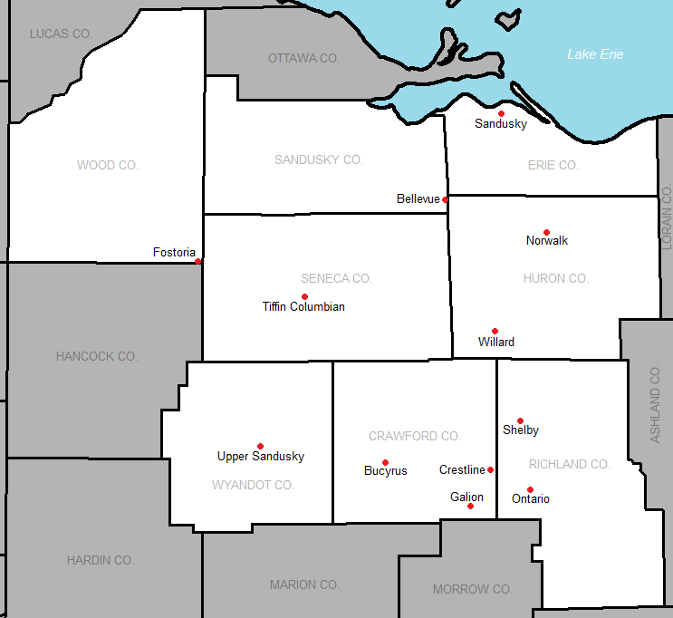
English: County outline made by the US Census. Modified by myself to show school locations. |
| Date | 4 August 2006 (original upload date) |
| Source | Transferred from en.wikipedia to Commons. |
| Author | The original uploader was Frank12 at English Wikipedia. |
Licensing
[edit]

|
Permission is granted to copy, distribute and/or modify this document under the terms of the GNU Free Documentation License, Version 1.2 or any later version published by the Free Software Foundation; with no Invariant Sections, no Front-Cover Texts, and no Back-Cover Texts. A copy of the license is included in the section entitled GNU Free Documentation License. |
| This file is licensed under the Creative Commons Attribution-Share Alike 3.0 Unported license. | ||
| ||
| This licensing tag was added to this file as part of the GFDL licensing update. |
Original upload log
[edit]
The original description page was here. All following user names refer to en.wikipedia.
| Date/Time | Dimensions | User | Comment |
|---|---|---|---|
| 2015-07-29 04:16 | 743×682× (32825 bytes) | Frank12 | Includes whole counties. |
| 2013-06-06 03:37 | 669×559× (27241 bytes) | Frank12 | made Ontario a current member |
| 2012-10-01 21:47 | 669×559× (27214 bytes) | Frank12 | removed Vermilion, who is no longer joining. |
| 2012-03-10 03:37 | 669×559× (27709 bytes) | Frank12 | added Ontario |
| 2011-11-08 01:35 | 669×559× (27197 bytes) | Frank12 | Added Vermilion |
| 2011-10-23 03:20 | 669×559× (26691 bytes) | Frank12 | Centered the labels for 2 counties. |
| 2011-10-23 03:03 | 669×559× (26788 bytes) | Frank12 | Altered to show the all-time members of the NOL. |
| 2006-08-04 13:03 | 655×425× (15121 bytes) | Frank12 | County outline made by the US Census. Modified by myself to show school locations. |
File history
Click on a date/time to view the file as it appeared at that time.
| Date/Time | Thumbnail | Dimensions | User | Comment | |
|---|---|---|---|---|---|
| current | 19:20, 19 June 2017 | | 743 × 682 (27 KB) | Frank12 (talk | contribs) | Changed all of the location dots to a red color. |
| 02:26, 16 May 2016 |  | 743 × 682 (32 KB) | OgreBot (talk | contribs) | (BOT): Reverting to most recent version before archival | |
| 02:26, 16 May 2016 |  | 669 × 559 (27 KB) | OgreBot (talk | contribs) | (BOT): Uploading old version of file from en.wikipedia; originally uploaded on 2013-06-06 03:37:50 by Frank12 | |
| 02:26, 16 May 2016 |  | 669 × 559 (27 KB) | OgreBot (talk | contribs) | (BOT): Uploading old version of file from en.wikipedia; originally uploaded on 2012-10-01 21:47:14 by Frank12 | |
| 02:26, 16 May 2016 |  | 669 × 559 (27 KB) | OgreBot (talk | contribs) | (BOT): Uploading old version of file from en.wikipedia; originally uploaded on 2012-03-10 03:37:06 by Frank12 | |
| 02:26, 16 May 2016 |  | 669 × 559 (27 KB) | OgreBot (talk | contribs) | (BOT): Uploading old version of file from en.wikipedia; originally uploaded on 2011-11-08 01:35:30 by Frank12 | |
| 02:26, 16 May 2016 |  | 669 × 559 (26 KB) | OgreBot (talk | contribs) | (BOT): Uploading old version of file from en.wikipedia; originally uploaded on 2011-10-23 03:20:06 by Frank12 | |
| 02:26, 16 May 2016 |  | 669 × 559 (26 KB) | OgreBot (talk | contribs) | (BOT): Uploading old version of file from en.wikipedia; originally uploaded on 2011-10-23 03:03:56 by Frank12 | |
| 02:26, 16 May 2016 |  | 655 × 425 (15 KB) | OgreBot (talk | contribs) | (BOT): Uploading old version of file from en.wikipedia; originally uploaded on 2006-08-04 13:03:23 by Frank12 | |
| 04:40, 25 April 2016 |  | 743 × 682 (32 KB) | FastilyClone (talk | contribs) | Transferred from enwp |
You cannot overwrite this file.
File usage on Commons
There are no pages that use this file.
File usage on other wikis
The following other wikis use this file:
- Usage on en.wikipedia.org
- Usage on www.wikidata.org