File:North Sea map-fi.png
Jump to navigation
Jump to search

Size of this preview: 479 × 600 pixels. Other resolutions: 192 × 240 pixels | 383 × 480 pixels | 613 × 768 pixels | 817 × 1,024 pixels | 2,475 × 3,100 pixels.
Original file (2,475 × 3,100 pixels, file size: 3.84 MB, MIME type: image/png)
Captions
Captions
Add a one-line explanation of what this file represents
Summary
[edit]
| Description |
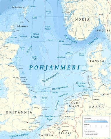
Suomi: Suomenkielinen Pohjanmeren kartta.
English: Map of the North Sea in Finnish. |
| Date | |
| Source |
Own work using GRASS GIS, Inkscape and GIMP. Data sources:
Map projection: Universal Transverse Mercator Typeface: Gentium Book Basic from SIL International |
| Author | Halava |
| Other versions |
  |
Licensing
[edit]
I, the copyright holder of this work, hereby publish it under the following licenses:
This file is licensed under the Creative Commons Attribution-Share Alike 3.0 Unported license.
- You are free:
- to share – to copy, distribute and transmit the work
- to remix – to adapt the work
- Under the following conditions:
- attribution – You must give appropriate credit, provide a link to the license, and indicate if changes were made. You may do so in any reasonable manner, but not in any way that suggests the licensor endorses you or your use.
- share alike – If you remix, transform, or build upon the material, you must distribute your contributions under the same or compatible license as the original.

|
Permission is granted to copy, distribute and/or modify this document under the terms of the GNU Free Documentation License, Version 1.2 or any later version published by the Free Software Foundation; with no Invariant Sections, no Front-Cover Texts, and no Back-Cover Texts. A copy of the license is included in the section entitled GNU Free Documentation License. |
You may select the license of your choice.
| Annotations | This image is annotated: View the annotations at Commons |
File history
Click on a date/time to view the file as it appeared at that time.
| Date/Time | Thumbnail | Dimensions | User | Comment | |
|---|---|---|---|---|---|
| current | 15:00, 15 October 2010 | | 2,475 × 3,100 (3.84 MB) | Halava (talk | contribs) | New place names |
| 17:45, 12 October 2010 |  | 2,475 × 3,100 (3.83 MB) | Halava (talk | contribs) | Some corrections; several new place names | |
| 11:19, 12 October 2010 |  | 2,475 × 3,100 (3.82 MB) | Halava (talk | contribs) | Minor corrections; improved legibility; Horns Rev | |
| 08:37, 10 October 2010 |  | 2,475 × 3,100 (3.75 MB) | Halava (talk | contribs) | Exclusive economic zones; Heligoland | |
| 09:21, 9 October 2010 |  | 2,475 × 3,100 (3.68 MB) | Halava (talk | contribs) | Lindisfarne; Norfolk Banks instead of Wells Bank | |
| 20:42, 8 October 2010 |  | 2,475 × 3,100 (3.67 MB) | Halava (talk | contribs) | Outlined Dogger Bank, fixed two typos | |
| 17:07, 8 October 2010 |  | 2,475 × 3,100 (3.65 MB) | Halava (talk | contribs) | Several improvements | |
| 11:13, 6 October 2010 |  | 2,475 × 3,100 (3.41 MB) | Halava (talk | contribs) | Switched color model back to RGB | |
| 09:57, 6 October 2010 |  | 2,475 × 3,100 (2.7 MB) | Halava (talk | contribs) | Fixed scale, indexed colors (reduced size) | |
| 19:12, 5 October 2010 |  | 2,475 × 3,100 (3.39 MB) | Halava (talk | contribs) | {{Information |Description={{fi|1=Suomenkielinen Pohjanmeren kartta.}} {{en|1=Map of North Sea in Finnish.}} |Source={{own}} using GRASS GIS, Inkscape and GIMP. Data sources: * Elevation and bathymetry data from NGDC ETOPO1 * Coastlines, rivers and borde |
You cannot overwrite this file.
File usage on Commons
The following 4 pages use this file:
File usage on other wikis
The following other wikis use this file:
- Usage on fi.wikipedia.org
- Usage on gd.wikipedia.org
- Usage on smn.wikipedia.org
- Usage on www.wikidata.org