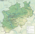
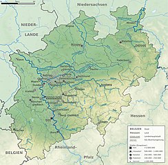
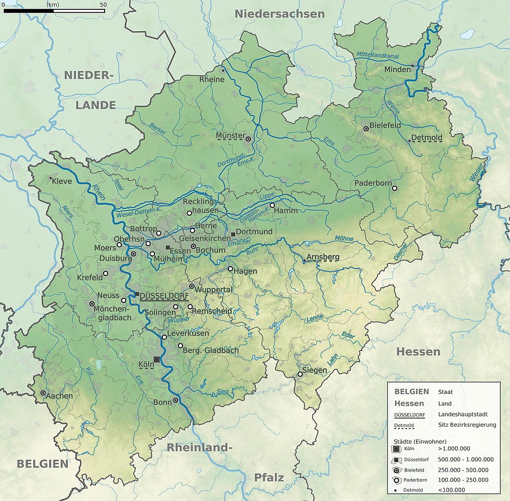
File:North Rhine-Westphalia topographic map 01.jpg
Jump to navigation
Jump to search

Size of this preview: 610 × 599 pixels. Other resolutions: 244 × 240 pixels | 489 × 480 pixels | 782 × 768 pixels | 1,043 × 1,024 pixels | 2,500 × 2,455 pixels.
Original file (2,500 × 2,455 pixels, file size: 1,011 KB, MIME type: image/jpeg)
Captions
Captions
Add a one-line explanation of what this file represents
Summary
[edit]{{Information |Description=
English: Topographic map of North Rhine-Westphalia, Germany.
Français : Carte topographique du land Rhénanie-du-Nord-Westphalie (Allemagne).
|Source=Own work
- File:North Rhine-Westphalia location map 02.svg by TUBS (Note: does not have the same geographic limits!)
- File:Location maps colorscale 3000.svg by Alexrk2
|Date=2009-12-21
|Author=TUBS![]()
![]() |other_versions=
[]
|other_versions=
[]
- Topographic and political maps of North Rhine-Westphalia
-
 Main towns and rivers (JPG)
 -
 Main mountain ranges, rivers and landscapes/ regions (JPG)
 -
 Rivers on relief (PNG)
 -
 Political entities (JPG)
 -
 Main towns and rivers (SVG for work purposes, may not render flawlessly. Contains all objects though.)
 -
 Main mountain ranges, rivers and landscapes/ regions (SVG for work purposes, may not render flawlessly. Contains all objects though.)
 -
 Political entities (SVG for work purposes, may not render flawlessly. Contains all objects though.)


Check out also the blank map versions for location purposes:
[]
- Location maps of North Rhine-Westphalia
-
 Main rivers and borders
 -
 Only borders
 -
 All vector objects visible
 -
 All vector objects w/o populated areas
 -
 Physical with hill shades
 -
 Physical w/o hill shades
 -
 Hill shades only
 -
 Physical with hill shades (JPG)
 -
→ derived, labeled labeled maps


| Object location | | View this and other nearby images on: OpenStreetMap |
|---|

|
File:North Rhine-Westphalia topographic map 01V.svg is a vector version of this file. It should be used in place of this JPG file when not inferior.
File:North Rhine-Westphalia topographic map 01.jpg → File:North Rhine-Westphalia topographic map 01V.svg
For more information, see Help:SVG. |
 |
Licensing
[edit]

|
Permission is granted to copy, distribute and/or modify this document under the terms of the GNU Free Documentation License, Version 1.2 or any later version published by the Free Software Foundation; with no Invariant Sections, no Front-Cover Texts, and no Back-Cover Texts. A copy of the license is included in the section entitled GNU Free Documentation License. |
This file is licensed under the Creative Commons Attribution 3.0 Unported, 2.5 Generic, 2.0 Generic and 1.0 Generic license.
Attribution: TUBS

- You are free:
- to share – to copy, distribute and transmit the work
- to remix – to adapt the work
- Under the following conditions:
- attribution – You must give appropriate credit, provide a link to the license, and indicate if changes were made. You may do so in any reasonable manner, but not in any way that suggests the licensor endorses you or your use.
This file is licensed under the Creative Commons Attribution-Share Alike 3.0 Unported, 2.5 Generic, 2.0 Generic and 1.0 Generic license.
Attribution: TUBS
- You are free:
- to share – to copy, distribute and transmit the work
- to remix – to adapt the work
- Under the following conditions:
- attribution – You must give appropriate credit, provide a link to the license, and indicate if changes were made. You may do so in any reasonable manner, but not in any way that suggests the licensor endorses you or your use.
- share alike – If you remix, transform, or build upon the material, you must distribute your contributions under the same or compatible license as the original.
| This file is made available under the Creative Commons CC0 1.0 Universal Public Domain Dedication. | |
| The person who associated a work with this deed has dedicated the work to the public domain by waiving all of their rights to the work worldwide under copyright law, including all related and neighboring rights, to the extent allowed by law. You can copy, modify, distribute and perform the work, even for commercial purposes, all without asking permission.
|
| I, the copyright holder of this work, release this work into the public domain. This applies worldwide. In some countries this may not be legally possible; if so: I grant anyone the right to use this work for any purpose, without any conditions, unless such conditions are required by law. |
| Copyleft: This work of art is free; you can redistribute it and/or modify it according to terms of the Free Art License. You will find a specimen of this license on the Copyleft Attitude site as well as on other sites. |

|
The copyright holder of this file, TUBS |
|
|
You may select the license of your choice.

|
I'd greatly appreciate, that you attribute this media file to Wikimedia Commons, if used outside Wikipedia or Commons. For use in publications such as books, newspapers, blogs, websites, please insert here the following line:
|
File history
Click on a date/time to view the file as it appeared at that time.
| Date/Time | Thumbnail | Dimensions | User | Comment | |
|---|---|---|---|---|---|
| current | 12:58, 13 January 2012 | | 2,500 × 2,455 (1,011 KB) | TUBS (talk | contribs) | corr |
| 03:22, 21 December 2009 |  | 2,400 × 2,357 (2.43 MB) | TUBS (talk | contribs) | == {{int:filedesc}} == {{Information |Description= {{de|Topografische Karte von Nordrhein-Westfalen, Germany.}} {{en|Topographic map of North Rhine-Westphalia, Germany. }} {{fr|Car |
You cannot overwrite this file.
File usage on Commons
The following 21 pages use this file:
- File:NRW cut 5.834–7.678°E, 50.453–52.515°N.png
- File:NRW cut 5.834–7.9546°E, 50.551–52.277°N2.png
- File:NRW relief cut 5.834–7.6046°E, 50.551–52.277°N.png
- File:NRW relief cut 5.834–8.718°E, 50.453–52.515°N.png
- File:North-Rhine-Westphalia-topographic-map-04.jpg
- File:North Rhine-Westphalia location map 01.svg
- File:North Rhine-Westphalia location map 02.svg
- File:North Rhine-Westphalia location map 03.svg
- File:North Rhine-Westphalia location map 04.svg
- File:North Rhine-Westphalia location map 05.svg
- File:North Rhine-Westphalia location map 06.svg
- File:North Rhine-Westphalia location map 07.svg
- File:North Rhine-Westphalia relief location map.jpg
- File:North Rhine-Westphalia topographic map 01.jpg
- File:North Rhine-Westphalia topographic map 01V.svg
- File:North Rhine-Westphalia topographic map 02.jpg
- File:North Rhine-Westphalia topographic map 02V.svg
- File:North Rhine-Westphalia topographic map 03.png
- File:North Rhine-Westphalia topographic map 04V.svg
- Template:Other versions/Location maps of North Rhine-Westphalia
- Template:Other versions/Topographical maps of North Rhine-Westphalia
File usage on other wikis
The following other wikis use this file:
- Usage on de.wikipedia.org
- Usage on de.wikisource.org
- Usage on es.wikipedia.org
- Usage on lb.wikipedia.org
- Usage on lmo.wikipedia.org
- Usage on no.wikipedia.org
- Usage on pdc.wikipedia.org