File:North Carolina Map Highlighting Johnston County.PNG
Jump to navigation
Jump to search
No higher resolution available.
North_Carolina_Map_Highlighting_Johnston_County.PNG (531 × 201 pixels, file size: 15 KB, MIME type: image/png)
Captions
Captions
Add a one-line explanation of what this file represents
Summary
[edit]
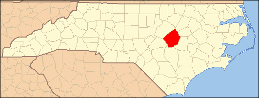
| Description | Locator Map of Johnston County, North Carolina, United States |
| Date | March 2007 and July 2007 |
| Source | taken from US Census website [1] and modified by User:Ruhrfisch and User:Dincher |
| Author | US Census, Ruhrfisch, Dincher |
| Permission (Reusing this file) |
US Census / US Government work is public domain, my modifications licensed under the GNU Free Documentation License |
Licensing
[edit]
I, Dincher, the copyright holder of this work, hereby publishes it under the following licenses:

|
Permission is granted to copy, distribute and/or modify this document under the terms of the GNU Free Documentation License, Version 1.2 or any later version published by the Free Software Foundation; with no Invariant Sections, no Front-Cover Texts, and no Back-Cover Texts. A copy of the license is included in the section entitled GNU Free Documentation License. |
| This file is licensed under the Creative Commons Attribution-Share Alike 3.0 Unported license. | ||
| Attribution: I, Dincher | ||
| ||
| This licensing tag was added to this file as part of the GFDL licensing update. |
This file is licensed under the Creative Commons Attribution-Share Alike 2.5 Generic license.
Attribution: I, Dincher
- You are free:
- to share – to copy, distribute and transmit the work
- to remix – to adapt the work
- Under the following conditions:
- attribution – You must give appropriate credit, provide a link to the license, and indicate if changes were made. You may do so in any reasonable manner, but not in any way that suggests the licensor endorses you or your use.
- share alike – If you remix, transform, or build upon the material, you must distribute your contributions under the same or compatible license as the original.
You may select the license of your choice.
File history
Click on a date/time to view the file as it appeared at that time.
| Date/Time | Thumbnail | Dimensions | User | Comment | |
|---|---|---|---|---|---|
| current | 04:27, 7 July 2007 | 531 × 201 (15 KB) | Gerry D (talk | contribs) | {{Information| |Description= Locator Map of Johnston County, North Carolina, United States |Source= taken from US Census website [http://factfinder.census.gov/] and modified by User:Ruhrfisch and User:Dincher |Date= March 2007 and July 2007 |Auth |
You cannot overwrite this file.
File usage on Commons
There are no pages that use this file.
File usage on other wikis
The following other wikis use this file:
- Usage on ar.wikipedia.org
- سميثفيلد
- كلايتون (كارولاينا الشمالية)
- فور أوكس (كارولاينا الشمالية)
- كينلي (كارولاينا الشمالية)
- ميكرو (كارولاينا الشمالية)
- بين ليفل (كارولاينا الشمالية)
- برنستون (كارولاينا الشمالية)
- سلمي (كارولاينا الشمالية)
- ويلسون إس ميلس (كارولاينا الشمالية)
- بنسون (كارولاينا الشمالية)
- قالب:مقاطعة جونستون (كارولاينا الشمالية)
- Usage on en.wikipedia.org
- Johnston County, North Carolina
- Benson, North Carolina
- Clayton, North Carolina
- Four Oaks, North Carolina
- Micro, North Carolina
- Pine Level, Johnston County, North Carolina
- Princeton, North Carolina
- Selma, North Carolina
- Smithfield, North Carolina
- West Smithfield, North Carolina
- Wilson's Mills, North Carolina
- Kenly, North Carolina
- Grabtown, Johnston County, North Carolina
- Template:Johnston County, North Carolina
- Willow Springs, North Carolina
- Archer Lodge, North Carolina
- Peacocks Crossroads, North Carolina
- Emit, North Carolina
- Flowers, North Carolina
- Jordan, North Carolina
- Powhatan, North Carolina
- McGee's Crossroads, North Carolina
- Hocutts Crossroads, North Carolina
- Stancils Chapel, North Carolina
- Cleveland, Johnston County, North Carolina
- User:Nyttend/County templates/NC/2
- National Register of Historic Places listings in Johnston County, North Carolina
- Category:Populated places in Johnston County, North Carolina
- Blackmans Crossroads, North Carolina
- Usage on uk.wikipedia.org
- Джонстон (округ, Північна Кароліна)
- Вікіпедія:Проєкт:Адміністративні одиниці країн світу/США/Північна Кароліна
- Бенсон (Північна Кароліна)
- Шаблон:Джонстон (округ, Північна Кароліна)
- Арчер-Лодж (Північна Кароліна)
- Клейтон (Північна Кароліна)
- Фор-Оукс (Північна Кароліна)
- Кенлі (Північна Кароліна)
- Майкро (Північна Кароліна)
- Пайн-Левел (округ Джонстон, Північна Кароліна)
View more global usage of this file.