File:North America from the French of Mr. D'Anville - improved with the back settlements of Virginia and course of Ohio - illustrated with geographical and historical remarks. NYPL489827.tiff
Jump to navigation
Jump to search

Size of this JPG preview of this TIF file: 678 × 599 pixels. Other resolutions: 272 × 240 pixels | 543 × 480 pixels | 869 × 768 pixels | 1,159 × 1,024 pixels | 2,317 × 2,048 pixels | 5,395 × 4,768 pixels.
Original file (5,395 × 4,768 pixels, file size: 50.48 MB, MIME type: image/tiff)
Captions
Captions
Add a one-line explanation of what this file represents
Summary
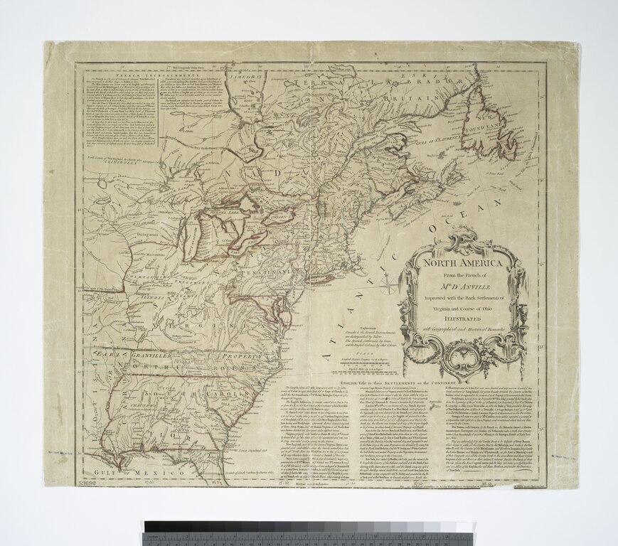
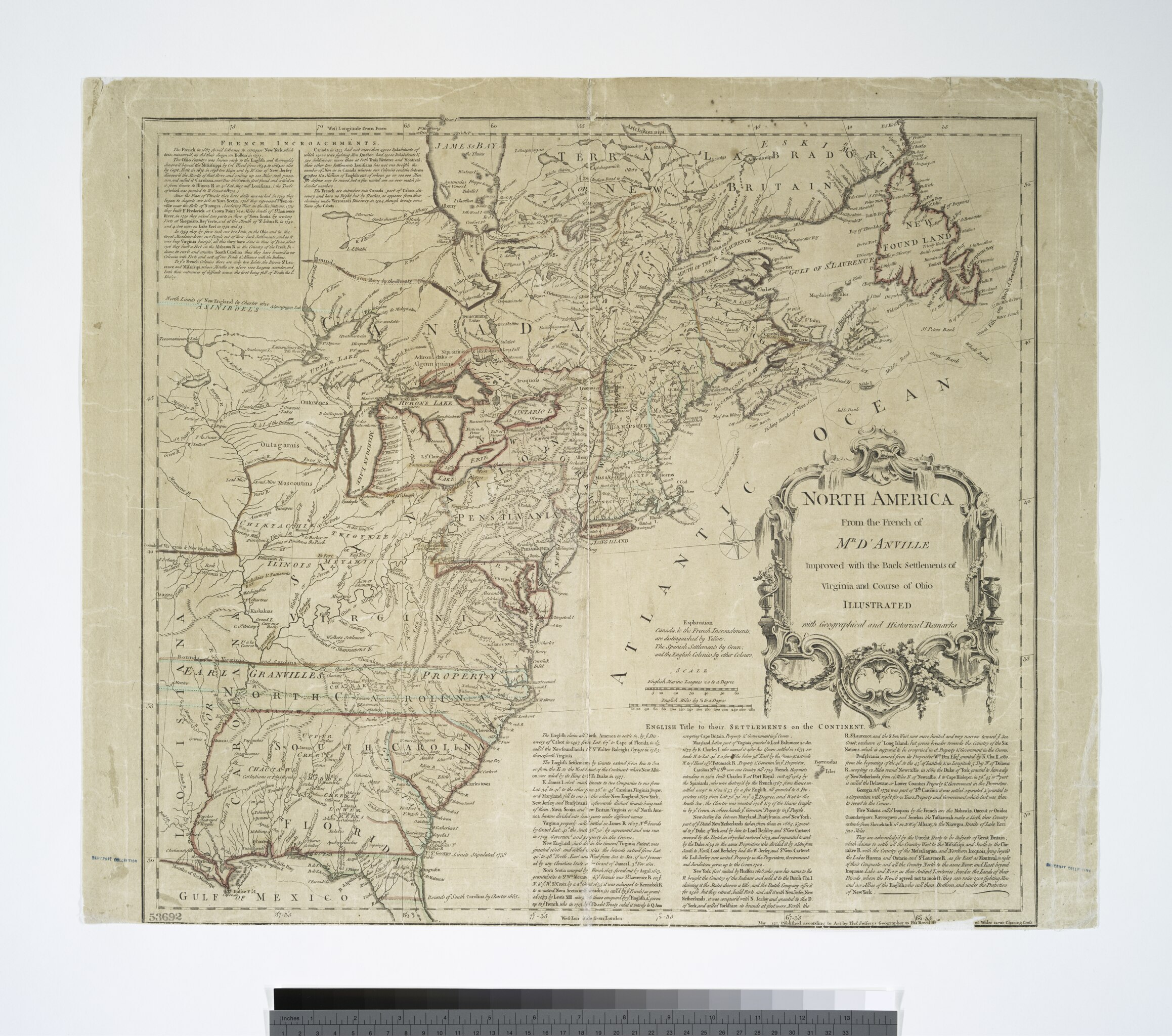
[edit]| Description | North America from the French of Mr. D'Anville : improved with the back settlements of Virginia and course of Ohio : illustrated with geographical and historical remarks.; Lawrence H. Slaughter Collection of English maps, charts, globes, books and atlases / Atlases / A summary, historical and political, of the first planting, progressive improvements, and present state of the British settlements in North-America ... By William Douglass, M.D. ... Boston, New-England, Printed: | |||||||||||||||||||||||
| Notes | "May 1755 published according to Act by Thos. Jefferys, geographer to His Royal Highness, the Prince of Wales near Charing Cross". ''Note 2.'') Covers the east coast from Labrador to northern Florida, and the interior as far west as the Mississippi Valley. ''Note 3.'') Includes decorative cartouche and texts: French incroachments -- English title to their settlements on the continent. ''Note 4.'') Prime meridians: Ferro and London. ''Note 5.'') Relief shown pictorially. ''Note 6.'') Lawrence H. Slaughter Collection ; 469. | |||||||||||||||||||||||
| Catalogue call number | Map Div. 97-6220 (Vol. 1, map facing t.p.) [In LHS 3019] | |||||||||||||||||||||||
| Item physical description | 1 map : hand col. ; 46 x 49 cm. folded to 20 x 12 cm. | |||||||||||||||||||||||
| Standard reference | Sabin, 20727 | |||||||||||||||||||||||
| Date | ||||||||||||||||||||||||
| Source |
http://digitalgallery.nypl.org/nypldigital/dgkeysearchdetail.cfm?imageID=489827
|
|||||||||||||||||||||||
| Author | William, ca. 1700-1752 -- Cartographer Douglass | |||||||||||||||||||||||
| Permission (Reusing this file) |
From The Lionel Pincus and Princess Firyal Map Division. http://maps.nypl.org
|
|||||||||||||||||||||||
| Source description | 2 v. ; 20.5 cm. | |||||||||||||||||||||||
| Location | Stephen A. Schwarzman Building / The Lionel Pincus and Princess Firyal Map Division | |||||||||||||||||||||||
| Digital item published | 2-26-2005; updated 1-9-2012 | |||||||||||||||||||||||
| Digital ID | 489827 | |||||||||||||||||||||||

The making of this file was supported by Wikimedia UK.
To see other files made with the support of Wikimedia UK, please see the category Supported by Wikimedia UK.
|
File history
Click on a date/time to view the file as it appeared at that time.
| Date/Time | Thumbnail | Dimensions | User | Comment | |
|---|---|---|---|---|---|
| current | 17:53, 13 August 2015 |  | 5,395 × 4,768 (50.48 MB) | Finavon (talk | contribs) | rotated |
| 16:37, 2 May 2014 |  | 4,768 × 5,395 (73.6 MB) | Fæ (talk | contribs) | GWToolset:: Creating mediafile for Fæ. Tranche 3 11591-16518 @ 2 May, 06:47 BST |
You cannot overwrite this file.
File usage on Commons
There are no pages that use this file.