File:Norda flughaveno de Tenerifo, panoramo, 1.jpeg
Jump to navigation
Jump to search

Size of this preview: 800 × 170 pixels. Other resolutions: 320 × 68 pixels | 640 × 136 pixels | 1,024 × 217 pixels | 4,032 × 856 pixels.
Original file (4,032 × 856 pixels, file size: 668 KB, MIME type: image/jpeg)
Captions
Captions
Add a one-line explanation of what this file represents
Summary
[edit]
| Description |
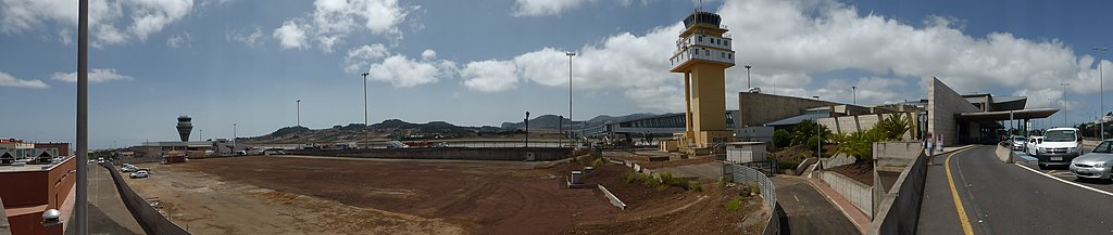
Deutsch: Panorama des Flughafens Teneriffa Nord (Los Rodeos).
Esperanto: Panorama vido de la Flughaveno Norda de Tenerifo (ES; iam "Los Rodeos").
Español: Vista panorámica del aeropuerto de Tenerife Norte (Los Rodeos). |
| Date | |
| Source | Self-photographed |
| Author | Aisano |
| Camera location | | View this and other nearby images on: OpenStreetMap |
|---|
| This is a retouched picture, which means that it has been digitally altered from its original version. Modifications: Personen und Autonummern verpixelt / bilderegumis personojn kaj aŭtoŝildojn / pixelización de personas y matrículas.
|

|
NOTE: This image is a panorama consisting of multiple frames that were merged or stitched in software. As a result, this image necessarily underwent some form of digital manipulation. These manipulations may include blending, blurring, cloning, and colour and perspective adjustments. As a result of these adjustments, the image content may be slightly different from reality at the points where multiple images were combined. This manipulation is often required due to lens, perspective, and parallax distortions.
|
Licensing
[edit]
I, the copyright holder of this work, hereby publish it under the following licenses:

|
Permission is granted to copy, distribute and/or modify this document under the terms of the GNU Free Documentation License, Version 1.2 or any later version published by the Free Software Foundation; with no Invariant Sections, no Front-Cover Texts, and no Back-Cover Texts. A copy of the license is included in the section entitled GNU Free Documentation License. |
This file is licensed under the Creative Commons Attribution-Share Alike 3.0 Unported, 2.5 Generic, 2.0 Generic and 1.0 Generic license.
- You are free:
- to share – to copy, distribute and transmit the work
- to remix – to adapt the work
- Under the following conditions:
- attribution – You must give appropriate credit, provide a link to the license, and indicate if changes were made. You may do so in any reasonable manner, but not in any way that suggests the licensor endorses you or your use.
- share alike – If you remix, transform, or build upon the material, you must distribute your contributions under the same or compatible license as the original.
You may select the license of your choice.
File history
Click on a date/time to view the file as it appeared at that time.
| Date/Time | Thumbnail | Dimensions | User | Comment | |
|---|---|---|---|---|---|
| current | 21:23, 18 September 2013 | 4,032 × 856 (668 KB) | Renardo la vulpo (talk | contribs) | {{Information |Description ={{de|1=Panorama des Flughafens Teneriffa Nord (Los Rodeos).}} {{eo|1=Panorama vido de la Flughaveno Norda de Tenerifo (ES; iam "Los Rodeos").}} {{es|1=Vista panorámica del aeropuerto de Tenerife Norte (Los Rodeos).}} |So... |
You cannot overwrite this file.
File usage on Commons
The following page uses this file: