File:Niue 1946 UK nautical chart - administrative boundaries added.jpg
Jump to navigation
Jump to search

Size of this preview: 508 × 599 pixels. Other resolutions: 203 × 240 pixels | 407 × 480 pixels | 651 × 768 pixels | 868 × 1,024 pixels | 2,107 × 2,486 pixels.
Original file (2,107 × 2,486 pixels, file size: 1.15 MB, MIME type: image/jpeg)
Captions
Captions
Add a one-line explanation of what this file represents
Summary
[edit]
| Description |
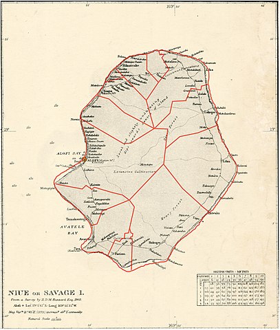
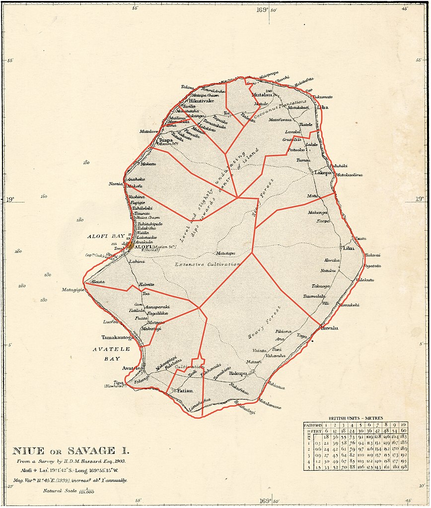
English: crop of Niue, from Nautical Chart: Plans of Islands in the South Pacific |
| Date | |
| Source | https://nla.gov.au/nla.obj-574969774/view (crop) |
| Author | Great Britain. Hydrographic Department |
Licensing
[edit]
This work created by the United Kingdom Government is in the public domain.
This is because it is one of the following:
HMSO has declared that the expiry of Crown Copyrights applies worldwide (ref: HMSO Email Reply)
|
 |
File history
Click on a date/time to view the file as it appeared at that time.
| Date/Time | Thumbnail | Dimensions | User | Comment | |
|---|---|---|---|---|---|
| current | 23:39, 2 February 2019 | | 2,107 × 2,486 (1.15 MB) | C21H22N2O2 (talk | contribs) | Jetzt mit den Grenzen, wie gewünscht. |
| 18:46, 2 February 2019 |  | 5,219 × 6,194 (21.63 MB) | Ratzer (talk | contribs) | File:Niue 1946 UK nautical chart.jpg cropped 1 % horizontally using CropTool with lossless mode. |
You cannot overwrite this file.
File usage on Commons
There are no pages that use this file.
File usage on other wikis
The following other wikis use this file:
- Usage on de.wikipedia.org