File:Nile Flood plain limits (2009).jpg
Jump to navigation
Jump to search
Size of this preview: 800 × 533 pixels. Other resolutions: 320 × 213 pixels | 640 × 427 pixels | 1,024 × 683 pixels | 1,280 × 853 pixels | 2,560 × 1,707 pixels | 3,888 × 2,592 pixels.
Original file (3,888 × 2,592 pixels, file size: 7.34 MB, MIME type: image/jpeg)
Captions
Captions
Add a one-line explanation of what this file represents
Summary
[edit].jpg&action=edit§ion=1)
| Description |
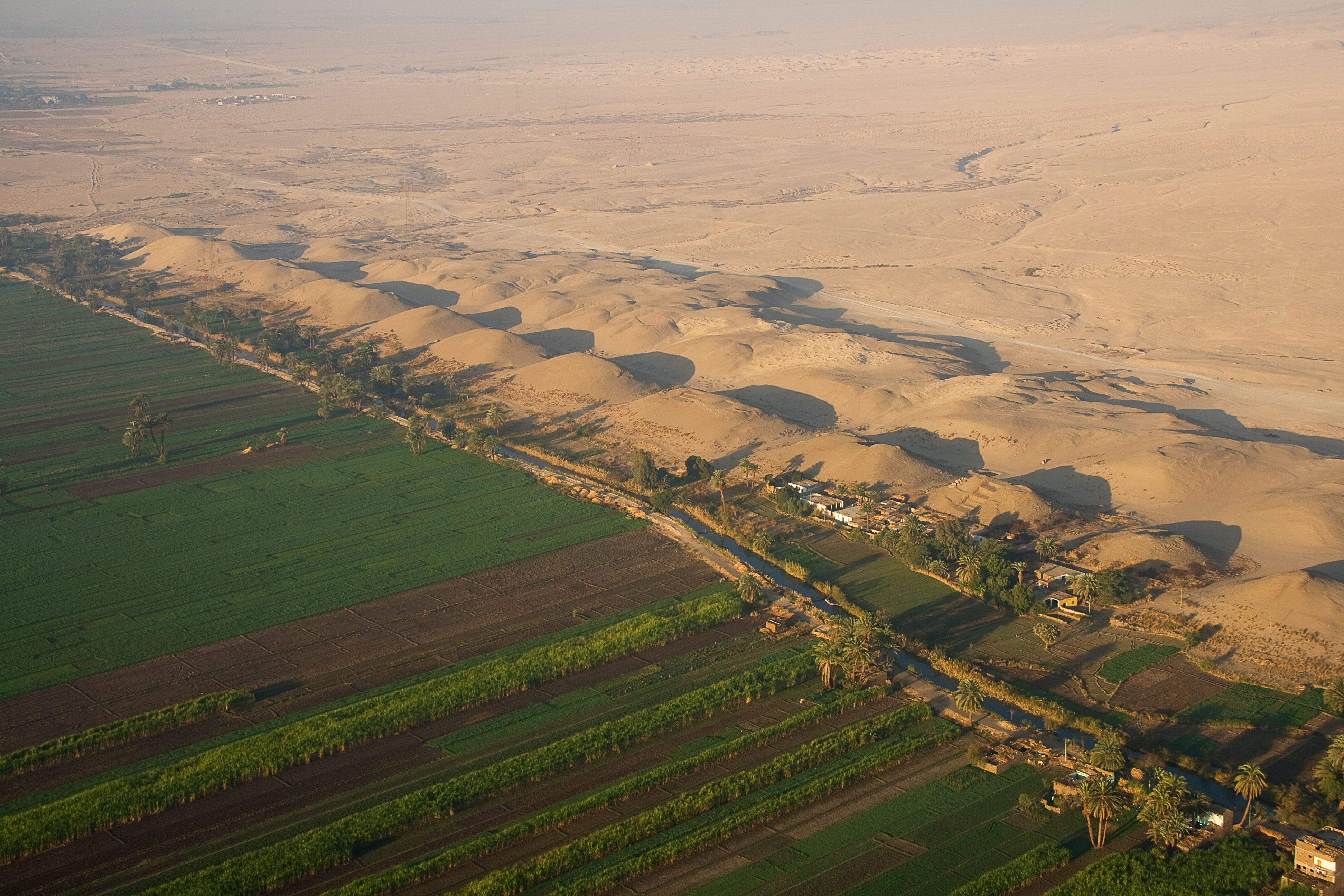
English: This aerial photograph starkly shows the historical limits of the Nile floodplain and the desert beyond. The floodplain's limits or borders have not changed with the construction of the Great Aswan Dam. Soil located beyond the green floodplain is of poor quality and cannot produce any crops. |
| Date | |
| Source | https://www.flickr.com/photos/waldenpond/4241812718/in/set-72157623122095180/ |
| Author | Andrew® |
Licensing
[edit].jpg&action=edit§ion=2)
This file is licensed under the Creative Commons Attribution 2.0 Generic license.
- You are free:
- to share – to copy, distribute and transmit the work
- to remix – to adapt the work
- Under the following conditions:
- attribution – You must give appropriate credit, provide a link to the license, and indicate if changes were made. You may do so in any reasonable manner, but not in any way that suggests the licensor endorses you or your use.
| This image was originally posted to Flickr by Andrew® at https://www.flickr.com/photos/20910509@N04/4241812718. It was reviewed on 22 March 2010 by FlickreviewR and was confirmed to be licensed under the terms of the cc-by-2.0. |
File history
Click on a date/time to view the file as it appeared at that time.
| Date/Time | Thumbnail | Dimensions | User | Comment | |
|---|---|---|---|---|---|
| current | 05:03, 22 March 2010 | | 3,888 × 2,592 (7.34 MB) | Leoboudv (talk | contribs) | {{Information |Description={{en|1=This aerial photograph starkly shows the historical limits of the Nile floodplain and the desert beyond. The floodplain's limits or borders have not changed with the construction of the Great Aswan Dam. Soil located beyon |
You cannot overwrite this file.
File usage on Commons
There are no pages that use this file.
.jpg&oldid=640170309)