File:Nikko station.jpg
Jump to navigation
Jump to search
Size of this preview: 800 × 533 pixels. Other resolutions: 320 × 213 pixels | 640 × 427 pixels | 1,024 × 682 pixels | 1,280 × 853 pixels.
Original file (1,280 × 853 pixels, file size: 416 KB, MIME type: image/jpeg)
Captions
Captions
Add a one-line explanation of what this file represents
Summary
[edit]
| Description |
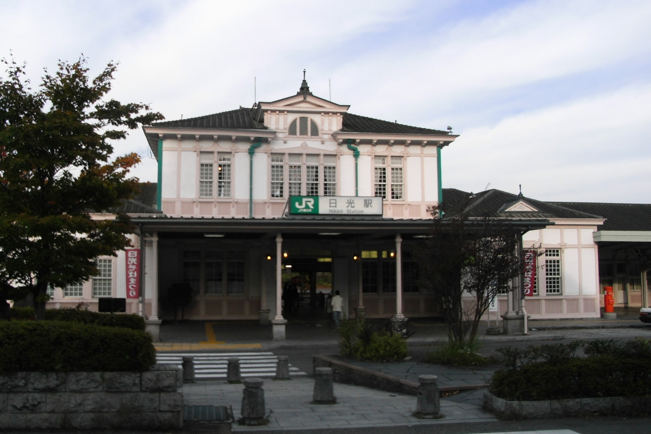
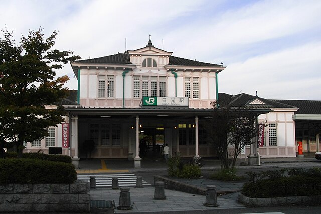
日本語: 栃木県日光市相生町、東日本旅客鉄道日光線日光駅。 English: Nikkō Station in Nikkō, Tochigi Prefecture, Japan. |
| Date | |
| Source | JR日光駅 |
| Author | Yamaguchi Yoshiaki |
| Camera location | | View this and other nearby images on: OpenStreetMap |
|---|
Licensing
| This image was originally posted to Flickr by woinary at https://www.flickr.com/photos/37807125@N00/3034915308. It was reviewed on 13 October 2011 by FlickreviewR and was confirmed to be licensed under the terms of the cc-by-sa-2.0. |
This file is licensed under the Creative Commons Attribution-Share Alike 2.0 Generic license.
- You are free:
- to share – to copy, distribute and transmit the work
- to remix – to adapt the work
- Under the following conditions:
- attribution – You must give appropriate credit, provide a link to the license, and indicate if changes were made. You may do so in any reasonable manner, but not in any way that suggests the licensor endorses you or your use.
- share alike – If you remix, transform, or build upon the material, you must distribute your contributions under the same or compatible license as the original.
File history
Click on a date/time to view the file as it appeared at that time.
| Date/Time | Thumbnail | Dimensions | User | Comment | |
|---|---|---|---|---|---|
| current | 13:14, 13 October 2011 | | 1,280 × 853 (416 KB) | Rfyuya (talk | contribs) | =={{int:filedesc}}== {{Information |description={{ja|1=栃木県日光市相生町、東日本旅客鉄道日光線日光駅。}}{{en|1=Nikkō Station in Nikkō, Tochigi Prefecture, Japan.}} |date=2008-11-02 |source=[http://www.flickr.com/photos/woinary/3 |
| 15:02, 2 November 2005 |  | 800 × 600 (81 KB) | Saniboh (talk | contribs) | Saniboh 2005.11.1 |
You cannot overwrite this file.
File usage on Commons
The following page uses this file:
File usage on other wikis
The following other wikis use this file:
- Usage on it.wikivoyage.org