File:Niederösterreich Dürre Wand - Hutberg Gelände Rastkreuz (290513).jpg
Jump to navigation
Jump to search

Size of this preview: 800 × 530 pixels. Other resolutions: 320 × 212 pixels | 640 × 424 pixels | 1,024 × 678 pixels | 1,280 × 848 pixels | 2,560 × 1,695 pixels | 3,269 × 2,165 pixels.
Original file (3,269 × 2,165 pixels, file size: 5.67 MB, MIME type: image/jpeg)
Captions
Captions
Add a one-line explanation of what this file represents
Summary
[edit]| Description |
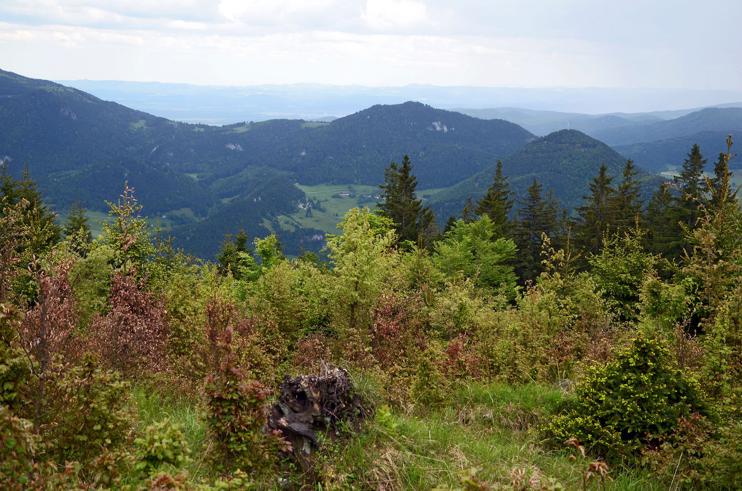
Deutsch: Niederösterreich, Miesenbach, Dürre Wand. Blick auf Hutberg (971 m, Marktgemeinde Puchberg am Schneeberg; im Bild Mitte rechts), Gelände (1.023 m, Marktgemeinde Grünbach am Schneeberg; links hinter Hutberg), Rastkreuz-Sattel (868 m, MG Grünbach a. S.; tiefster Punkt der Bergkette links vom Gelände – danach Anstieg zu Plackles, Hohe-Wand-Plateau) |
| Date | |
| Source | Own work |
| Author | Earnest B |
| Annotations | This image is annotated: View the annotations at Commons |

.jpg&action=edit§ion=1)
.jpg)
.jpg&action=edit§ion=2)
File history
Click on a date/time to view the file as it appeared at that time.
| Date/Time | Thumbnail | Dimensions | User | Comment | |
|---|---|---|---|---|---|
| current | 10:18, 22 June 2013 | | 3,269 × 2,165 (5.67 MB) | Earnest B (talk | contribs) | {{Information |Description ={{de|1=Niederösterreich, Miesenbach, Dürre Wand. Blick auf Hutberg (971 m, Marktgemeinde Puchberg am Schneeberg; im Bild Mitte rechts), Gelände (1.023 m, Marktgemeinde Grünbach am Schneeberg; links hinter Hutberg), Ra... |
You cannot overwrite this file.
File usage on Commons
There are no pages that use this file.
File usage on other wikis
The following other wikis use this file:
- Usage on de.wikipedia.org
.jpg&oldid=427060222)