File:Nicholas County 1933.jpg
Jump to navigation
Jump to search

Size of this preview: 792 × 600 pixels. Other resolutions: 317 × 240 pixels | 634 × 480 pixels | 1,014 × 768 pixels | 1,280 × 970 pixels | 2,560 × 1,939 pixels | 3,249 × 2,461 pixels.
Original file (3,249 × 2,461 pixels, file size: 1.56 MB, MIME type: image/jpeg)
Captions
Captions
Add a one-line explanation of what this file represents
Summary
[edit]| Warning | The original file is very high-resolution. It might not load properly or could cause your browser to freeze when opened at full size. |
|---|
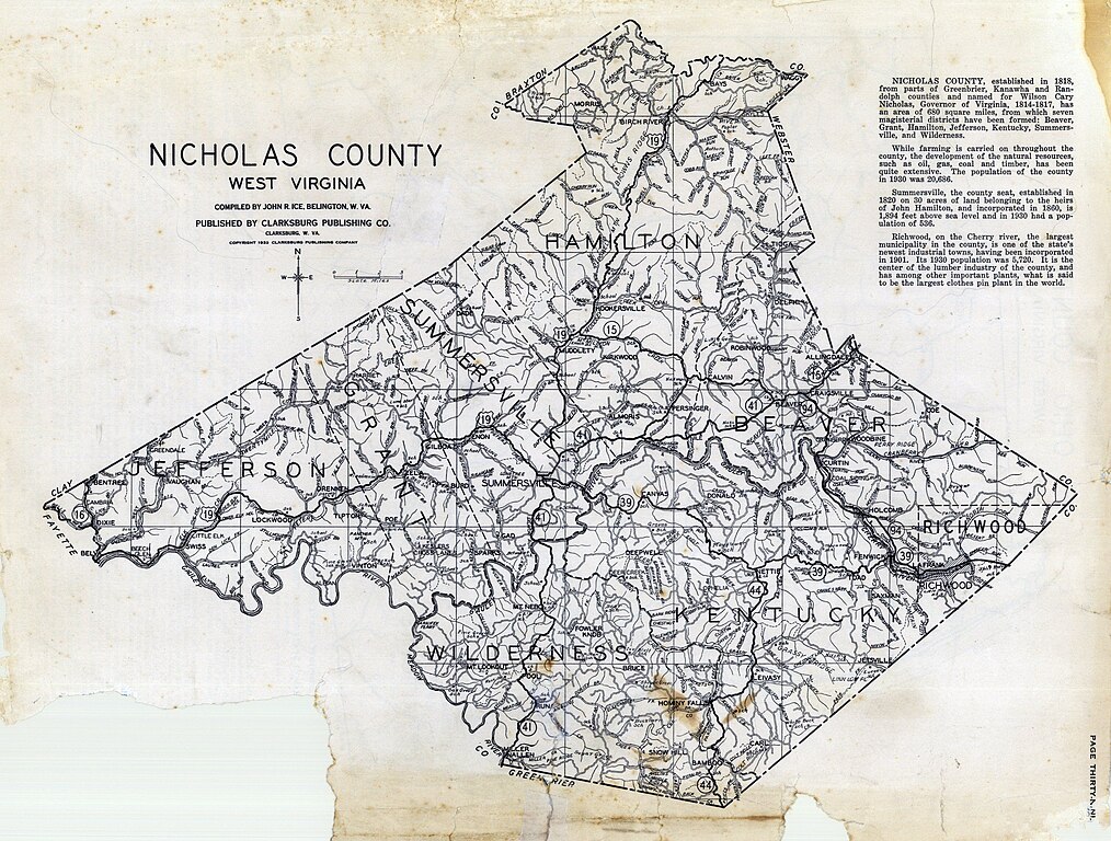
| Title |
Nicholas County - Hamilton, Jefferson, Summersville, Grant, Beaver, richwood, Kentucky, Wilderness |
|||
| Description |
Clarksburg Publishing Company |
|||
| Date | ||||
| Source | https://www.familysearch.org/library/books/records/item/577089-new-descriptive-atlas-of-west-virginia | |||
| Creator |
Full Atlas Title: West Virginia State Atlas 1933 |
|||
| Permission (Reusing this file) |
|
|||
| Georeferencing | If inappropriate please set warp_status = skip to hide. |

File history
Click on a date/time to view the file as it appeared at that time.
| Date/Time | Thumbnail | Dimensions | User | Comment | |
|---|---|---|---|---|---|
| current | 18:02, 25 March 2024 | | 3,249 × 2,461 (1.56 MB) | Scewing (talk | contribs) | == {{int:filedesc}} == {{LargeImage}} {{Map |title =Nicholas County - Hamilton, Jefferson, Summersville, Grant, Beaver, richwood, Kentucky, Wilderness |description =Clarksburg Publishing Company |author =Full Atlas Title: West Virginia State Atlas 1933 |date =1933 |source =https://www.familysearch.org/library/books/records/item/577089-new-descriptive-atlas-of-west-virginia |permission ={{PD-US-not renewed}} |scale... |
You cannot overwrite this file.
File usage on Commons
There are no pages that use this file.