File:Ngajangel STS106-720-82.JPG
Jump to navigation
Jump to search

Size of this preview: 604 × 599 pixels. Other resolutions: 242 × 240 pixels | 484 × 480 pixels | 774 × 768 pixels | 1,032 × 1,024 pixels | 2,064 × 2,048 pixels | 4,127 × 4,096 pixels.
Original file (4,127 × 4,096 pixels, file size: 769 KB, MIME type: image/jpeg)
Captions
Captions
Add a one-line explanation of what this file represents
Summary
[edit]
| Description |
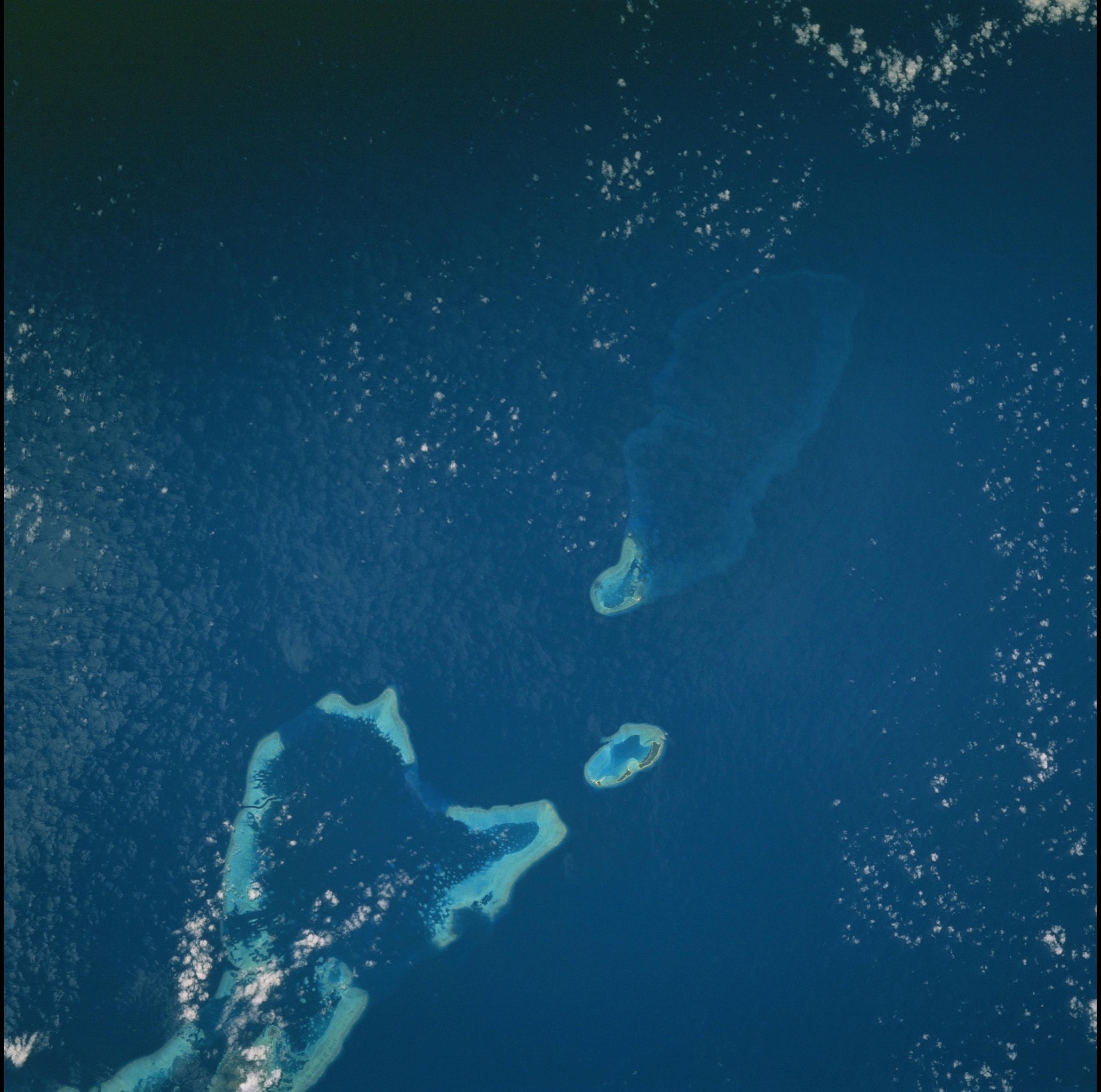
English: Northern part of Palau archipelago:in the north, the large submerged Velasco Reef, in the center Ngaruangel Reef, lower right Kayangel (Ngajangel) Atoll, and below the northern Barrier Reef of Babelthuap, Ngerchelong Reef Polski: Północna część archipelagu Palau widziana z wahadłowca Atlantis |
| Date | |
| Source | Gateway to Astronaut Photography of Earth: STS106-720-82 |
| Author | NASA |
| Camera location | | View this and other nearby images on: OpenStreetMap |
|---|
Taken during STS-106 Space Shuttle mission
Licensing
[edit]
| This file is in the public domain in the United States because it was solely created by NASA. NASA copyright policy states that "NASA material is not protected by copyright unless noted". (See Template:PD-USGov, NASA copyright policy page or JPL Image Use Policy.) | ||
 |
Warnings:
|
File history
Click on a date/time to view the file as it appeared at that time.
| Date/Time | Thumbnail | Dimensions | User | Comment | |
|---|---|---|---|---|---|
| current | 14:54, 31 August 2015 | | 4,127 × 4,096 (769 KB) | Szczureq (talk | contribs) | User created page with UploadWizard |
You cannot overwrite this file.
File usage on Commons
There are no pages that use this file.