File:Newtonmore geograph-3481675-by-Ben-Brooksbank.jpg
Jump to navigation
Jump to search

Size of this preview: 800 × 489 pixels. Other resolutions: 320 × 195 pixels | 640 × 391 pixels | 1,200 × 733 pixels.
Original file (1,200 × 733 pixels, file size: 192 KB, MIME type: image/jpeg)
Captions
Captions
Add a one-line explanation of what this file represents
Summary
[edit]
| Description |
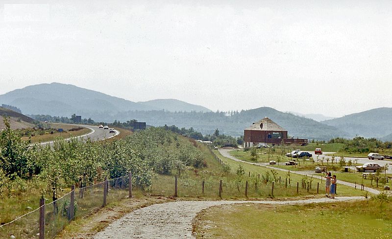
English: SW up Spey Valley from Raliabeag viewpoint near Newtonmore, 1986. Mountains on horizon are in the Gaick Forest range, east of Drumochter. On the left is the A9 road and just off to the right was the Perth - Aviemore - Inverness railway. |
| Date | |
| Source | From geograph.org.uk |
| Author | Ben Brooksbank |
| Permission (Reusing this file) |
Creative Commons Attribution Share-alike license 2.0 |
| Attribution (required by the license) | Ben Brooksbank / SW up Spey Valley from Raliabeag viewpoint near Newtonmore, 1986 / |
| Camera location | | View this and other nearby images on: OpenStreetMap |
|---|
Licensing
[edit]

|
This image was taken from the Geograph project collection. See this photograph's page on the Geograph website for the photographer's contact details. The copyright on this image is owned by Ben Brooksbank and is licensed for reuse under the Creative Commons Attribution-ShareAlike 2.0 license.
|
This file is licensed under the Creative Commons Attribution-Share Alike 2.0 Generic license.
Attribution: Ben Brooksbank
- You are free:
- to share – to copy, distribute and transmit the work
- to remix – to adapt the work
- Under the following conditions:
- attribution – You must give appropriate credit, provide a link to the license, and indicate if changes were made. You may do so in any reasonable manner, but not in any way that suggests the licensor endorses you or your use.
- share alike – If you remix, transform, or build upon the material, you must distribute your contributions under the same or compatible license as the original.
File history
Click on a date/time to view the file as it appeared at that time.
| Date/Time | Thumbnail | Dimensions | User | Comment | |
|---|---|---|---|---|---|
| current | 08:25, 4 August 2013 | | 1,200 × 733 (192 KB) | Chevin (talk | contribs) | == {{int:filedesc}} == {{Information |Description={{en|1='''SW up Spey Valley from Raliabeag viewpoint near Newtonmore, 1986.'''<br/> Mountains on horizon are in the Gaick Forest range, east of Drumochter. On the left is the A9 road and just off to the... |
You cannot overwrite this file.
File usage on Commons
There are no pages that use this file.