File:Newport UK community map (blank).svg
Jump to navigation
Jump to search

Size of this PNG preview of this SVG file: 693 × 600 pixels. Other resolutions: 277 × 240 pixels | 555 × 480 pixels | 888 × 768 pixels | 1,184 × 1,024 pixels | 2,367 × 2,048 pixels | 1,425 × 1,233 pixels.
Original file (SVG file, nominally 1,425 × 1,233 pixels, file size: 537 KB)
Captions
Captions
Add a one-line explanation of what this file represents
| Description |
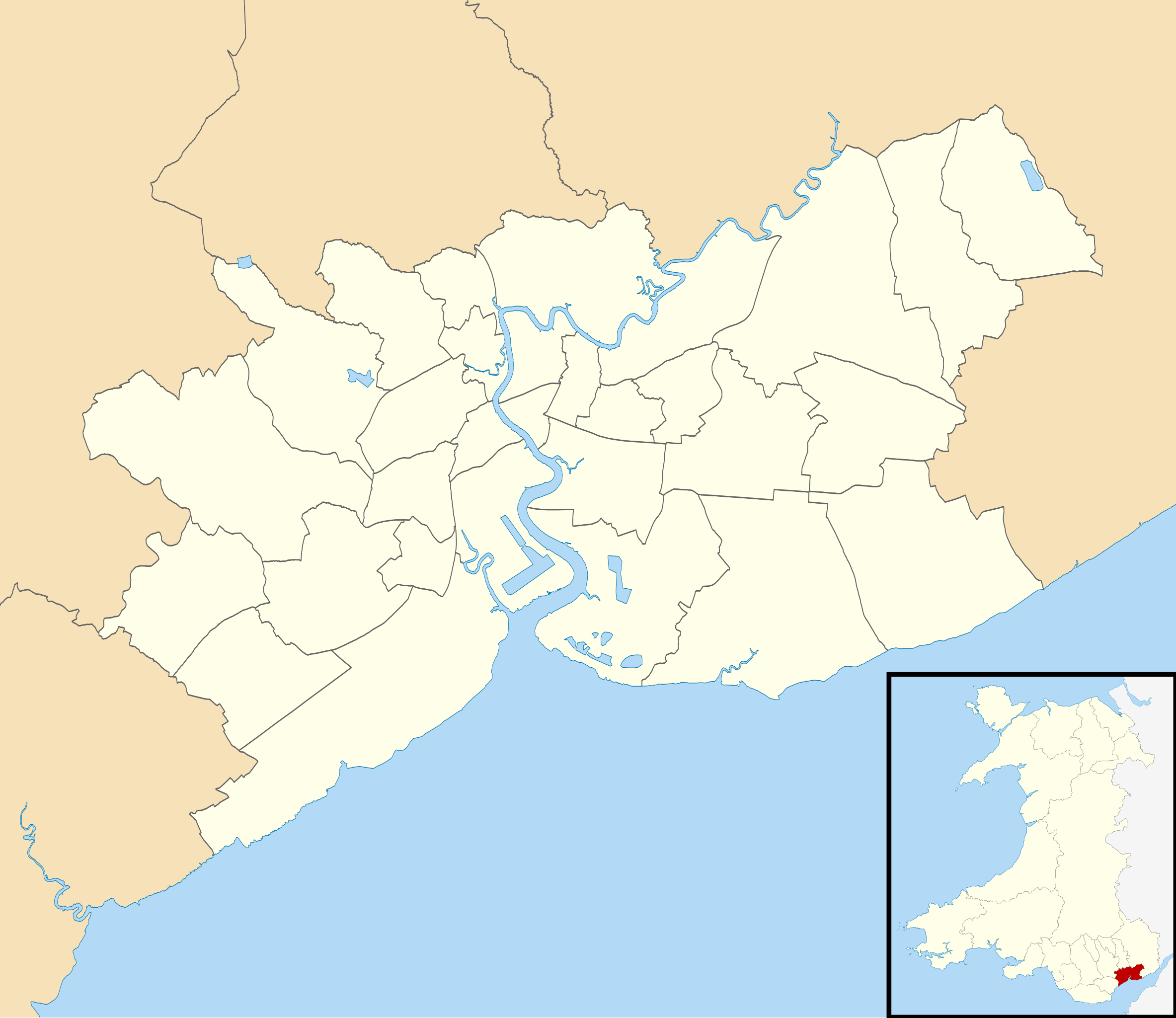
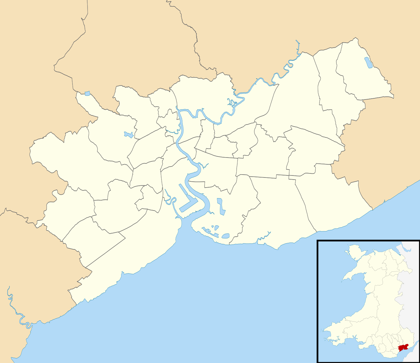
Blank map of Newport, UK with communities shown. Equirectangular map projection on WGS 84 datum, with N/S stretched 160% Geographic limits:
|
| Date | |
| Source |
|
| Author | Nilfanion, created using Ordnance Survey data |
| Permission (Reusing this file) |
This file is licensed under the Creative Commons Attribution-Share Alike 3.0 Unported license. Attribution: Contains Ordnance Survey data © Crown copyright and database right
|
File history
Click on a date/time to view the file as it appeared at that time.
| Date/Time | Thumbnail | Dimensions | User | Comment | |
|---|---|---|---|---|---|
| current | 18:10, 16 October 2010 | | 1,425 × 1,233 (537 KB) | Nilfanion (talk | contribs) | {{Information |Description=Blank map of Newport, UK with communities shown. Equirectangular map projection on WGS 84 datum, with N/S stretched 160% Geographic limits: *West: 3.15W *East: 2.78W *North: 51.67N *South: 51.47N |Source=[[w:Ordn |
You cannot overwrite this file.
File usage on Commons
The following 32 pages use this file:
- Newport / Casnewydd
- User:Nilfanion/Maps/Counties
- User:Nilfanion/Maps/Wales
- File:Wales Newport Community Allt-yr-Yn map.svg
- File:Wales Newport Community Alway map.svg
- File:Wales Newport Community Beechwood map.svg
- File:Wales Newport Community Bettws map.svg
- File:Wales Newport Community Bishton map.svg
- File:Wales Newport Community Caerleon map.svg
- File:Wales Newport Community Coedkernew map.svg
- File:Wales Newport Community Gaer map.svg
- File:Wales Newport Community Goldcliff map.svg
- File:Wales Newport Community Graig map.svg
- File:Wales Newport Community Langstone map.svg
- File:Wales Newport Community Liswerry map.svg
- File:Wales Newport Community Llanvaches map.svg
- File:Wales Newport Community Llanwern map.svg
- File:Wales Newport Community Malpas map.svg
- File:Wales Newport Community Marshfield map.svg
- File:Wales Newport Community Michaelstone-y-Fedw map.svg
- File:Wales Newport Community Nash map.svg
- File:Wales Newport Community Penhow map.svg
- File:Wales Newport Community Pillgwenlly map.svg
- File:Wales Newport Community Redwick map.svg
- File:Wales Newport Community Ringland map.svg
- File:Wales Newport Community Rogerstone map.svg
- File:Wales Newport Community Shaftesbury map.svg
- File:Wales Newport Community St Julians map.svg
- File:Wales Newport Community Stow Hill map.svg
- File:Wales Newport Community Tredegar Park map.svg
- File:Wales Newport Community Victoria map.svg
- File:Wales Newport Community Wentlooge map.svg
.svg&oldid=733022645)