File:Neworleansbook Greater New Orleans Map.jpg
Jump to navigation
Jump to search
Size of this preview: 593 × 600 pixels. Other resolutions: 237 × 240 pixels | 475 × 480 pixels | 759 × 768 pixels | 1,013 × 1,024 pixels | 2,130 × 2,154 pixels.
Original file (2,130 × 2,154 pixels, file size: 2.26 MB, MIME type: image/jpeg)
Captions
Captions
Add a one-line explanation of what this file represents
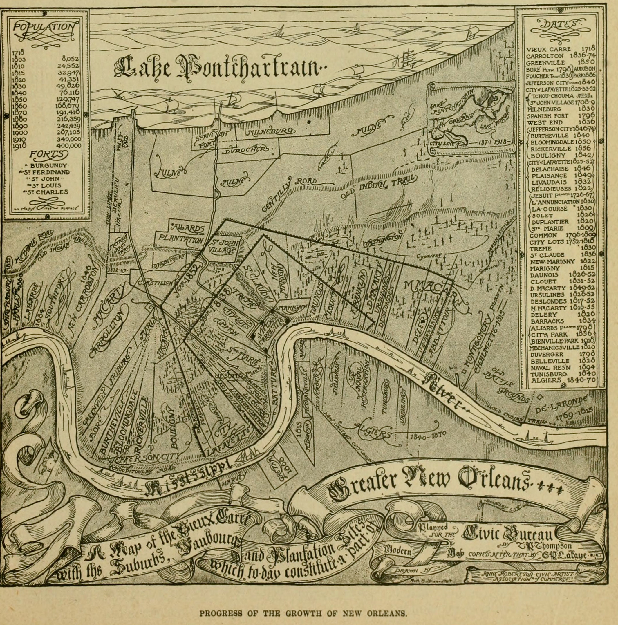
| Description | "Progress of the Growth of New Orleans" "A Map of the Vieux Carre with its Suburbs, Faubourgs, and Plantation Sites which today constitute a part of Greater New Orleans", published 1919 | ||||||
| Date | 1919(publication) | ||||||
| Source |
Map in "The New Orleans Book" published by the Orleans Parish School Board, New Orleans; Searcy & Pfaff, Ltd, 720-728 Perdido Street, New Orleans, printers. Via [1] |
||||||
| Author | Signature looks to say "Thompson" | ||||||
| Permission (Reusing this file) |
|


File history
Click on a date/time to view the file as it appeared at that time.
| Date/Time | Thumbnail | Dimensions | User | Comment | |
|---|---|---|---|---|---|
| current | 02:46, 4 August 2012 | | 2,130 × 2,154 (2.26 MB) | Infrogmation (talk | contribs) | {{Information |Description="Progress of the Growth of New Orleans" "A Map of the Vieux Carre with its Suburbs, Faubourgs, and Plantation Sites which today constitute a part of Greater New Orleans", published 1919 |Source= Map in "The New Orleans Book" ... |
You cannot overwrite this file.
File usage on Commons
There are no pages that use this file.