File:New zealand counties 1913.jpg
Jump to navigation
Jump to search
Size of this preview: 419 × 599 pixels. Other resolutions: 168 × 240 pixels | 336 × 480 pixels | 537 × 768 pixels | 716 × 1,024 pixels | 2,024 × 2,894 pixels.
Original file (2,024 × 2,894 pixels, file size: 1.04 MB, MIME type: image/jpeg)
Captions
Captions
Add a one-line explanation of what this file represents
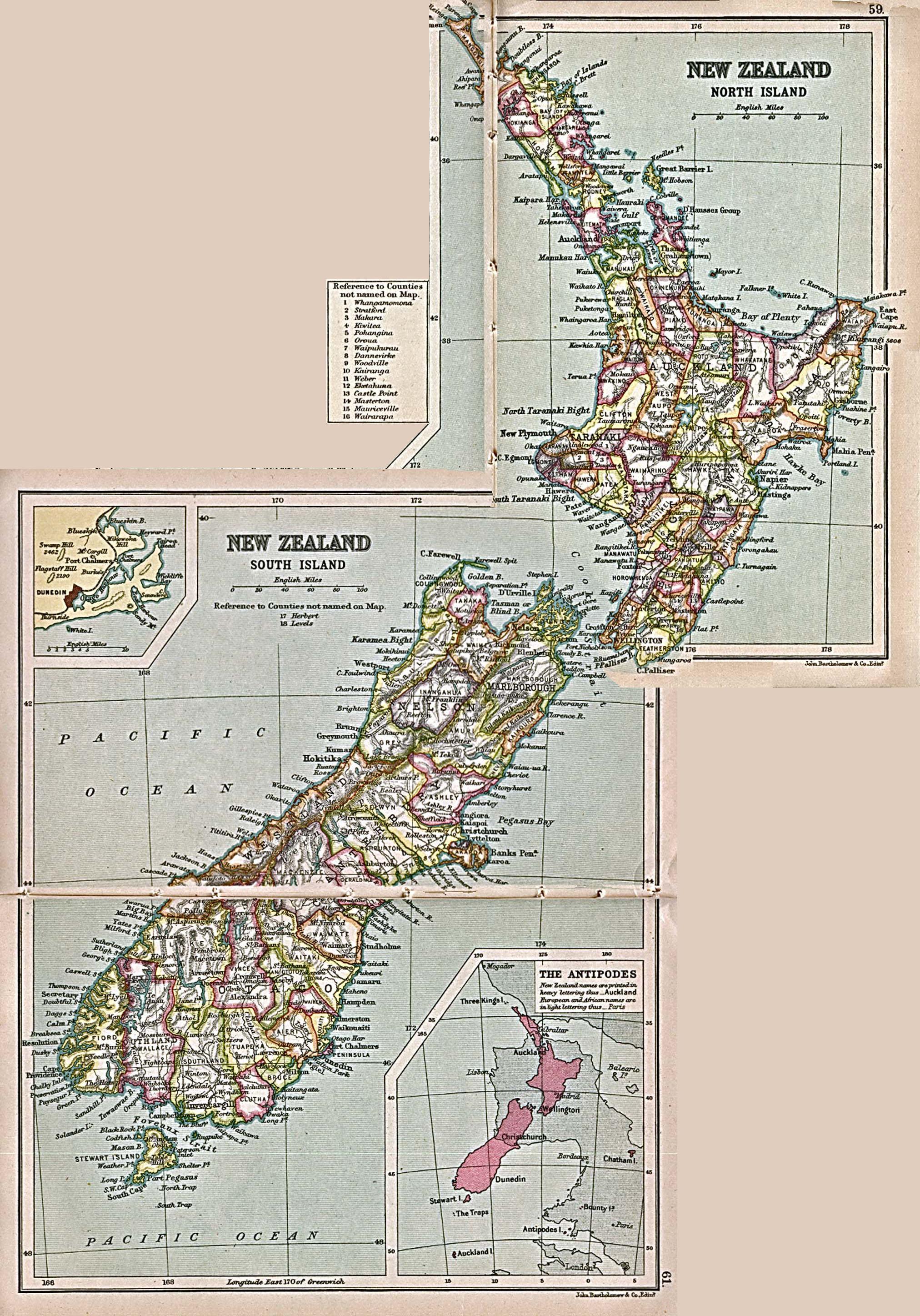
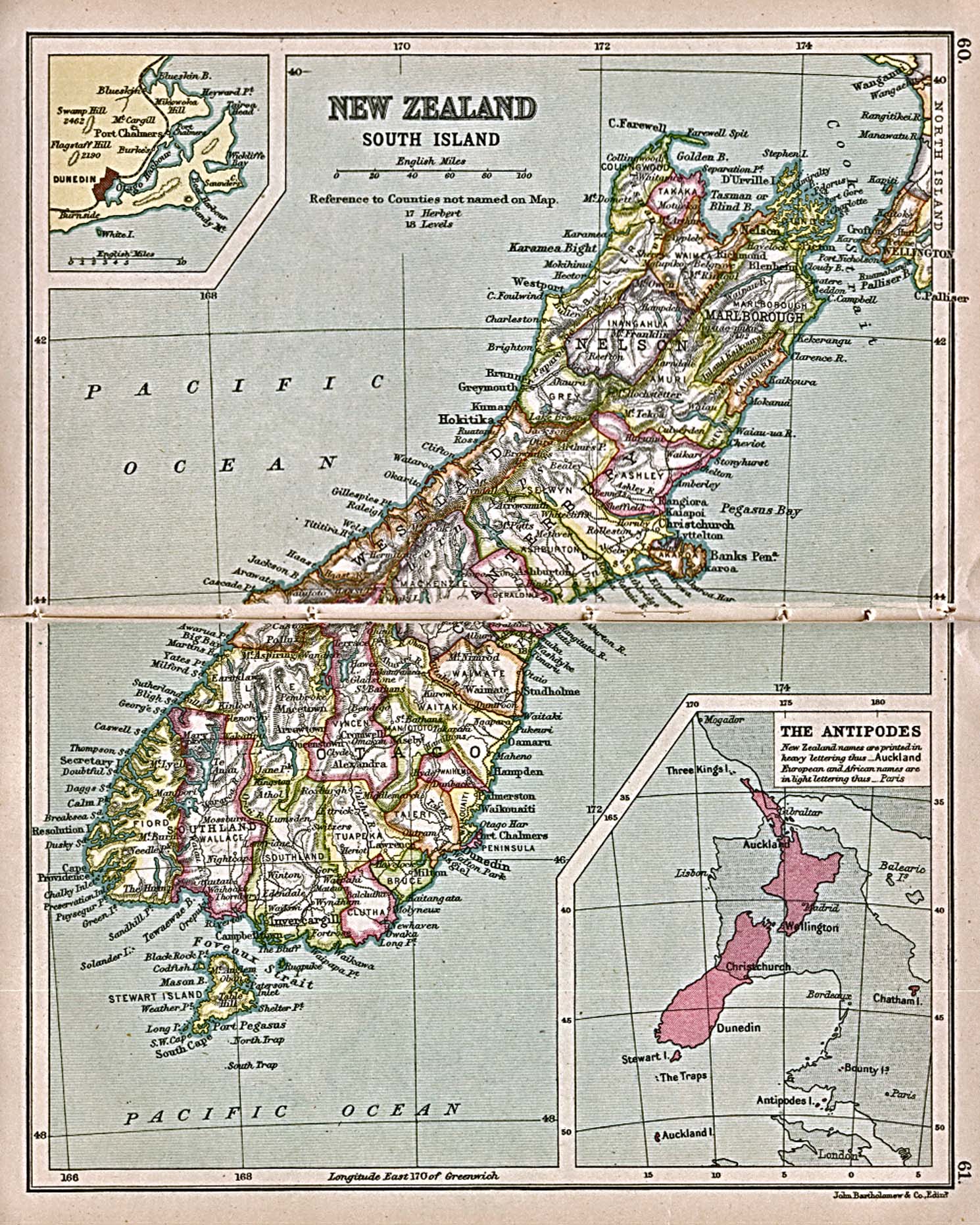
| Description | Map showing counties in New Zealand, 1913 | ||||
| Date | |||||
| Source | Two public domain maps from PCL collection: north, south | ||||
| Author | J.G. Bartholomew | ||||
| Permission (Reusing this file) |
|
||||
Note: Although published in 1913, this map was probably drawn earlier, as it is out of date according to other references available. For example, it does not show the subdivision of Selwyn County into ten smaller counties which accurred in 1910.
File history
Click on a date/time to view the file as it appeared at that time.
| Date/Time | Thumbnail | Dimensions | User | Comment | |
|---|---|---|---|---|---|
| current | 13:16, 19 May 2007 | | 2,024 × 2,894 (1.04 MB) | Roke~commonswiki (talk | contribs) | {{Information |Description= Map showing counties in New Zealand, 1913 |Source= Two public domain maps from PCL collection: [http://www.lib.utexas.edu/maps/historical/new_zealand_n_island_1913.jpg north], [http://www.lib.utexas.edu/maps/historical/new_zeal |
You cannot overwrite this file.
File usage on Commons
There are no pages that use this file.
File usage on other wikis
The following other wikis use this file:
- Usage on en.wikipedia.org