File:New Years Day, Stonehaven - geograph.org.uk - 312509.jpg
Jump to navigation
Jump to search
Size of this preview: 412 × 599 pixels. Other resolutions: 165 × 240 pixels | 440 × 640 pixels.
Original file (440 × 640 pixels, file size: 88 KB, MIME type: image/jpeg)
Captions
Captions
Add a one-line explanation of what this file represents
Summary
[edit]
| Description |
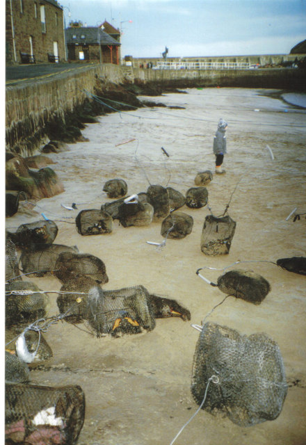
English: New Years Day, Stonehaven Here is the evidence of the previous nights celebrations.The'fireball'is a cage of wire netting about two feet in circumference, packed with all sorts of flammable material and soaked in paraffin. It is attached to a five foot length of wire and can weigh up to twenty pounds. Swinging it around your head is no mean feat. The display parades through the streets and then the 'fireballs' are tossed into the sea.These unusual celebrations seem to be linked to an old 19th century fishermans festival, and maybe even pagan festivals before that. |
| Date | |
| Source | From geograph.org.uk |
| Author | Carol Walker |
| Attribution (required by the license) | Carol Walker / New Years Day, Stonehaven / |
| Camera location | | View this and other nearby images on: OpenStreetMap |
|---|
_heading:90.00&language=en)
| Object location | | View this and other nearby images on: OpenStreetMap |
|---|
_heading:90.00&language=en)
Licensing
[edit]

|
This image was taken from the Geograph project collection. See this photograph's page on the Geograph website for the photographer's contact details. The copyright on this image is owned by Carol Walker and is licensed for reuse under the Creative Commons Attribution-ShareAlike 2.0 license.
|
This file is licensed under the Creative Commons Attribution-Share Alike 2.0 Generic license.
Attribution: Carol Walker
- You are free:
- to share – to copy, distribute and transmit the work
- to remix – to adapt the work
- Under the following conditions:
- attribution – You must give appropriate credit, provide a link to the license, and indicate if changes were made. You may do so in any reasonable manner, but not in any way that suggests the licensor endorses you or your use.
- share alike – If you remix, transform, or build upon the material, you must distribute your contributions under the same or compatible license as the original.
- Remove redundant categories and try to put this image in the most specific category/categories
- Remove this template
- The location categories are based on information from this geonames tool and this OpenStreetMap tool combined with a database. You can also have a look at this tool from mysociety.
- The topic category from Geograph was Festival (find similar images at Geograph)
File history
Click on a date/time to view the file as it appeared at that time.
| Date/Time | Thumbnail | Dimensions | User | Comment | |
|---|---|---|---|---|---|
| current | 15:22, 30 December 2010 | | 440 × 640 (88 KB) | GeographBot (talk | contribs) | == {{int:filedesc}} == {{Information |description={{en|1=New Years Day, Stonehaven Here is the evidence of the previous nights celebrations.The'fireball'is a cage of wire netting about two feet in circumference, packed with all sorts of flammable material |
You cannot overwrite this file.
File usage on Commons
There are no pages that use this file.