File:New Orleans Map the Creole Guide 1910.jpg
Jump to navigation
Jump to search

Size of this preview: 771 × 600 pixels. Other resolutions: 309 × 240 pixels | 617 × 480 pixels | 987 × 768 pixels | 1,280 × 996 pixels | 2,560 × 1,992 pixels | 3,354 × 2,610 pixels.
Original file (3,354 × 2,610 pixels, file size: 3.93 MB, MIME type: image/jpeg)
Captions
Captions
Add a one-line explanation of what this file represents
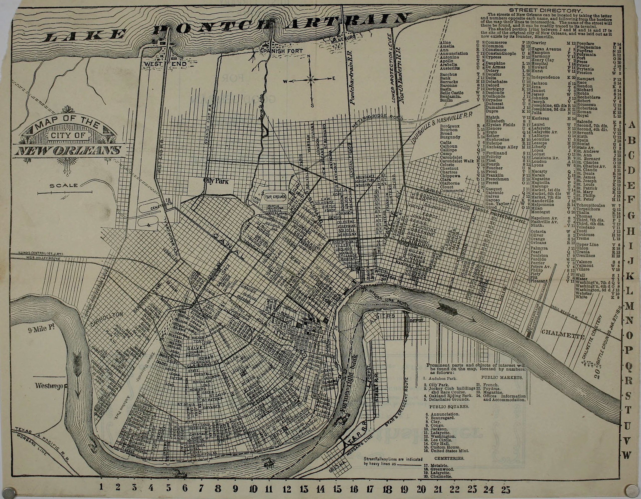
| Description | Map of New Orleans, 1910 | ||||||
| Date | |||||||
| Source |
Map published inside the front cover of "The Creole - Tourist's Guide and Sketch Book to the City of New Orleans", with map by compiled and published by the Creole Publishing Co. Manage Covers The Creole tourist's guide and sketch book to the city of New Orleans Via [1] |
||||||
| Author | The Creole Publishing Company, New Orleans | ||||||
| Permission (Reusing this file) |
|


File history
Click on a date/time to view the file as it appeared at that time.
| Date/Time | Thumbnail | Dimensions | User | Comment | |
|---|---|---|---|---|---|
| current | 23:11, 18 December 2011 | | 3,354 × 2,610 (3.93 MB) | Infrogmation (talk | contribs) | {{Information |Description= Map of New Orleans, 1910 |Source= Map published inside the front cover of "The Creole - Tourist's Guide and Sketch Book to the City of New Orleans", with map by compiled and published by the Creole Publishing Co. Manage Covers |
You cannot overwrite this file.
File usage on Commons
There are no pages that use this file.