File:New NASA Satellite Takes the Salton Sea's Temperature.jpg
Jump to navigation
Jump to search
Size of this preview: 602 × 599 pixels. Other resolutions: 241 × 240 pixels | 482 × 480 pixels | 771 × 768 pixels | 1,029 × 1,024 pixels | 2,057 × 2,048 pixels | 7,322 × 7,289 pixels.
Original file (7,322 × 7,289 pixels, file size: 13.33 MB, MIME type: image/jpeg)
Captions
Captions
Add a one-line explanation of what this file represents
Summary
[edit]
| Warning | The original file is very high-resolution. It might not load properly or could cause your browser to freeze when opened at full size. |
|---|
| Description |
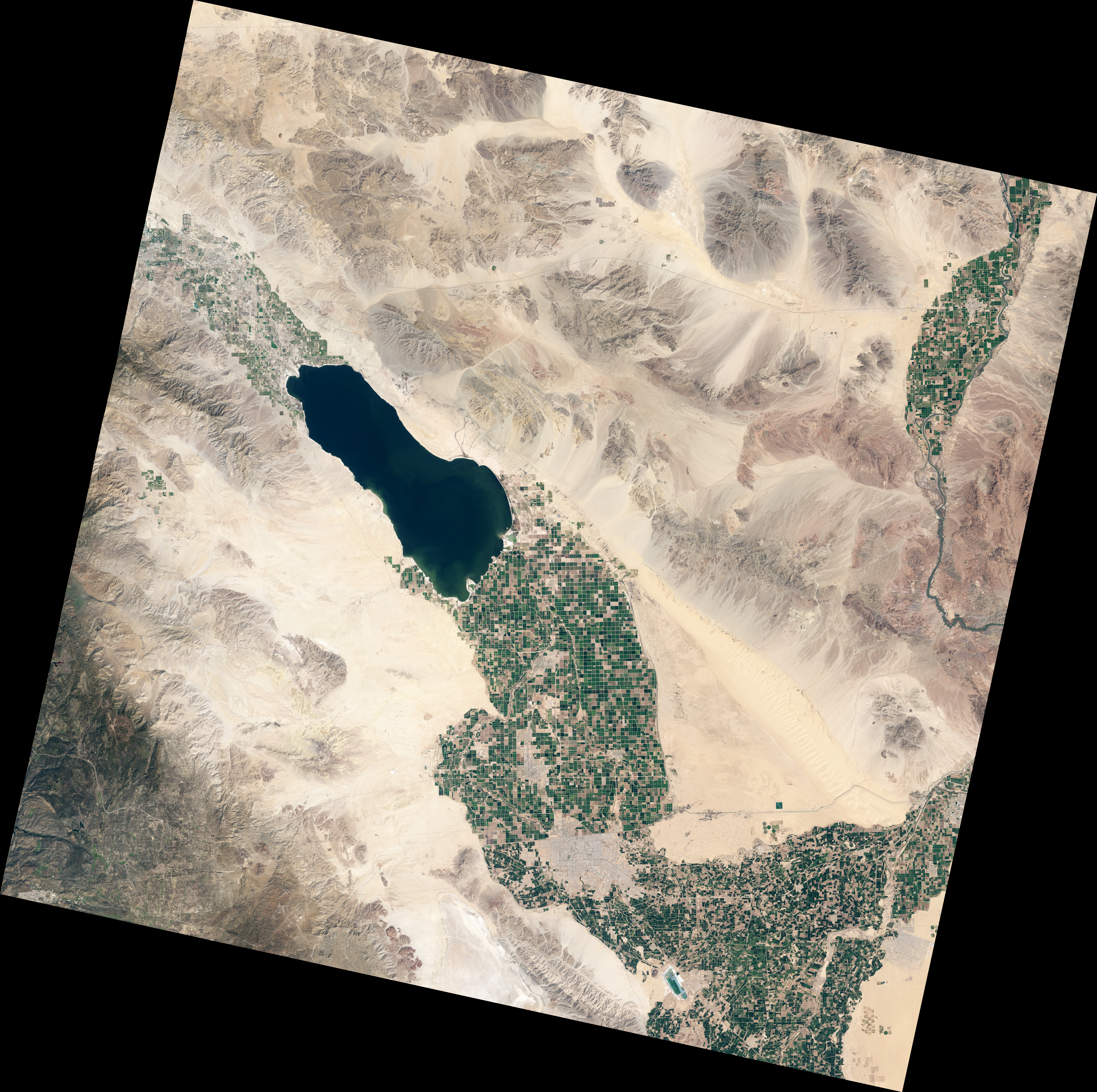
English: This true-color image of Salton Sea in Southern California, taken Mar. 24, 2013, by LDCM's Operational Land Imager (OLI) instrument, shows the same scene as the TIRS image. |
| Date | |
| Source | http://www.nasa.gov/mission_pages/landsat/news/salton-sea.html |
| Author | USGS/NASA's Earth Observatory |
Licensing
[edit]
| This file is in the public domain in the United States because it was solely created by NASA. NASA copyright policy states that "NASA material is not protected by copyright unless noted". (See Template:PD-USGov, NASA copyright policy page or JPL Image Use Policy.) | ||
 |
Warnings:
|
File history
Click on a date/time to view the file as it appeared at that time.
| Date/Time | Thumbnail | Dimensions | User | Comment | |
|---|---|---|---|---|---|
| current | 10:18, 23 April 2013 | | 7,322 × 7,289 (13.33 MB) | Stas1995 (talk | contribs) | User created page with UploadWizard |
You cannot overwrite this file.
File usage on Commons
There are no pages that use this file.