File:Nevers (Nièvre) - 49146982713.jpg
Original file (3,264 × 4,928 pixels, file size: 10.39 MB, MIME type: image/jpeg)
Captions
Captions
Summary
[edit]_-_49146982713.jpg&action=edit§ion=1)
| Description |
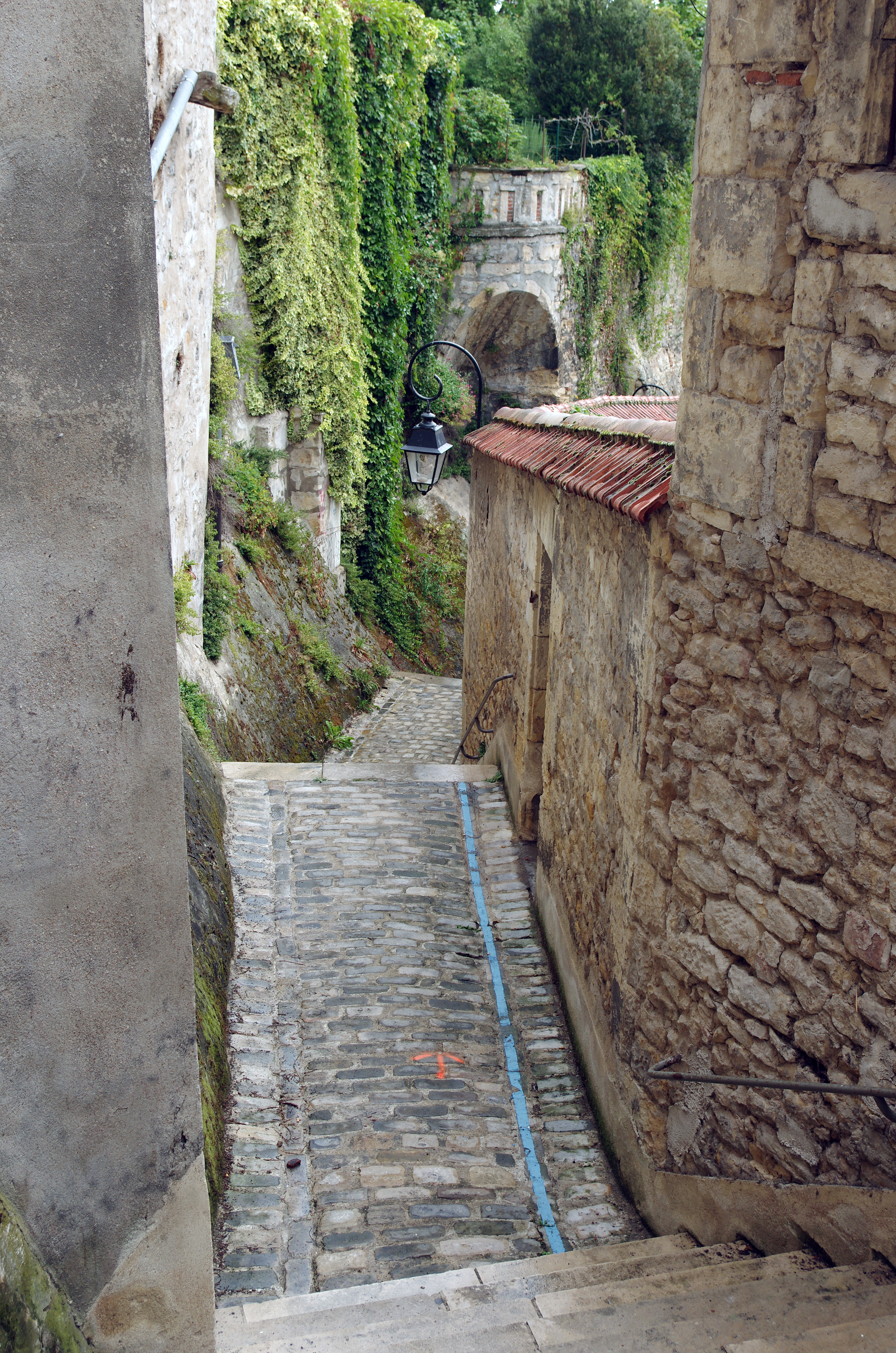
English: Nevers (Nièvre)
Vestiges des anciens remparts (XIIe-XVIIe siècles), rue de la Fontaine. Vers l'an mil, la population qui atteignait 7000 âmes, déborda de l'enceinte primitive. Le comte de Nevers, Pierre de Courtenay, jugea utile, vers 1198, de faire édifier une nouvelle enceinte plus vaste. Il fit construire les remparts le long des cours d'eau (la Loire, le ruisseau de la Passière, la Nièvre, l’Éperon, le ruisseau de la Sangsue). Disposition qui empêchait de passer sous les remparts par des souterrains, ceux-ci se retrouvant inondés. Au XIVe siècle, les fortifications seront modifiées par l'apparition de l'artillerie. Au pied de l'ancienne poterne de La Fontaine, devenue rue de La Fontaine, il y avait la fontaine de Beaupré. |
| Date | Taken on 20 August 2016, 10:44:02 |
| Source | https://www.flickr.com/photos/26082117@N07/49146982713/ |
| Author | sybarite48 |
| Camera location | | View this and other nearby images on: OpenStreetMap |
|---|
_-_49146982713.jpg¶ms=046.987460_N_0003.160638_E_globe:Earth_type:camera_heading:66.34&language=en)
Licensing
[edit]_-_49146982713.jpg&action=edit§ion=2)
- You are free:
- to share – to copy, distribute and transmit the work
- to remix – to adapt the work
- Under the following conditions:
- attribution – You must give appropriate credit, provide a link to the license, and indicate if changes were made. You may do so in any reasonable manner, but not in any way that suggests the licensor endorses you or your use.
| This image was originally posted to Flickr by sybarite48 at https://flickr.com/photos/26082117@N07/49146982713. It was reviewed on 27 August 2020 by FlickreviewR 2 and was confirmed to be licensed under the terms of the cc-by-2.0. |
File history
Click on a date/time to view the file as it appeared at that time.
| Date/Time | Thumbnail | Dimensions | User | Comment | |
|---|---|---|---|---|---|
| current | 19:46, 27 August 2020 | | 3,264 × 4,928 (10.39 MB) | B2Belgium (talk | contribs) | Uploaded a work by sybarite48 from https://www.flickr.com/photos/26082117@N07/49146982713/ with UploadWizard |
You cannot overwrite this file.
File usage on Commons
There are no pages that use this file.
_-_49146982713.jpg&oldid=884093012)