File:Neve Glacier North Cascades USGS.jpg
Original file (2,882 × 2,512 pixels, file size: 3.85 MB, MIME type: image/jpeg)
Captions
Captions
Summary
[edit]
| Description |
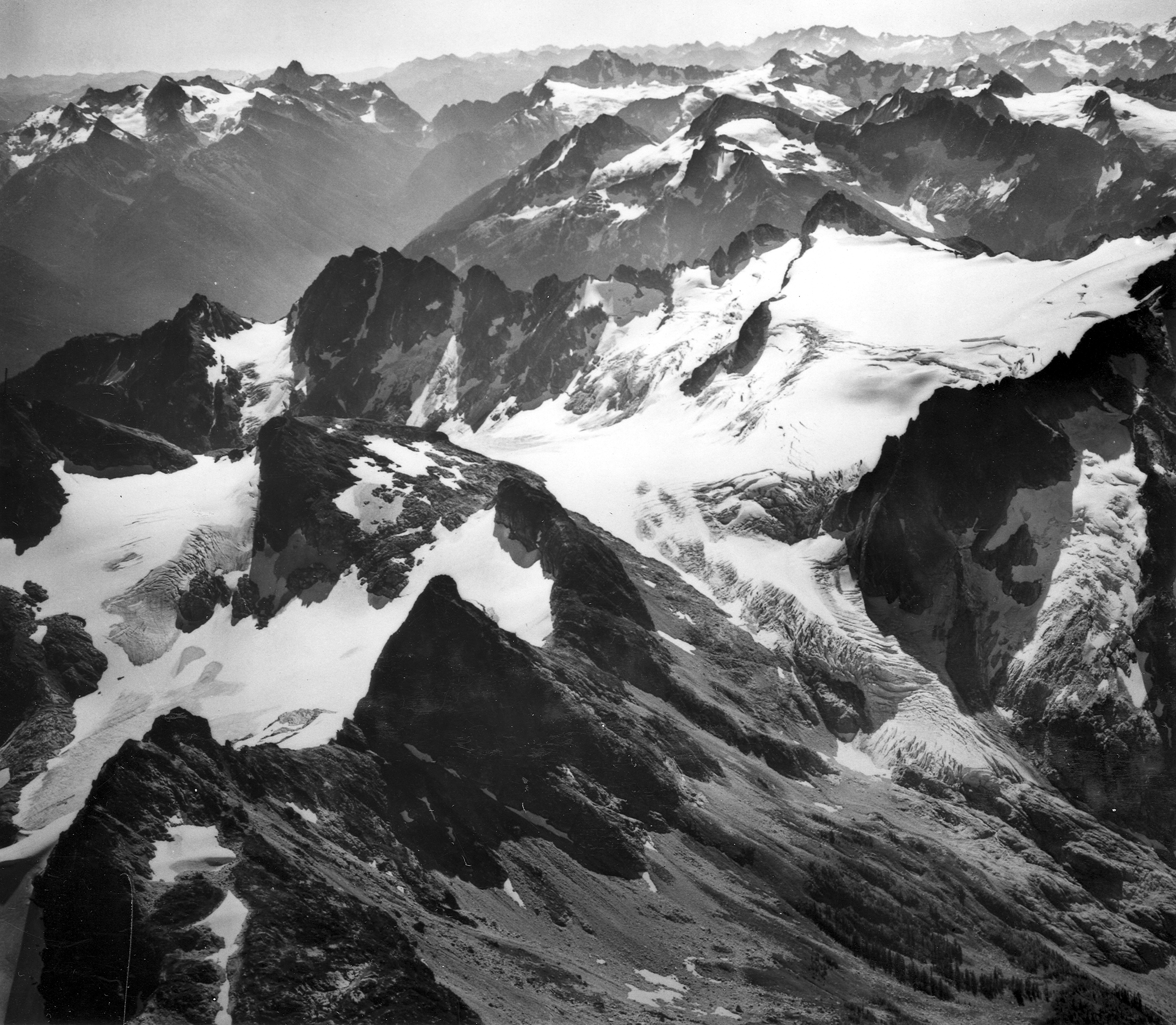
Ladder Creek and Neve Glaciers, Snowfield Peak, in North Cascades National Park. This scene displays the rugged nature of the North Cascades where glacierized peaks rise abruptly from heavily timbered valleys that are less than 1,000 m above sea level. The Cascade divide is crossed by trail at Park Creek Pass (altitude 1,845 m) top left; Goode Mountain (altitude 2,800 m) is to the left, and Buckner Mountain (altitude 2,780 m) with Boston Glacier (7 square km in area) is to the right of the pass. Timberline is at about 1,860 m. Skagit and Whatcom Counties, Washington. ca. 1966. (Aerial view) Published as figure 4 in U. S. Geological Survey. Professional paper 715-A. 1971. Pinnacle Peak (bottom left) and Paul Bunyans Stump (bottom left center) with Colonial Glacier behind and left; Snowfield Peak (upper right center middle distance) with Neve Glacier descending past the center to the left and Ladder Creek Glacier descending from the center toward the lower right. View direction: 150° Image file: http://libraryphoto.cr.usgs.gov/htmllib/btch453/btch453j/btch453z/mmf00003.jpg |
| Source | U.S. Geological Survey Photographic Library |
| Author | M. F. Meier |
Licensing
[edit]
This image is in the public domain in the United States because it only contains materials that originally came from the United States Geological Survey, an agency of the United States Department of the Interior. For more information, see the official USGS copyright policy.
|
File history
Click on a date/time to view the file as it appeared at that time.
| Date/Time | Thumbnail | Dimensions | User | Comment | |
|---|---|---|---|---|---|
| current | 06:27, 11 June 2009 | | 2,882 × 2,512 (3.85 MB) | BlueCanoe (talk | contribs) | {{Information |Description=Ladder Creek and Neve Glaciers, Snowfield Peak, in North Cascades National Park. This scene displays the rugged nature of the North Cascades where glacierized peaks rise abruptly from heavily timbered valleys that are less than |
You cannot overwrite this file.
File usage on Commons
The following 3 pages use this file:
File usage on other wikis
The following other wikis use this file:
- Usage on arz.wikipedia.org
- Usage on ceb.wikipedia.org
- Usage on cs.wikipedia.org
- Usage on da.wikipedia.org
- Usage on en.wikipedia.org
- Usage on es.wikipedia.org
- Usage on fr.wikipedia.org
- Usage on he.wikipedia.org
- Usage on it.wikipedia.org
- Usage on ko.wikipedia.org
- Usage on lld.wikipedia.org
- Usage on no.wikipedia.org
- Usage on ur.wikipedia.org
- Usage on vi.wikipedia.org
- Usage on www.wikidata.org