File:Nevada State Route 375.svg
Jump to navigation
Jump to search

Size of this PNG preview of this SVG file: 439 × 599 pixels. Other resolutions: 176 × 240 pixels | 351 × 480 pixels | 562 × 768 pixels | 750 × 1,024 pixels | 1,500 × 2,048 pixels | 1,114 × 1,521 pixels.
Original file (SVG file, nominally 1,114 × 1,521 pixels, file size: 741 KB)
Captions
Captions
Add a one-line explanation of what this file represents
Summary
[edit]| Description | |||
| Date | (UTC) | ||
| Source |
|
||
| Author |
|
||
| Other versions | |||
| SVG | W3C-validity not checked.
|
||
| Graphic Lab |

| Object location | | View this and other nearby images on: OpenStreetMap |
|---|
Licensing
[edit]
I, the copyright holder of this work, hereby publish it under the following licenses:
| Copyleft: This work of art is free; you can redistribute it and/or modify it according to terms of the Free Art License. You will find a specimen of this license on the Copyleft Attitude site as well as on other sites. |
This file is licensed under the Creative Commons Attribution-Share Alike Attribution-Share Alike 4.0 International, 3.0 Unported, 2.5 Generic, 2.0 Generic and 1.0 Generic license.
- You are free:
- to share – to copy, distribute and transmit the work
- to remix – to adapt the work
- Under the following conditions:
- attribution – You must give appropriate credit, provide a link to the license, and indicate if changes were made. You may do so in any reasonable manner, but not in any way that suggests the licensor endorses you or your use.
- share alike – If you remix, transform, or build upon the material, you must distribute your contributions under the same or compatible license as the original.
You may select the license of your choice.
Original upload log
[edit]
This image is a derivative work of the following images:
- File:Roadmap_Nevada.svg licensed with Cc-by-2.5, Cc-by-sa-3.0-migrated, GFDL
- 2006-11-17T16:07:00Z Mortadelo2005 1116x1559 (867728 Bytes) == Sumario == Mapa de carreteras de Nevada. Elaboración propia, [[User:Mortadelo2005|Mortadelo2005]] 16:04, 17 November 2006 (UTC) [[Category:Nevada]] == Licensing == {{self2|GFDL|cc-by-2.5}}
- 2006-11-17T16:04:25Z Mortadelo2005 1116x1559 (418328 Bytes) Mapa de carreteras de Nevada. Elaboración propia, ~~~~ [[Category:Nevada]]
Uploaded with derivativeFX
File history
Click on a date/time to view the file as it appeared at that time.
| Date/Time | Thumbnail | Dimensions | User | Comment | |
|---|---|---|---|---|---|
| current | 22:50, 26 July 2013 | | 1,114 × 1,521 (741 KB) | Fredddie (talk | contribs) | switched out US 375 marker for NV 375 marker, color changes to be like other US road maps |
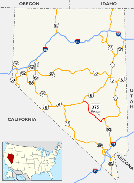
| 17:29, 24 October 2011 |  | 1,114 × 1,521 (732 KB) | Sémhur (talk | contribs) | == {{int:filedesc}} == {{Information |Description={{Multilingual description |en= Roadmap_Nevada of en:Nevada, United States of America, with Route 375 highlighted. |fr= Carte des principaux axes routiers du fr:Nevada, États-Unis d'Amérique, |
You cannot overwrite this file.
File usage on Commons
The following page uses this file:
File usage on other wikis
The following other wikis use this file:
- Usage on de.wikipedia.org
- Usage on fr.wikipedia.org
- Usage on it.wikipedia.org
- Usage on nl.wikipedia.org
- Usage on pl.wikipedia.org
- Usage on vi.wikipedia.org
- Usage on www.wikidata.org