File:Neubrandenburg Stargarder Tor.jpg
Jump to navigation
Jump to search
No higher resolution available.
Neubrandenburg_Stargarder_Tor.jpg (640 × 480 pixels, file size: 75 KB, MIME type: image/jpeg)
Captions
Captions
Add a one-line explanation of what this file represents
Summary
[edit]
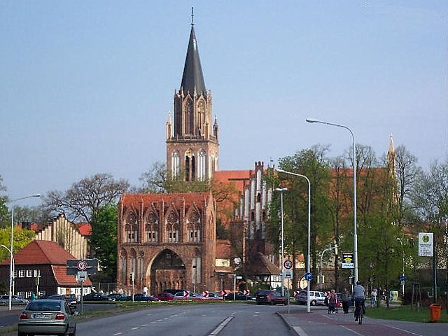
| Description | Neubrandenburg, Stargarder Tor und Marienkirche |
| Date | |
| Source | Own work |
| Author | Ch.Pagenkopf |

|
Permission is granted to copy, distribute and/or modify this document under the terms of the GNU Free Documentation License, Version 1.2 or any later version published by the Free Software Foundation; with no Invariant Sections, no Front-Cover Texts, and no Back-Cover Texts. A copy of the license is included in the section entitled GNU Free Documentation License. |
| This file is licensed under the Creative Commons Attribution-Share Alike 3.0 Unported license. | ||
| ||
| This licensing tag was added to this file as part of the GFDL licensing update. |
| Camera location | | View this and other nearby images on: OpenStreetMap |
|---|
File history
Click on a date/time to view the file as it appeared at that time.
| Date/Time | Thumbnail | Dimensions | User | Comment | |
|---|---|---|---|---|---|
| current | 06:54, 13 April 2008 | | 640 × 480 (75 KB) | Chpagenkopf (talk | contribs) | {{Information |Description=Neubrandenburg, Stargarder Tor und Marienkirche |Source=own Work |Date=21.10.2007 |Author=Ch.Pagenkopf |Permission= |other_versions= }} {{GNU}} {{Location dec|53.55163|13.26306 [[Category:City gates in Meckl |
You cannot overwrite this file.
File usage on Commons
The following 9 pages use this file:
File usage on other wikis
The following other wikis use this file:
- Usage on an.wikipedia.org
- Usage on ar.wikipedia.org
- Usage on arz.wikipedia.org
- Usage on az.wikipedia.org
- Usage on ba.wikipedia.org
- Usage on be.wikipedia.org
- Usage on ca.wikipedia.org
- Usage on ceb.wikipedia.org
- Usage on da.wikipedia.org
- Usage on de.wikipedia.org
- Usage on de.wikivoyage.org
- Usage on el.wikipedia.org
- Usage on en.wikipedia.org
- Usage on en.wikivoyage.org
- Usage on eu.wikipedia.org
- Usage on hu.wikipedia.org
- Usage on hy.wikipedia.org
- Usage on it.wikipedia.org
- Usage on ku.wikipedia.org
- Usage on lmo.wikipedia.org
- Usage on nds.wikipedia.org
- Usage on no.wikipedia.org
- Usage on pl.wikipedia.org
- Usage on ro.wikipedia.org
- Usage on ru.wikipedia.org
- Usage on sr.wikipedia.org
- Usage on tt.wikipedia.org
- Usage on uz.wikipedia.org
- Usage on vo.wikipedia.org
- Usage on www.wikidata.org
- Usage on zh.wikipedia.org