File:Neu Zauche Friedensstrasse 01.JPG
Jump to navigation
Jump to search

Size of this preview: 800 × 402 pixels. Other resolutions: 320 × 161 pixels | 640 × 321 pixels | 1,024 × 514 pixels | 1,280 × 643 pixels | 2,560 × 1,286 pixels | 5,297 × 2,660 pixels.
Original file (5,297 × 2,660 pixels, file size: 10.27 MB, MIME type: image/jpeg)
Captions
Captions
Add a one-line explanation of what this file represents
Summary
[edit]
| Description |
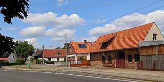
Deutsch: Blick entlang der Friedensstraße in Neu Zauche, Landkreis Dahme-Spreewald, Brandenburg, Deutschland.
English: Houses along Peace Street (Friedensstraße) in Neu Zauche, Landkreis Dahme-Spreewald, Brandenburg, Germany. |
| Date | Taken on 27 June 2013 |
| Source | Own work |
| Author | J.-H. Janßen |
| Camera location | | View this and other nearby images on: OpenStreetMap |
|---|
| This image is not public domain. Please respect copyright protection detailed in the rules of the license. Specifically excluded is use in social media if that social media web site, forum or blog etc. does not insist on compliance and publication with Creative Commons licensing declaration. Particularly excluded under this license is uploading as a third party to Facebook... please read here. To avoid copyright violation the up-loader to any allowable media, social or otherwise, must attribute the image to the Wikimedia Commons author, web link to this file, and provide follow-on Attribution-ShareAlike 4.0 International license declaration and attribution, even if the image has been altered, manipulated or built upon. |
Licensing
[edit]
I, the copyright holder of this work, hereby publish it under the following license:
This file is licensed under the Creative Commons Attribution-Share Alike 4.0 International license.
- You are free:
- to share – to copy, distribute and transmit the work
- to remix – to adapt the work
- Under the following conditions:
- attribution – You must give appropriate credit, provide a link to the license, and indicate if changes were made. You may do so in any reasonable manner, but not in any way that suggests the licensor endorses you or your use.
- share alike – If you remix, transform, or build upon the material, you must distribute your contributions under the same or compatible license as the original.
File history
Click on a date/time to view the file as it appeared at that time.
| Date/Time | Thumbnail | Dimensions | User | Comment | |
|---|---|---|---|---|---|
| current | 12:55, 25 June 2016 | | 5,297 × 2,660 (10.27 MB) | J.-H. Janßen (talk | contribs) | {{Information |Description={{de|1=Blick entlang der Friedensstraße in Neu Zauche, Landkreis Dahme-Spreewald, Brandenburg, Deutschland.}} {{en|1=Houses along ''Peace Street'' (''F... |
You cannot overwrite this file.
File usage on Commons
The following page uses this file:
File usage on other wikis
The following other wikis use this file:
- Usage on ca.wikipedia.org
- Usage on ceb.wikipedia.org
- Usage on ce.wikipedia.org
- Usage on de.wikipedia.org
- Usage on es.wikipedia.org
- Usage on eu.wikipedia.org
- Usage on fr.wikipedia.org
- Usage on hu.wikipedia.org
- Usage on it.wikipedia.org
- Usage on ku.wikipedia.org
- Usage on lt.wikipedia.org
- Usage on pl.wikipedia.org
- Usage on ro.wikipedia.org
- Usage on ru.wikipedia.org
- Usage on sr.wikipedia.org
- Usage on sv.wikipedia.org
- Usage on tt.wikipedia.org
- Usage on uk.wikipedia.org
- Usage on uz.wikipedia.org
- Usage on vi.wikipedia.org
- Usage on www.wikidata.org
- Usage on zh.wikipedia.org