File:Netherlands, Tedingerbroekpolder (1).jpg

Original file (1,440 × 1,312 pixels, file size: 1.13 MB, MIME type: image/jpeg)
Captions
Captions
Summary
[edit].jpg&action=edit§ion=1)
| Description |
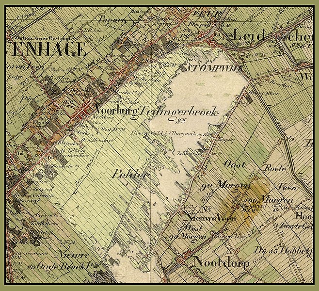
Nederlands: De Tedingerbroekpolder tussen Den Haag en Delft in 1850 (deel van een kaart van Zuid-Holland). Dit gebied is momenteel sterk verstedelijkt en dicht bevolkt.
English: The Tedingerbroek Polder between The Hague and Delft in 1850 (part of a map of the Province of South Holland, Netherlands). This area is now completely urbanized and densely populated. |
| Date | |
| Source | Nationaal Archief. http://www.gahetna.nl/collectie/afbeeldingen/kaartencollectie/zoeken/ |
| Author | Enderlein, H.J., Schuurman, J. |
The "P" of "Polder" in this map lies approximately at this location:
| Camera location | | View this and other nearby images on: OpenStreetMap |
|---|
.jpg¶ms=052.057294_N_0004.375478_E_globe:Earth_type:camera_region:NL_&language=en)
Collectie / Nationaal Archief, Kaarten Zuid-Holland (http://www.gahetna.nl/) Serie: Nettekeningen 1:25.000 van de veldminuten ten behoeven van de Topografische Militaire Kaart, 1850-1864 Beschrijving: Topografische kaart van Den Haag en Leiden en omgeving. 1850. Nummer toegang: 4.TOPO ; Inventarisnummer 8.30
Licensing
[edit].jpg&action=edit§ion=2)
|
This is a faithful photographic reproduction of a two-dimensional, public domain work of art. The work of art itself is in the public domain for the following reason:
The official position taken by the Wikimedia Foundation is that "faithful reproductions of two-dimensional public domain works of art are public domain". This photographic reproduction is therefore also considered to be in the public domain in the United States. In other jurisdictions, re-use of this content may be restricted; see Reuse of PD-Art photographs for details. {{PD-Art}} template without license parameter: please specify why the underlying work is public domain in both the source country and the United States
(Usage: {{PD-Art|1=|deathyear=''year of author's death''|country=''source country''}}, where parameter 1= can be PD-old-auto, PD-old-auto-expired, PD-old-auto-1996, PD-old-100 or similar. See Commons:Multi-license copyright tags for more information.) | ||||
File history
Click on a date/time to view the file as it appeared at that time.
| Date/Time | Thumbnail | Dimensions | User | Comment | |
|---|---|---|---|---|---|
| current | 12:45, 10 December 2011 | | 1,440 × 1,312 (1.13 MB) | Loranchet (talk | contribs) | Improved version, with colour differences showing polder. |
| 21:31, 13 October 2011 |  | 1,440 × 1,312 (1.12 MB) | Loranchet (talk | contribs) | {{Information |Description ={{nl|1=De Tedingerbroekpolder tussen Den Haag en Delft in 1850 (deel van een kaart van Zuid-Holland). Dit gebied is momenteel sterk verstedelijkt en dicht bevolkt.}} {{en|1=The Tedingerbroek Polder between The Hague and Delf |
You cannot overwrite this file.
File usage on Commons
There are no pages that use this file.
File usage on other wikis
The following other wikis use this file:
- Usage on nl.wikipedia.org
.jpg&oldid=771364424)