File:Nepal zones.svg
Jump to navigation
Jump to search

Size of this PNG preview of this SVG file: 800 × 534 pixels. Other resolutions: 320 × 213 pixels | 640 × 427 pixels | 1,024 × 683 pixels | 1,280 × 854 pixels | 2,560 × 1,707 pixels | 1,531 × 1,021 pixels.
Original file (SVG file, nominally 1,531 × 1,021 pixels, file size: 114 KB)
Captions
Captions
Add a one-line explanation of what this file represents
Summary
[edit]Info
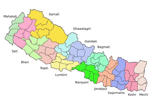
[edit]| Description | Map of the zones of Nepal. Created by Summit Raj Tuladhar, on 23 January 2007 for public domain use. Vectorised by RaviC on 19 Dec 08 |
| Date | 23 January 2007, 19 dec 08 |
| Source | en:image:Nepal_zones.png |
| Author | w:en:user:summitraj, w:en:user:RaviC |
| Other versions |
|

Licensing
[edit]

|
The copyright holder of this work allows anyone to use it for any purpose including unrestricted redistribution, commercial use, and modification.
Usage notes:
|
| I, the copyright holder of this work, release this work into the public domain. This applies worldwide. In some countries this may not be legally possible; if so: I grant anyone the right to use this work for any purpose, without any conditions, unless such conditions are required by law. |
File history
Click on a date/time to view the file as it appeared at that time.
| Date/Time | Thumbnail | Dimensions | User | Comment | |
|---|---|---|---|---|---|
| current | 20:53, 19 December 2008 | | 1,531 × 1,021 (114 KB) | RaviC (talk | contribs) | == Info == {{Information |Description=Map of the zones of Nepal. Created by Summit Raj Tuladhar, on 23 January 2007 for public domain use. Vectorised by RaviC on 19 Dec 08 |Source=en:image:Nepal_zones.png |Date=23 January 200 |
You cannot overwrite this file.
File usage on Commons
The following 2 pages use this file:
File usage on other wikis
The following other wikis use this file:
- Usage on ar.wikipedia.org
- Usage on ast.wikipedia.org
- Usage on bh.wikipedia.org
- Usage on bn.wikipedia.org
- Usage on en.wikipedia.org
- Usage on es.wikipedia.org
- Usage on fa.wikipedia.org
- Usage on hi.wikipedia.org
- Usage on mai.wikipedia.org
- Usage on nds-nl.wikipedia.org
- Usage on ne.wikipedia.org
- Usage on ro.wikipedia.org
- Usage on simple.wikipedia.org
- Usage on ta.wikipedia.org
- Usage on uk.wikipedia.org
- Usage on ur.wikipedia.org