File:Nassau-Weilburg-map.png
Jump to navigation
Jump to search

Size of this preview: 800 × 533 pixels. Other resolutions: 320 × 213 pixels | 640 × 426 pixels | 1,024 × 682 pixels | 1,280 × 853 pixels | 3,029 × 2,018 pixels.
Original file (3,029 × 2,018 pixels, file size: 475 KB, MIME type: image/png)
Captions
Captions
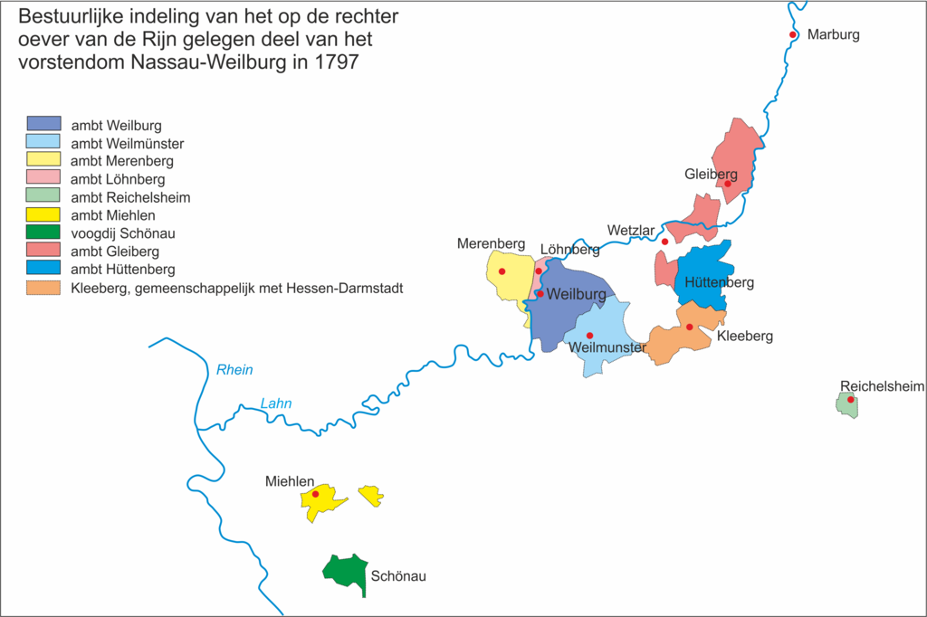
map of the distrticts of administration in 1789
Summary
[edit]
| Description |
Nederlands: het op de rechter oever van de Rijn gelegen deel van het vorstendom Nassau-Weilburg in 1789
English: the part of the principality Nassau-Weilburg on the eastern side of the river Rhine in 1789 |
| Date | |
| Source | Own work |
| Author | Kooij |
Licensing
[edit]
I, the copyright holder of this work, hereby publish it under the following license:
This file is licensed under the Creative Commons Attribution-Share Alike 4.0 International license.
- You are free:
- to share – to copy, distribute and transmit the work
- to remix – to adapt the work
- Under the following conditions:
- attribution – You must give appropriate credit, provide a link to the license, and indicate if changes were made. You may do so in any reasonable manner, but not in any way that suggests the licensor endorses you or your use.
- share alike – If you remix, transform, or build upon the material, you must distribute your contributions under the same or compatible license as the original.
File history
Click on a date/time to view the file as it appeared at that time.
| Date/Time | Thumbnail | Dimensions | User | Comment | |
|---|---|---|---|---|---|
| current | 12:33, 29 June 2019 | | 3,029 × 2,018 (475 KB) | Kooij (talk | contribs) | correction in map |
| 21:58, 28 May 2019 |  | 3,029 × 2,021 (517 KB) | Kooij (talk | contribs) | correctie naam Reichelsheim | |
| 21:47, 28 May 2019 |  | 3,029 × 2,021 (517 KB) | Kooij (talk | contribs) | User created page with UploadWizard |
You cannot overwrite this file.
File usage on Commons
There are no pages that use this file.
File usage on other wikis
The following other wikis use this file:
- Usage on nl.wikipedia.org