File:Nasielsk (gmina) location map.png
Jump to navigation
Jump to search

Size of this preview: 800 × 597 pixels. Other resolutions: 320 × 239 pixels | 640 × 477 pixels | 1,024 × 764 pixels | 1,231 × 918 pixels.
Original file (1,231 × 918 pixels, file size: 367 KB, MIME type: image/png)
Captions
Captions
Add a one-line explanation of what this file represents
| Description |
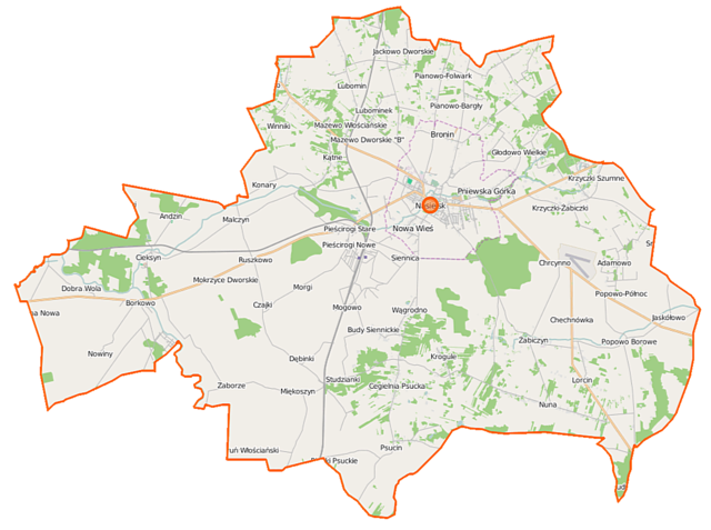
Polski: Mapa gminy Nasielsk, Polska
English: Map of Gmina Nasielsk, Poland |
|||||||||
| Date | ||||||||||
| Source | You may find a page on the OpenStreetMap wiki page for Nasielsk (gmina) | |||||||||
| Creator |
OpenStreetMap contributors OpenStreetMap contributors |
|||||||||
| Permission (Reusing this file) |
OpenStreetMap data is available under the Open Database License (details). Map tiles are licensed under the Creative Commons Attribution-ShareAlike 2.0 license (CC-BY-SA 2.0).
This file is licensed under the Creative Commons Attribution-Share Alike 2.0 Generic license.
|
|||||||||
| Geotemporal data | ||||||||||
| Bounding box |
|
|||||||||
| Georeferencing | If inappropriate please set warp_status = skip to hide. | |||||||||
File history
Click on a date/time to view the file as it appeared at that time.
| Date/Time | Thumbnail | Dimensions | User | Comment | |
|---|---|---|---|---|---|
| current | 11:08, 12 September 2014 | | 1,231 × 918 (367 KB) | VanWiel (talk | contribs) | |
| 18:46, 19 August 2014 |  | 1,231 × 918 (352 KB) | VanWiel (talk | contribs) | {{OpenStreetMap | name = Nasielsk (gmina) | location = Nasielsk (gmina) | description = {{pl|Mapa gminy Nasielsk, Polska}} {{en|Map of Gmina Nasielsk, Poland}} | top = 52.6487 | left = 20.5970 | r... |
You cannot overwrite this file.
File usage on Commons
There are no pages that use this file.
File usage on other wikis
The following other wikis use this file:
- Usage on fr.wikipedia.org
- Usage on mk.wikipedia.org
- Usage on nl.wikipedia.org
- Usage on pl.wikipedia.org
- Nasielsk (gmina)
- Nasielsk
- Andzin
- Budy Siennickie
- Cegielnia Psucka
- Chechnówka
- Chlebiotki
- Chrcynno
- Cieksyn
- Głodowo Wielkie
- Jackowo Dworskie
- Jackowo Włościańskie
- Jaskółowo
- Kątne
- Kędzierzawice
- Krogule
- Krzyczki-Pieniążki
- Krzyczki Szumne
- Krzyczki-Żabiczki
- Lelewo
- Lorcin (województwo mazowieckie)
- Malczyn
- Mazewo Dworskie „A”
- Mazewo Dworskie „B”
- Mazewo Włościańskie
- Miękoszyn
- Miękoszynek
- Mogowo
- Mokrzyce Dworskie
- Mokrzyce Włościańskie
- Nuna
- Nowe Pieścirogi
- Paulinowo (powiat nowodworski)
- Pianowo-Bargły
- Pianowo-Daczki
- Popowo Borowe
- Popowo-Północ
- Psucin
- Słustowo
- Stare Pieścirogi
- Toruń Dworski
- Toruń Włościański
- Borkowo (województwo mazowieckie)
- Czajki (województwo mazowieckie)
- Studzianki (województwo mazowieckie)
- Winniki (województwo mazowieckie)
- Żabiczyn (województwo mazowieckie)
View more global usage of this file.
_location_map.png)
_location_map.png&oldid=519984715)