File:Naruszewo (gmina) location map.png
Jump to navigation
Jump to search

Size of this preview: 765 × 600 pixels. Other resolutions: 306 × 240 pixels | 612 × 480 pixels | 980 × 768 pixels | 1,046 × 820 pixels.
Original file (1,046 × 820 pixels, file size: 178 KB, MIME type: image/png)
Captions
Captions
Add a one-line explanation of what this file represents
| Description |
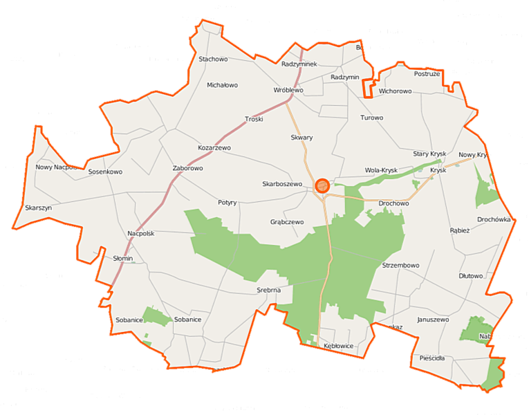
Polski: Mapa gminy Naruszewo, Polska
English: Map of Gmina Naruszewo, Poland |
|||||||||
| Date | ||||||||||
| Source | You may find a page on the OpenStreetMap wiki page for Naruszewo (gmina) | |||||||||
| Creator |
OpenStreetMap contributors OpenStreetMap contributors |
|||||||||
| Permission (Reusing this file) |
OpenStreetMap data is available under the Open Database License (details). Map tiles are licensed under the Creative Commons Attribution-ShareAlike 2.0 license (CC-BY-SA 2.0).
This file is licensed under the Creative Commons Attribution-Share Alike 2.0 Generic license.
|
|||||||||
| Geotemporal data | ||||||||||
| Bounding box |
|
|||||||||
| Georeferencing | If inappropriate please set warp_status = skip to hide. | |||||||||
File history
Click on a date/time to view the file as it appeared at that time.
| Date/Time | Thumbnail | Dimensions | User | Comment | |
|---|---|---|---|---|---|
| current | 11:33, 18 September 2014 | | 1,046 × 820 (178 KB) | VanWiel (talk | contribs) | |
| 20:24, 30 May 2014 |  | 1,000 × 776 (382 KB) | VanWiel (talk | contribs) | {{OpenStreetMap | name = Naruszewo (gmina) | location = Naruszewo (gmina) | description = {{pl|Mapa gminy Naruszewo, Polska}} {{en|Map of Gmina Naruszewo, Poland}} | top = 52.5884 | left = 20.1819... |
You cannot overwrite this file.
File usage on Commons
There are no pages that use this file.
File usage on other wikis
The following other wikis use this file:
- Usage on fr.wikipedia.org
- Usage on nl.wikipedia.org
- Usage on pl.wikipedia.org
- Naruszewo (gmina)
- Drochowo
- Drochówka
- Dłutowo
- Grąbczewo (województwo mazowieckie)
- Krysk
- Kozarzewo
- Łazęki
- Naruszewo
- Nowe Naruszewo
- Nowy Nacpolsk
- Pieścidła
- Postróże
- Potyry
- Skwary (województwo mazowieckie)
- Sobanice
- Sosenkowo
- Stary Nacpolsk
- Strzembowo
- Troski
- Wichorowo
- Januszewo (województwo mazowieckie)
- Kębłowice (województwo mazowieckie)
- Skarboszewo (województwo mazowieckie)
- Skarszyn (województwo mazowieckie)
- Zaborowo (województwo mazowieckie)
- Michałowo (powiat płoński)
- Radzymin (powiat płoński)
- Srebrna (powiat płoński)
- Stachowo (powiat płoński)
- Żukowo (powiat płoński)
- Nacpolsk
- Rąbież (powiat płoński)
- Radzyminek
- Wronino
- Beszyno
- Wola-Krysk
- Wróblewo (powiat płoński)
- Nowy Krysk
- Żukowo Poświętne
- Parafia Świętych Apostołów Piotra i Pawła w Radzyminku
- Parafia św. Tekli w Naruszewie
- Parafia Kościoła Katolickiego Mariawitów w Michałowie
- Rezerwat przyrody Noskowo
- Drochówka za Rąbieżem
- Sosenkowo-Osiedle
- Stary Skarszyn
- Tustań-Leśniczówka
View more global usage of this file.
_location_map.png)
_location_map.png&oldid=647022976)