File:Nansen Fram Map-de.svg
Jump to navigation
Jump to search

Size of this PNG preview of this SVG file: 800 × 479 pixels. Other resolutions: 320 × 192 pixels | 640 × 383 pixels | 1,024 × 614 pixels | 1,280 × 767 pixels | 2,560 × 1,534 pixels | 1,003 × 601 pixels.
Original file (SVG file, nominally 1,003 × 601 pixels, file size: 177 KB)
Captions
Captions
Add a one-line explanation of what this file represents
Summary
[edit]
| Description |
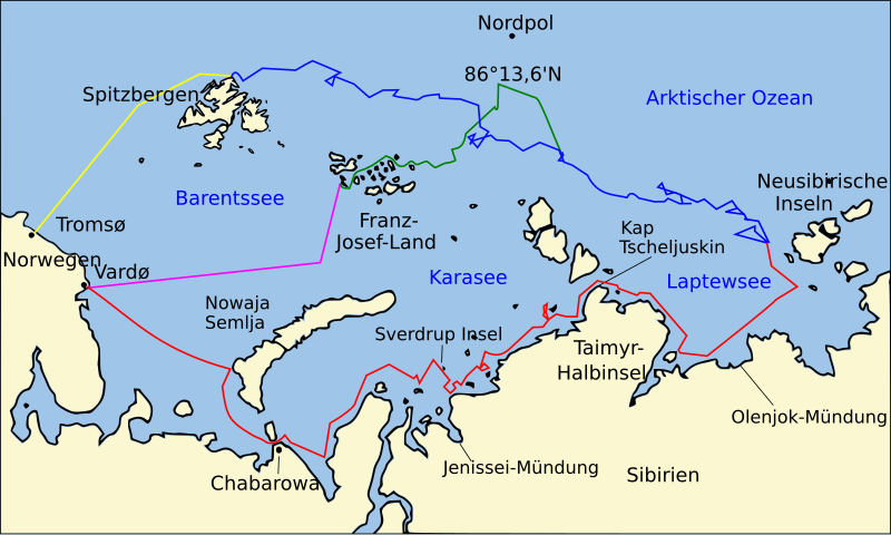
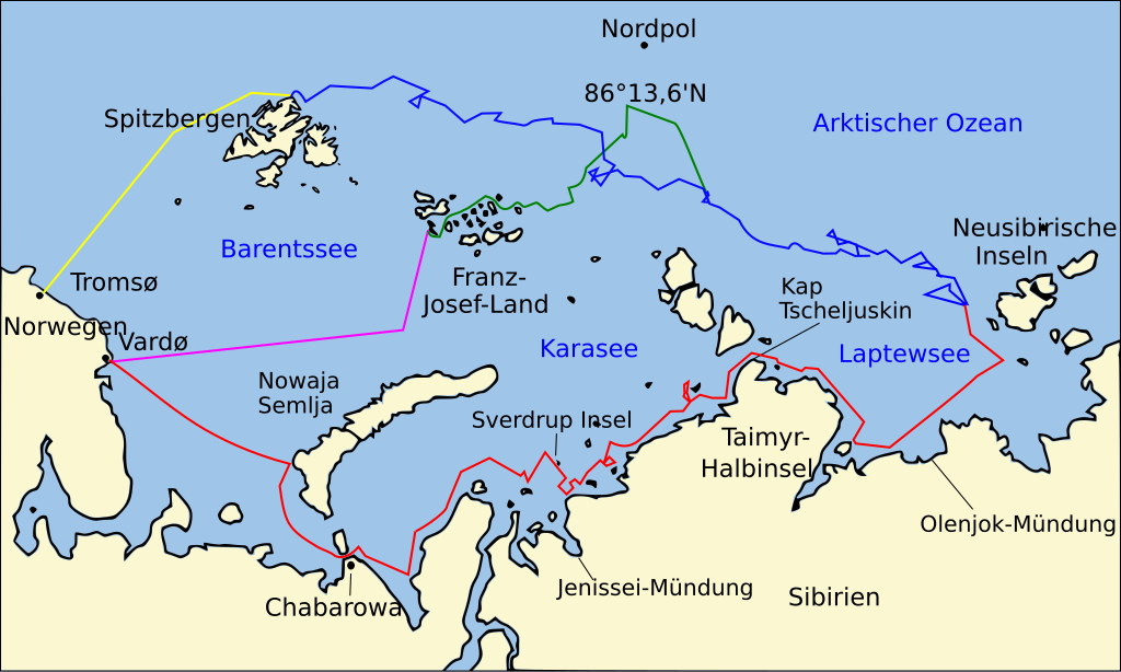
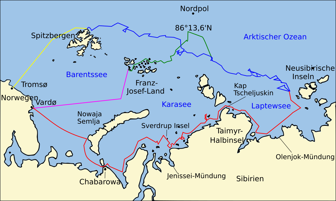
Deutsch: Karte des Arktischen Ozeans mit den Routen der Fram-Expedition unter der Leitung von Fridtjof Nansen:
Östliche Route der Fram von Vardø entlang der sibirischen Küste bis zu den Neusibirischen Inseln und ins Packeis, Jul. bis Sept. 1893
Drift der Fram durch das Packeis von den Neusibirischen Inseln bis nach Spitzbergen, Sept. 1893 – Aug. 1896
Marsch von Nansen und Johansen nach Norden bis 86°13,6'N und die nachfolgende Rückkehr nach Kap Flora auf Franz-Josef-Land, Feb. 1895 – Jun. 1896 Nansens und Johansens Rückfahrt von Kap Flora nach Vardø from Cape Flora, Aug. 1896 Rückfahrt der Fram von Spitzbergen nach Tromsø, Aug. 1896 |
| Date | |
| Source | Own work |
| Author | Jamiri |
| Other versions | File:Nansen Fram Map.svg |
Licensing
[edit]
I, the copyright holder of this work, hereby publish it under the following licenses:

|
Permission is granted to copy, distribute and/or modify this document under the terms of the GNU Free Documentation License, Version 1.2 or any later version published by the Free Software Foundation; with no Invariant Sections, no Front-Cover Texts, and no Back-Cover Texts. A copy of the license is included in the section entitled GNU Free Documentation License. |
This file is licensed under the Creative Commons Attribution 3.0 Unported license.
- You are free:
- to share – to copy, distribute and transmit the work
- to remix – to adapt the work
- Under the following conditions:
- attribution – You must give appropriate credit, provide a link to the license, and indicate if changes were made. You may do so in any reasonable manner, but not in any way that suggests the licensor endorses you or your use.
You may select the license of your choice.
File history
Click on a date/time to view the file as it appeared at that time.
| Date/Time | Thumbnail | Dimensions | User | Comment | |
|---|---|---|---|---|---|
| current | 21:47, 8 December 2011 | | 1,003 × 601 (177 KB) | Jamiri (talk | contribs) | Spitsbergen → Spitzbergen |
| 13:46, 30 April 2011 |  | 1,003 × 601 (177 KB) | Jamiri (talk | contribs) | {{Information |Description ={{de|1=Karte des Arktischen Ozeans mit den Routen der Fram-Expedition unter der Leitung von Fridtjof Nansen: {{legend|red|Östliche Route der Fram von Vardø entlang der sibirischen Küste bis zu den Neusibirischen Inseln u |
You cannot overwrite this file.
File usage on Commons
There are no pages that use this file.
File usage on other wikis
The following other wikis use this file:
- Usage on de.wikipedia.org