File:Nanatsumori 6mountains fromOohirajouato.jpg
Jump to navigation
Jump to search
Size of this preview: 800 × 450 pixels. Other resolutions: 320 × 180 pixels | 640 × 360 pixels | 1,024 × 576 pixels | 1,280 × 720 pixels | 3,200 × 1,800 pixels.
Original file (3,200 × 1,800 pixels, file size: 1.63 MB, MIME type: image/jpeg)
Captions
Captions
Add a one-line explanation of what this file represents
Summary
[edit]
| Description |
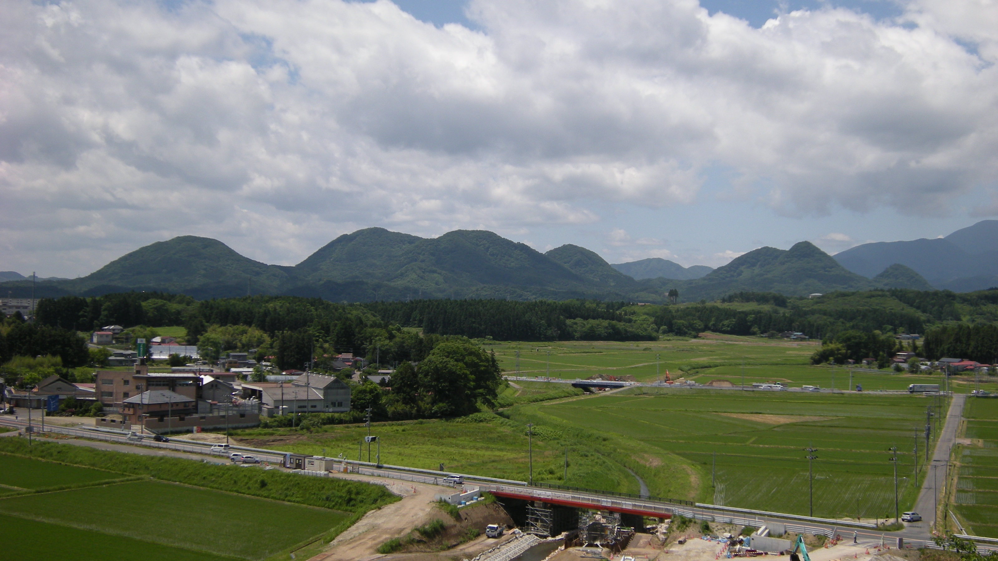
日本語:宮城県黒川郡大和町の七ツ森の七山のうちの、東側にかたまった六山。大衡村の大衡城跡より南西に向いて撮影。
左から、松倉山、撫倉山、大倉山、蜂倉山、すこし間が空いて、鎌倉山、遂倉山。遂倉山のさらに右に、低く三角のたんがら森が写っている。笹倉山は、この位置からは撫倉山の背後に隠れている。手前の道路は国道四号線。 |
| Date | |
| Source | Own work |
| Author | Wkatsuhiro |
| Camera location | | View this and other nearby images on: OpenStreetMap |
|---|
Licensing
[edit]
| I, the copyright holder of this work, release this work into the public domain. This applies worldwide. In some countries this may not be legally possible; if so: I grant anyone the right to use this work for any purpose, without any conditions, unless such conditions are required by law. |
File history
Click on a date/time to view the file as it appeared at that time.
| Date/Time | Thumbnail | Dimensions | User | Comment | |
|---|---|---|---|---|---|
| current | 23:57, 26 June 2009 | | 3,200 × 1,800 (1.63 MB) | Wkatsuhiro (talk | contribs) | {{Information |Description={{ja|1=宮城県黒川郡大和町の七ツ森の七山のうちの、東側にかたまった六山。大衡村の大衡城跡より南西に向いて撮影。 左から、松倉山、撫倉山、大倉山� |
You cannot overwrite this file.
File usage on Commons
The following page uses this file:
File usage on other wikis
The following other wikis use this file:
- Usage on ja.wikipedia.org