File:Nadachikuzure Stereogram.jpg
Jump to navigation
Jump to search

Size of this preview: 800 × 479 pixels. Other resolutions: 320 × 192 pixels | 640 × 383 pixels | 1,024 × 613 pixels | 1,420 × 850 pixels.
Original file (1,420 × 850 pixels, file size: 235 KB, MIME type: image/jpeg)
Captions
Captions
Add a one-line explanation of what this file represents
Summary
[edit]
| Description |
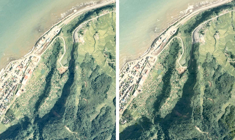
'Nadachikuzure'. Landslide of Nadachi Town in Niigata, Japan. ja: 名立崩れ航空写真のステレオグラム(交差法) |
| Date | Y1976 |
| Source | See below |
| Author | Triglav |
| Object location | | View this and other nearby images on: OpenStreetMap |
|---|
Licensing
[edit]

|
The copyright holder of this file, the Ministry of Land, Infrastructure, Transport and Tourism of Japan, allows anyone to use it for any purpose, provided that the copyright holder is properly attributed. Redistribution, derivative work, commercial use, and all other use is permitted. |
Attribution:
Copyright © National Land Image Information (Color Aerial Photographs), Ministry of Land, Infrastructure, Transport and Tourism
|
 |
This image is copyrighted by the Ministry of Land, Infrastructure, Transport and Tourism of Japan. For terms of use, see the stipulation to use of National Land Information (in Japanese) and message from MLIT (in Japanese and English). When you display this image on an article, include the following phrase in the description: "Made based on National Land Image Information (Color Aerial Photographs), Ministry of Land, Infrastructure, Transport and Tourism".
|
File history
Click on a date/time to view the file as it appeared at that time.
| Date/Time | Thumbnail | Dimensions | User | Comment | |
|---|---|---|---|---|---|
| current | 15:58, 25 February 2012 | | 1,420 × 850 (235 KB) | Triglav (talk | contribs) | {{Information |Description=Nadachikuzure in Niigata, Japan.<br />ja: 名立崩れ航空写真のステレオグラム(交差法) |Source=See below |Date=Y1976 |Location= |Author=Triglav |Permission= |other_vers... |
You cannot overwrite this file.
File usage on Commons
The following 2 pages use this file:
File usage on other wikis
The following other wikis use this file: