File:NTS Areas Frenchman Flat.png
Jump to navigation
Jump to search

Size of this preview: 423 × 599 pixels. Other resolutions: 169 × 240 pixels | 339 × 480 pixels | 542 × 768 pixels | 723 × 1,024 pixels | 1,841 × 2,606 pixels.
Original file (1,841 × 2,606 pixels, file size: 55 KB, MIME type: image/png)
Captions
Captions
Add a one-line explanation of what this file represents
Summary
[edit]
| Description |
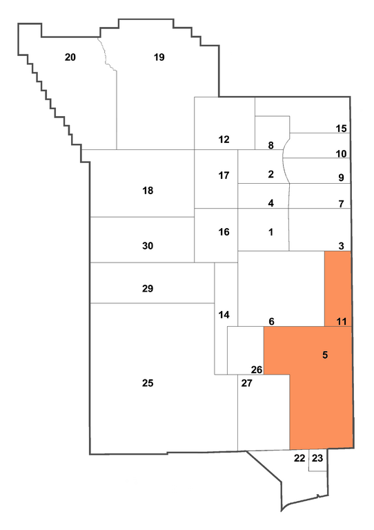
English: Graphic image of the Nuclear Test Site (NTS) geographic section called Frenchman Flat, as defined by Area 5 and Area 11, per United States Geographic Survey.
http://pubs.usgs.gov/of/2003/ofr-03-125/ofr-03-125.pdf |
| Date | |
| Source | Own work |
| Author | Binksternet |
| Permission (Reusing this file) |
Public domain. No restrictions on use. |
Licensing
[edit]
| I, the copyright holder of this work, release this work into the public domain. This applies worldwide. In some countries this may not be legally possible; if so: I grant anyone the right to use this work for any purpose, without any conditions, unless such conditions are required by law. |
File history
Click on a date/time to view the file as it appeared at that time.
| Date/Time | Thumbnail | Dimensions | User | Comment | |
|---|---|---|---|---|---|
| current | 00:38, 30 October 2011 | | 1,841 × 2,606 (55 KB) | Bomazi (talk | contribs) | Removed caption. |
| 19:40, 8 March 2009 |  | 1,841 × 2,744 (64 KB) | Binksternet (talk | contribs) | {{Information |Description={{en|1=Graphic image of the Nuclear Test Site (NTS) geographic section called Frenchman Flat, as defined by Area 5 and Area 11, per United States Geographic Survey. http://pubs.usgs.gov/of/2003/ofr-03-125/ofr-03-125.pdf}} |Sou |
You cannot overwrite this file.
File usage on Commons
There are no pages that use this file.
File usage on other wikis
The following other wikis use this file:
- Usage on no.wikipedia.org
- Usage on pt.wikipedia.org