File:NSG Hermannsdorf (2).jpg
Jump to navigation
Jump to search

Size of this preview: 678 × 600 pixels. Other resolutions: 271 × 240 pixels | 543 × 480 pixels | 868 × 768 pixels | 1,158 × 1,024 pixels | 2,316 × 2,048 pixels | 4,484 × 3,966 pixels.
Original file (4,484 × 3,966 pixels, file size: 7.8 MB, MIME type: image/jpeg)
Captions
Captions
Add a one-line explanation of what this file represents
Summary
[edit].jpg&action=edit§ion=1)
| Description |
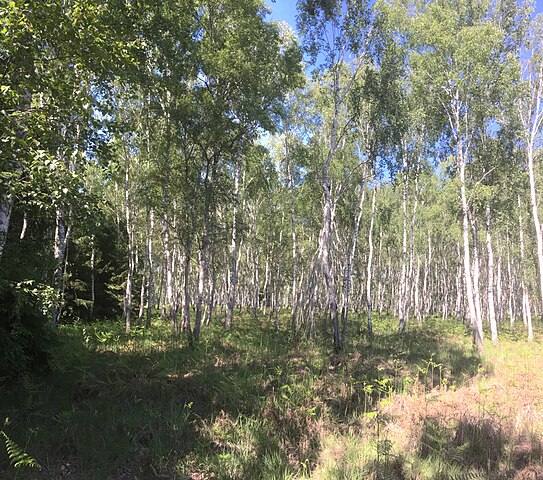
Deutsch: Naturschutzgebiet Hermannsdorf, nahe Weißwasser/O.L., Kennung D 84, WDPA-Nr. 14425, Landkreis Görlitz, Fläche 21,5 ha, Datum der Verordnung 1967
English: Nature reserve area Hermannsdorf, near Weißwasser/O.L. |
| Date | |
| Source | Own work |
| Author | Tommes |
| Camera location | | View this and other nearby images on: OpenStreetMap |
|---|
.jpg¶ms=051.477600_N_0014.648542_E_globe:Earth_type:camera_alt:134.14578_source:exif_heading:121.66&language=en)
| Object location | | View this and other nearby images on: OpenStreetMap |
|---|
.jpg¶ms=051.477800_N_0014.653800_E_globe:Earth_class:object_type:object_region:DE-SN_&language=en)
This is a picture of the protected area listed at WDPA under the ID 14425
|
Licensing
[edit].jpg&action=edit§ion=2)
I, the copyright holder of this work, hereby publish it under the following license:
This file is licensed under the Creative Commons Attribution-Share Alike 4.0 International license.
- You are free:
- to share – to copy, distribute and transmit the work
- to remix – to adapt the work
- Under the following conditions:
- attribution – You must give appropriate credit, provide a link to the license, and indicate if changes were made. You may do so in any reasonable manner, but not in any way that suggests the licensor endorses you or your use.
- share alike – If you remix, transform, or build upon the material, you must distribute your contributions under the same or compatible license as the original.
This image was uploaded as part of Wiki Loves Earth 2019.
|
 |
File history
Click on a date/time to view the file as it appeared at that time.
| Date/Time | Thumbnail | Dimensions | User | Comment | |
|---|---|---|---|---|---|
| current | 19:37, 30 May 2019 | | 4,484 × 3,966 (7.8 MB) | Tommes (talk | contribs) | == {{int:filedesc}} == {{Information |Description = {{de|1=Naturschutzgebiet Hermannsdorf, nahe Weißwasser/O.L., Kennung D 84, WDPA-Nr. [https://www.protectedplanet.net/14425 14425], Landkreis Görlitz, Fläche 21,5 ha, Datum der Verordnung 1967}} {{en|1=Nature reserve area Hermannsdorf, near Weißwasser/O.L.}} |Source = {{own}} |Author = <span style="font-family: Segoe Scr... |
You cannot overwrite this file.
File usage on Commons
The following page uses this file:
.jpg&oldid=739769751)