File:NSB El 18 2245 Tunga.jpg
Jump to navigation
Jump to search
Size of this preview: 800 × 494 pixels. Other resolutions: 320 × 198 pixels | 640 × 395 pixels | 1,024 × 632 pixels | 1,280 × 790 pixels | 2,560 × 1,580 pixels | 6,606 × 4,078 pixels.
Original file (6,606 × 4,078 pixels, file size: 7.22 MB, MIME type: image/jpeg)
Captions
Captions
Add a one-line explanation of what this file represents
Summary
[edit]
| Description |
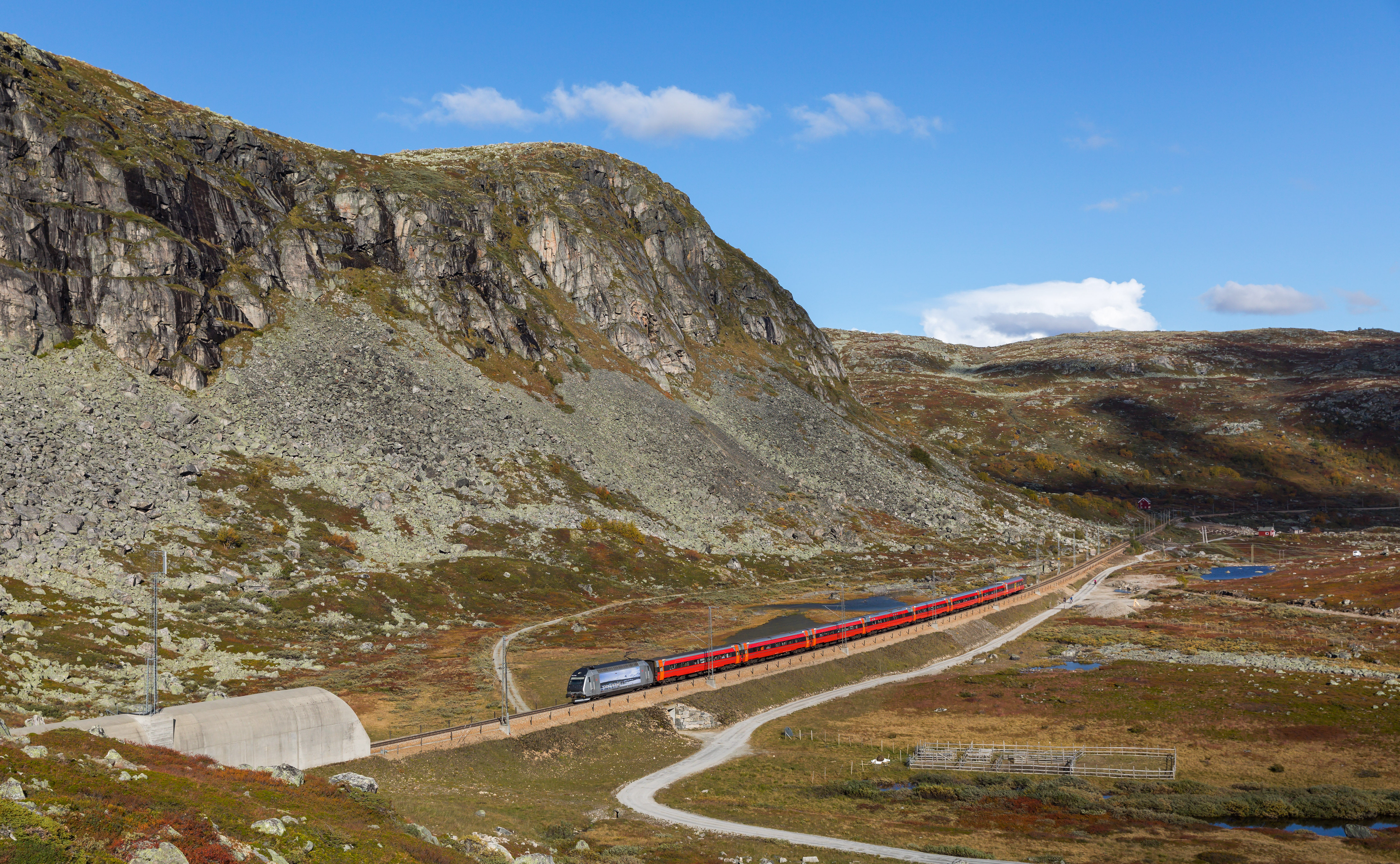
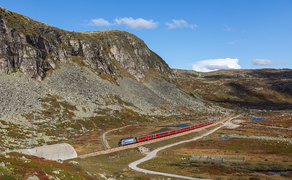
English: This Regiontog Oslo - Bergen has just reached the rebuilt part of the line across the Hardangervidda. El 18 2245 quickly accelerates the B7 coaches (with a B5 at the end) to 160 km/h and is about to enter the Tunga tunnel. Taken near Haugastøl, Norway.
Deutsch: Dieser Regiontog von Oslo nach Bergen hat soeben den Neubauabschnitt über die Hardangervidda erreicht. El 18 2245 beschleunigt die B7-Wagen (mit einem B5 am Ende) rasch auf 160 km/h und wird gleich in den Tunga-Tunnel einfahren. Aufgenommen in der Nähe von Haugastøl, Norwegen. |
| Date | |
| Source | Own work, also avilable at https://bahnbilder.ch/picture/27719 |
| Author | Kabelleger / David Gubler |
| Camera location | | View this and other nearby images on: OpenStreetMap |
|---|
Licensing
[edit]
I, the copyright holder of this work, hereby publish it under the following license:
This file is licensed under the Creative Commons Attribution-Share Alike 4.0 International license.
- You are free:
- to share – to copy, distribute and transmit the work
- to remix – to adapt the work
- Under the following conditions:
- attribution – You must give appropriate credit, provide a link to the license, and indicate if changes were made. You may do so in any reasonable manner, but not in any way that suggests the licensor endorses you or your use.
- share alike – If you remix, transform, or build upon the material, you must distribute your contributions under the same or compatible license as the original.
File history
Click on a date/time to view the file as it appeared at that time.
| Date/Time | Thumbnail | Dimensions | User | Comment | |
|---|---|---|---|---|---|
| current | 20:17, 29 September 2017 | | 6,606 × 4,078 (7.22 MB) | Kabelleger (talk | contribs) | User created page with UploadWizard |
You cannot overwrite this file.
File usage on Commons
The following 2 pages use this file:
File usage on other wikis
The following other wikis use this file:
- Usage on cs.wikipedia.org
- Usage on de.wikivoyage.org
- Usage on en.wikipedia.org
- Usage on en.wikivoyage.org
- Usage on fa.wikipedia.org
- Usage on hu.wikipedia.org
- Usage on id.wikipedia.org
- Usage on no.wikipedia.org
- Usage on pl.wikipedia.org
- Usage on simple.wikipedia.org
- Usage on sl.wikipedia.org
- Usage on www.wikidata.org
- Usage on zh.wikipedia.org