File:NRW-RB33.svg
Jump to navigation
Jump to search

Size of this PNG preview of this SVG file: 527 × 524 pixels. Other resolutions: 241 × 240 pixels | 483 × 480 pixels | 772 × 768 pixels | 1,030 × 1,024 pixels | 2,060 × 2,048 pixels.
Original file (SVG file, nominally 527 × 524 pixels, file size: 124 KB)
Captions
Captions
Add a one-line explanation of what this file represents
Summary
[edit]
| Description |
|
| Date | (UTC) |
| Source | self-made, based on File:NRW-RB33.png and File:North Rhine-Westphalia location map 02.svg |
| Author | Freddy2001 (talk) |
Licensing
[edit]
| I, the copyright holder of this work, release this work into the public domain. This applies worldwide. In some countries this may not be legally possible; if so: I grant anyone the right to use this work for any purpose, without any conditions, unless such conditions are required by law. |
File history
Click on a date/time to view the file as it appeared at that time.
| Date/Time | Thumbnail | Dimensions | User | Comment | |
|---|---|---|---|---|---|
| current | 14:38, 22 March 2016 | | 527 × 524 (124 KB) | Mansent (talk | contribs) | Upload Zweig nach Heinsberg korrigiert |
| 14:36, 22 March 2016 |  | 527 × 524 (124 KB) | Mansent (talk | contribs) | Zweig nach Heinsberg ergänzt | |
| 14:17, 3 June 2015 |  | 527 × 524 (121 KB) | Freddy2001 (talk | contribs) | Color fix (#FF0000 to #CC0000) | |
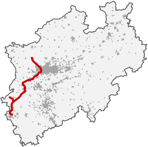
| 14:08, 3 June 2015 |  | 527 × 524 (121 KB) | Freddy2001 (talk | contribs) | {{Information |Description= * {{de|Streckenkarte der Linie RB 33 „Rhein-Niers-Bahn“ in Nordrhein-Westfalen}} * {{en|map of the Regionalbahn-line 33 “Rhein-Niers-Bahn” in the German state of North Rhine-Westphalia}} |Source=self-made, based... |
You cannot overwrite this file.
File usage on Commons
The following 9 pages use this file:
- User:Chumwa/OgreBot/Potential transport maps/2016 March 21-31
- User:Chumwa/OgreBot/Public transport information/2015 June 1-10
- User:Chumwa/OgreBot/Public transport information/2016 March 21-31
- User:Chumwa/OgreBot/Transport Maps/2015 June 1-10
- User:Chumwa/OgreBot/Transport Maps/2016 March 21-31
- User:Chumwa/OgreBot/Travel and communication maps/2016 March 21-31
- User:Nordlicht8/Rail Germany/2015 June 1-10
- User:Nordlicht8/Rail Germany/2016 March 21-31
- Category:Rhein-Niers-Bahn
File usage on other wikis
The following other wikis use this file:
- Usage on de.wikipedia.org
- Usage on www.wikidata.org