File:NPS valley-forge-mt-joy-trail-map.jpg
Jump to navigation
Jump to search

Size of this preview: 320 × 599 pixels. Other resolutions: 256 × 480 pixels | 410 × 768 pixels | 546 × 1,024 pixels | 1,388 × 2,600 pixels.
Original file (1,388 × 2,600 pixels, file size: 679 KB, MIME type: image/jpeg)
Captions
Captions
Add a one-line explanation of what this file represents
Summary
[edit]
| Description |
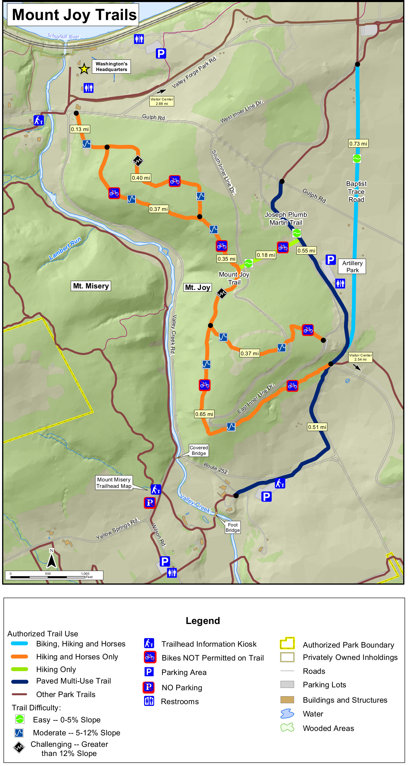
English: Mt. Joy trail map that shows the hilly trails around Mt. Joy that have some nice views looking over Valley Forge and Valley Creek. The Mount Joy trails are mostly for hikers and horses. |
| Date | |
| Source | U.S. National Park Service (http://npmaps.com/wp-content/uploads/valley-forge-mt-joy-trail-map.jpg) |
| Author | U.S. National Park Service, restoration/cleanup by Matt Holly |
Licensing
[edit]
| This image or media file contains material based on a work of a National Park Service employee, created as part of that person's official duties. As a work of the U.S. federal government, such work is in the public domain in the United States. See the NPS website and NPS copyright policy for more information. |
File history
Click on a date/time to view the file as it appeared at that time.
| Date/Time | Thumbnail | Dimensions | User | Comment | |
|---|---|---|---|---|---|
| current | 09:48, 17 May 2017 | | 1,388 × 2,600 (679 KB) | RKBot (talk | contribs) | =={{int:filedesc}}== {{Information |description= {{en|1=Mt. Joy trail map that shows the hilly trails around Mt. Joy that have some nice views looking over Valley Forge and Valley Creek. The Mount Joy trails are mostly for hikers and horses.}} |date= 2... |
You cannot overwrite this file.
File usage on Commons
The following page uses this file: