File:NPS sleeping-bear-heritage-trail-map.jpg
Jump to navigation
Jump to search

Size of this preview: 618 × 599 pixels. Other resolutions: 247 × 240 pixels | 495 × 480 pixels | 1,000 × 970 pixels.
Original file (1,000 × 970 pixels, file size: 380 KB, MIME type: image/jpeg)
Captions
Captions
Add a one-line explanation of what this file represents
Summary
[edit]
| Description |
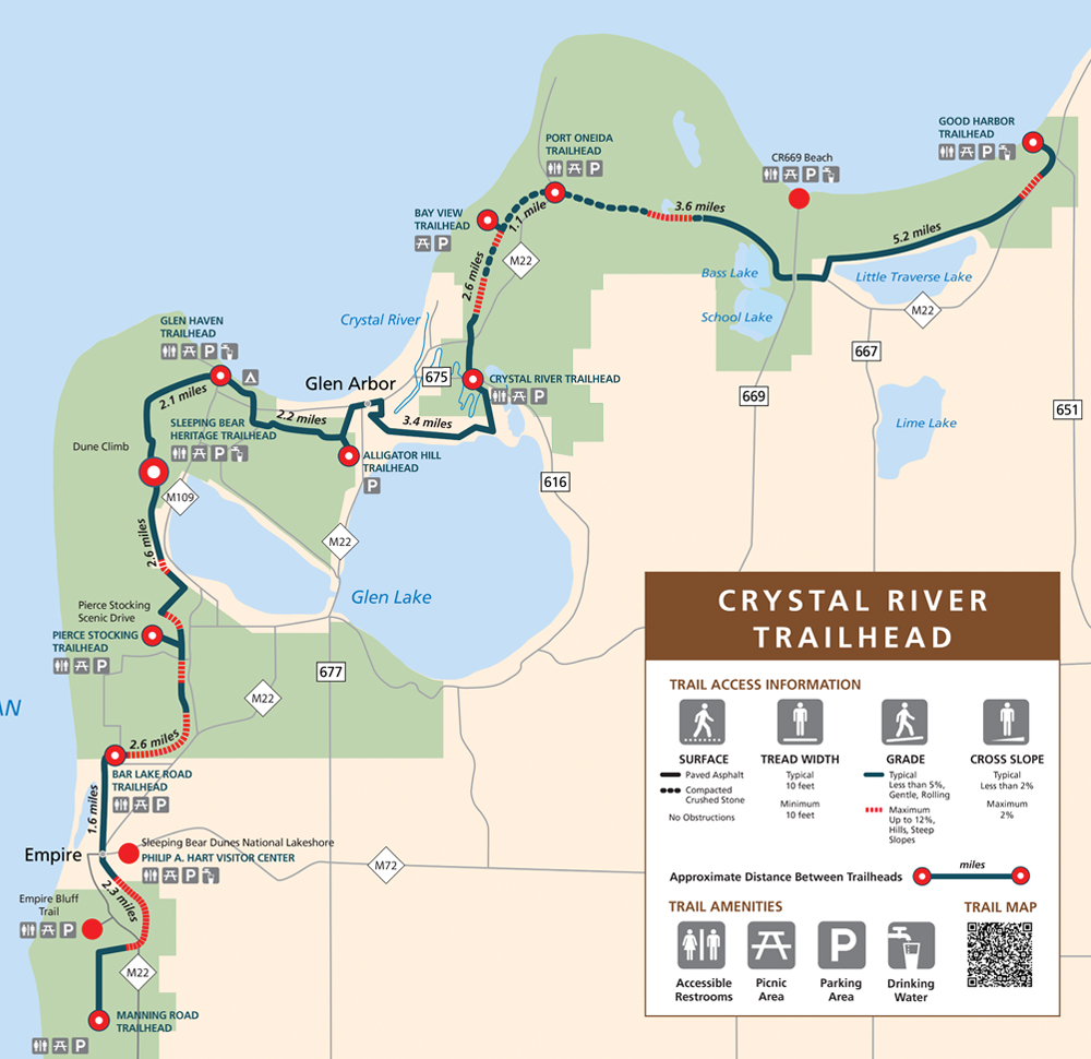
English: Sleeping Bear Heritage Trail map, showing the length of the trail from Good Harbor Trailhead in the north to Manning Road Trailhead to the south, labeling the distance between points of interest. |
| Date | |
| Source | U.S. National Park Service (http://npmaps.com/wp-content/uploads/sleeping-bear-heritage-trail-map.jpg) |
| Author | U.S. National Park Service, restoration/cleanup by Matt Holly |
Licensing
[edit]
| This image or media file contains material based on a work of a National Park Service employee, created as part of that person's official duties. As a work of the U.S. federal government, such work is in the public domain in the United States. See the NPS website and NPS copyright policy for more information. |
File history
Click on a date/time to view the file as it appeared at that time.
| Date/Time | Thumbnail | Dimensions | User | Comment | |
|---|---|---|---|---|---|
| current | 09:34, 17 May 2017 | | 1,000 × 970 (380 KB) | RKBot (talk | contribs) | =={{int:filedesc}}== {{Information |description= {{en|1=Sleeping Bear Heritage Trail map, showing the length of the trail from Good Harbor Trailhead in the north to Manning Road Trailhead to the south, labeling the distance between points of interest.}... |
You cannot overwrite this file.
File usage on Commons
The following page uses this file: