File:NPS sleeping-bear-dunes-platte-plains-hiking-ski-trail-map.gif
Jump to navigation
Jump to search

Size of this preview: 610 × 600 pixels. Other resolutions: 244 × 240 pixels | 488 × 480 pixels | 781 × 768 pixels | 1,215 × 1,195 pixels.
Original file (1,215 × 1,195 pixels, file size: 476 KB, MIME type: image/gif, 0.1 s)
Captions
Captions
Add a one-line explanation of what this file represents
Summary
[edit]
| Description |
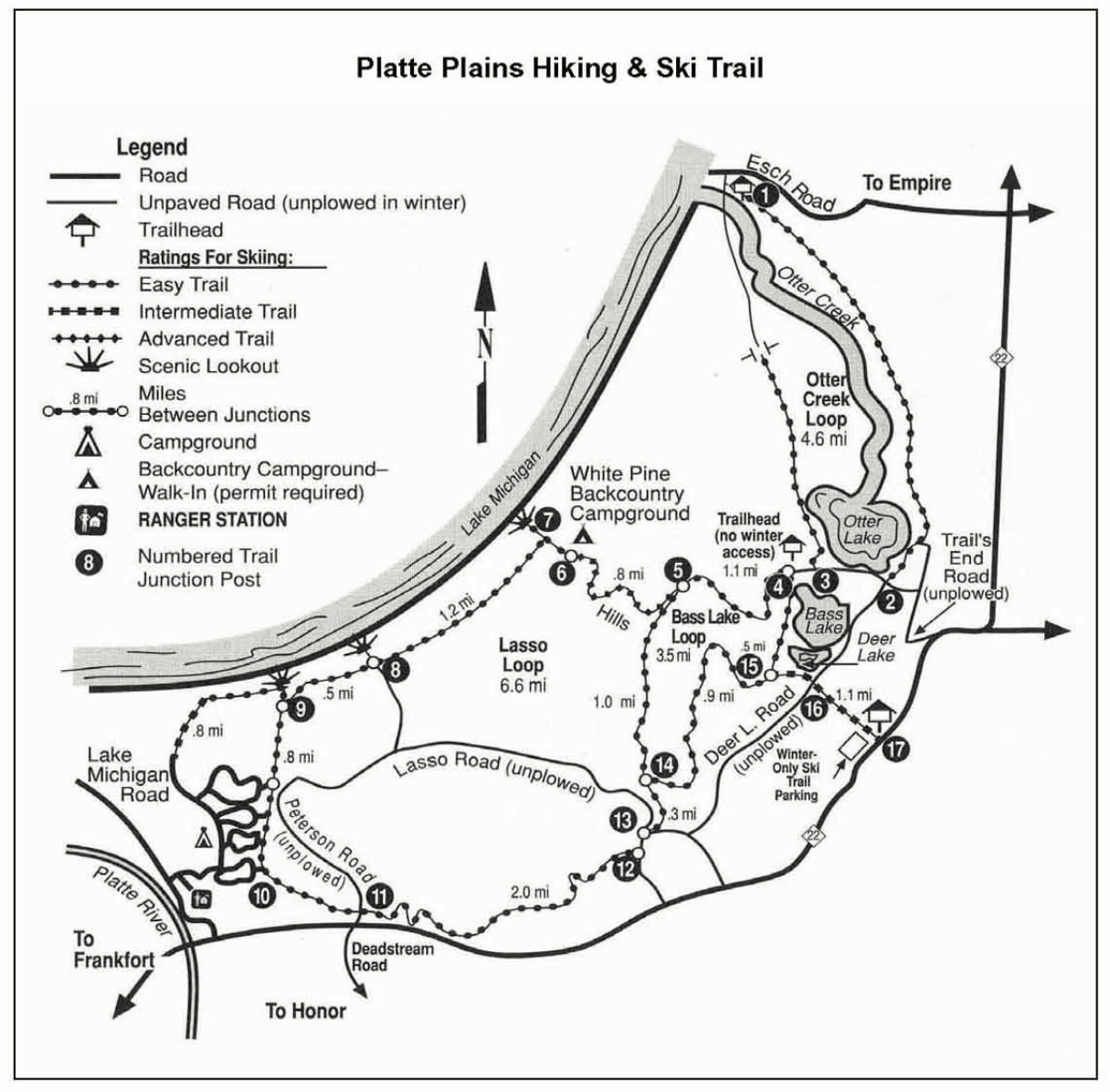
English: The Platte Plains map focuses on the hiking and ski trails located in the area near Otter Lake, Bass Lake, and the White Pine backcountry campground. These are mostly easy ski trails. |
| Date | |
| Source | U.S. National Park Service (http://npmaps.com/wp-content/uploads/sleeping-bear-dunes-platte-plains-hiking-ski-trail-map.gif) |
| Author | U.S. National Park Service, restoration/cleanup by Matt Holly |
Licensing
[edit]
| This image or media file contains material based on a work of a National Park Service employee, created as part of that person's official duties. As a work of the U.S. federal government, such work is in the public domain in the United States. See the NPS website and NPS copyright policy for more information. |
File history
Click on a date/time to view the file as it appeared at that time.
| Date/Time | Thumbnail | Dimensions | User | Comment | |
|---|---|---|---|---|---|
| current | 09:36, 17 May 2017 | | 1,215 × 1,195 (476 KB) | RKBot (talk | contribs) | =={{int:filedesc}}== {{Information |description= {{en|1=The Platte Plains map focuses on the hiking and ski trails located in the area near Otter Lake, Bass Lake, and the White Pine backcountry campground. These are mostly easy ski trails.}} |date= 201... |
You cannot overwrite this file.
File usage on Commons
The following page uses this file: