File:NPS shenandoah-big-meadows-trail-map.gif
Jump to navigation
Jump to search

Size of this preview: 424 × 599 pixels. Other resolutions: 170 × 240 pixels | 339 × 480 pixels | 543 × 768 pixels | 1,178 × 1,665 pixels.
Original file (1,178 × 1,665 pixels, file size: 141 KB, MIME type: image/gif)
Captions
Captions
Add a one-line explanation of what this file represents
Summary
[edit]
| Description |
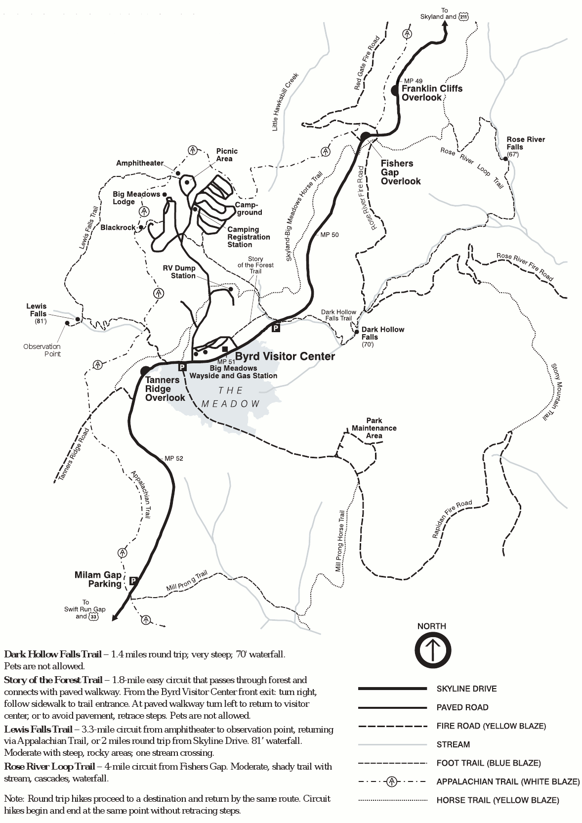
English: Big Meadows trail map, showing trails near the Byrd Visitor Center to waterfalls such as Dark Hollow Falls, Rose River Falls, and Lewis Falls. You’ll also find the Big Meadows Lodge and campground. |
| Date | |
| Source | U.S. National Park Service (http://npmaps.com/wp-content/uploads/shenandoah-big-meadows-trail-map.gif) |
| Author | U.S. National Park Service, restoration/cleanup by Matt Holly |
Licensing
[edit]
| This image or media file contains material based on a work of a National Park Service employee, created as part of that person's official duties. As a work of the U.S. federal government, such work is in the public domain in the United States. See the NPS website and NPS copyright policy for more information. |
File history
Click on a date/time to view the file as it appeared at that time.
| Date/Time | Thumbnail | Dimensions | User | Comment | |
|---|---|---|---|---|---|
| current | 09:31, 17 May 2017 | | 1,178 × 1,665 (141 KB) | RKBot (talk | contribs) | =={{int:filedesc}}== {{Information |description= {{en|1=Big Meadows trail map, showing trails near the Byrd Visitor Center to waterfalls such as Dark Hollow Falls, Rose River Falls, and Lewis Falls. You’ll also find the Big Meadows Lodge and campgrou... |
You cannot overwrite this file.
File usage on Commons
The following page uses this file: