File:NPS rocky-mountain-kawunceeche-valley-trail-map.jpg
Jump to navigation
Jump to search

Size of this preview: 638 × 599 pixels. Other resolutions: 256 × 240 pixels | 511 × 480 pixels | 818 × 768 pixels | 1,090 × 1,024 pixels | 2,500 × 2,348 pixels.
Original file (2,500 × 2,348 pixels, file size: 994 KB, MIME type: image/jpeg)
Captions
Captions
Add a one-line explanation of what this file represents
Summary
[edit]
| Description |
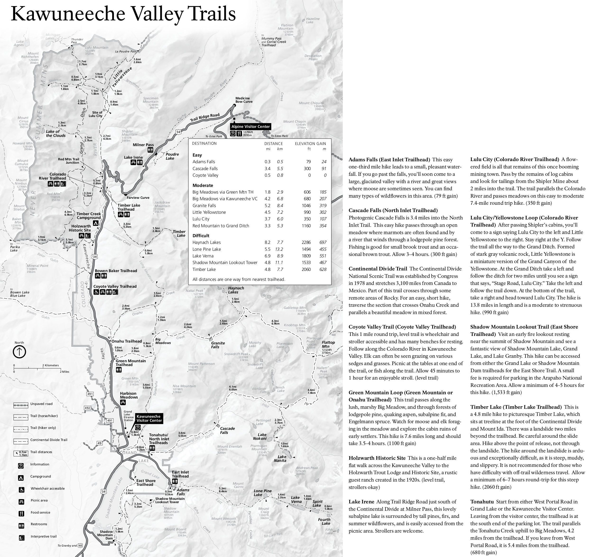
English: Kawuneeche trail map and guide, showing the locations and distance of many of the relatively quiet west side trails. Also nice are the included trail descriptions and time estimates. |
| Date | |
| Source | U.S. National Park Service (http://npmaps.com/wp-content/uploads/rocky-mountain-kawunceeche-valley-trail-map.jpg) |
| Author | U.S. National Park Service, restoration/cleanup by Matt Holly |
Licensing
[edit]
| This image or media file contains material based on a work of a National Park Service employee, created as part of that person's official duties. As a work of the U.S. federal government, such work is in the public domain in the United States. See the NPS website and NPS copyright policy for more information. |
File history
Click on a date/time to view the file as it appeared at that time.
| Date/Time | Thumbnail | Dimensions | User | Comment | |
|---|---|---|---|---|---|
| current | 02:02, 17 May 2017 | | 2,500 × 2,348 (994 KB) | RKBot (talk | contribs) | =={{int:filedesc}}== {{Information |description= {{en|1=Kawuneeche trail map and guide, showing the locations and distance of many of the relatively quiet west side trails. Also nice are the included trail descriptions and time estimates.}} |date= 2017... |
You cannot overwrite this file.
File usage on Commons
There are no pages that use this file.