File:NPS pictured-rocks-chapel-basin-map.jpg
Jump to navigation
Jump to search

Size of this preview: 537 × 600 pixels. Other resolutions: 215 × 240 pixels | 430 × 480 pixels | 687 × 768 pixels | 1,128 × 1,260 pixels.
Original file (1,128 × 1,260 pixels, file size: 140 KB, MIME type: image/jpeg)
Captions
Captions
Add a one-line explanation of what this file represents
Summary
[edit]
| Description |
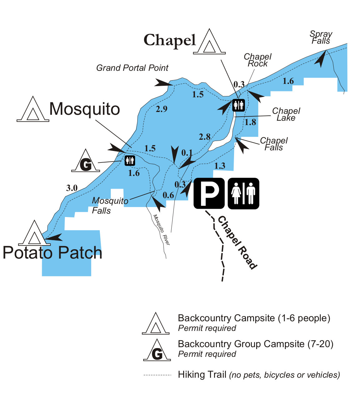
English: This Chapel Basin trail map shows the trails west of Beaver Lake, including Spray Falls, Chapel Lake, Chapel Beach, and Grand Portal Point. Mileages between points of interest are also included. |
| Date | |
| Source | U.S. National Park Service (http://npmaps.com/wp-content/uploads/pictured-rocks-chapel-basin-map.jpg) |
| Author | U.S. National Park Service, restoration/cleanup by Matt Holly |
Licensing
[edit]
| This image or media file contains material based on a work of a National Park Service employee, created as part of that person's official duties. As a work of the U.S. federal government, such work is in the public domain in the United States. See the NPS website and NPS copyright policy for more information. |
File history
Click on a date/time to view the file as it appeared at that time.
| Date/Time | Thumbnail | Dimensions | User | Comment | |
|---|---|---|---|---|---|
| current | 01:51, 17 May 2017 | | 1,128 × 1,260 (140 KB) | RKBot (talk | contribs) | =={{int:filedesc}}== {{Information |description= {{en|1=This Chapel Basin trail map shows the trails west of Beaver Lake, including Spray Falls, Chapel Lake, Chapel Beach, and Grand Portal Point. Mileages between points of interest are also included.}}... |
You cannot overwrite this file.
File usage on Commons
The following page uses this file: