File:NPS ozark-alley-spring-map.jpg
Jump to navigation
Jump to search

Size of this preview: 800 × 551 pixels. Other resolutions: 320 × 220 pixels | 640 × 440 pixels | 1,024 × 705 pixels | 1,302 × 896 pixels.
Original file (1,302 × 896 pixels, file size: 135 KB, MIME type: image/jpeg)
Captions
Captions
Add a one-line explanation of what this file represents
Summary
[edit]
| Description |
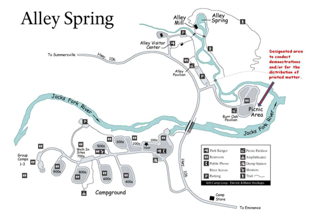
English: This Alley Spring area map focuses on the Alley Spring vicinity of the Jacks Fork River, including the several loops of the campground, visitor center, Alley Mill, Alley Spring, and picnic area. |
| Date | |
| Source | U.S. National Park Service (http://npmaps.com/wp-content/uploads/ozark-alley-spring-map.jpg) |
| Author | U.S. National Park Service, restoration/cleanup by Matt Holly |
Licensing
[edit]
| This image or media file contains material based on a work of a National Park Service employee, created as part of that person's official duties. As a work of the U.S. federal government, such work is in the public domain in the United States. See the NPS website and NPS copyright policy for more information. |
File history
Click on a date/time to view the file as it appeared at that time.
| Date/Time | Thumbnail | Dimensions | User | Comment | |
|---|---|---|---|---|---|
| current | 01:47, 17 May 2017 | | 1,302 × 896 (135 KB) | RKBot (talk | contribs) | =={{int:filedesc}}== {{Information |description= {{en|1=This Alley Spring area map focuses on the Alley Spring vicinity of the Jacks Fork River, including the several loops of the campground, visitor center, Alley Mill, Alley Spring, and picnic area.}}... |
You cannot overwrite this file.
File usage on Commons
The following page uses this file: