File:NPS organ-pipe-arch-canyon-trail-map.jpg
Jump to navigation
Jump to search

Size of this preview: 800 × 374 pixels. Other resolutions: 320 × 149 pixels | 640 × 299 pixels | 1,430 × 668 pixels.
Original file (1,430 × 668 pixels, file size: 299 KB, MIME type: image/jpeg)
Captions
Captions
Add a one-line explanation of what this file represents
Summary
[edit]
| Description |
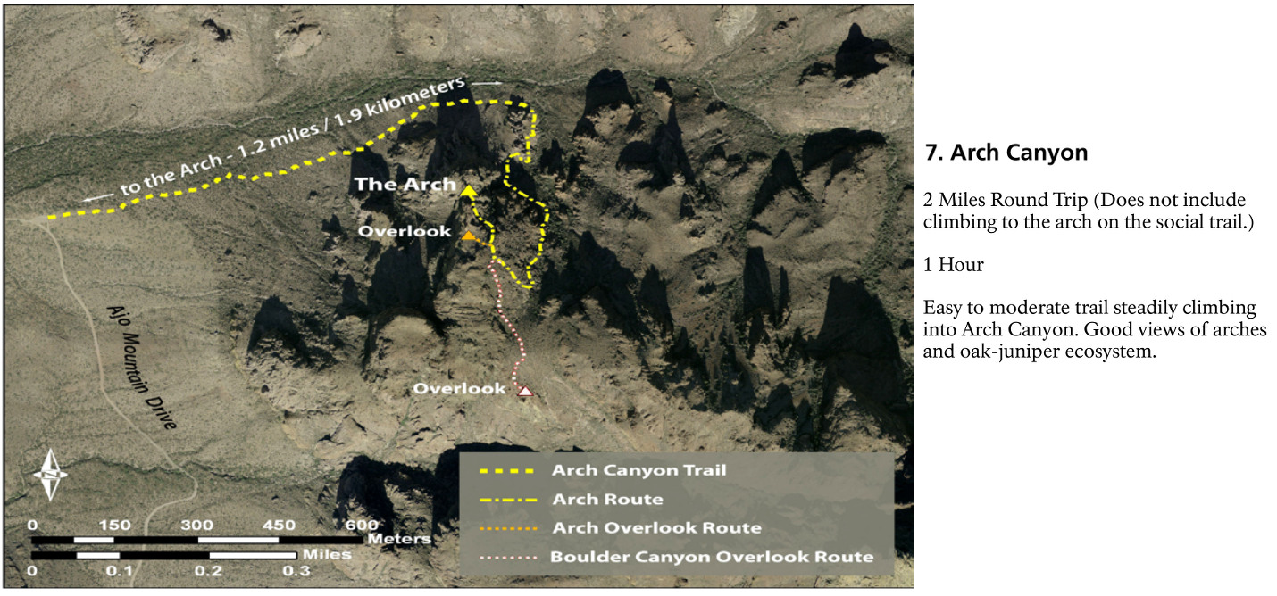
English: Arch Canyon trail map, focusing on the trail to the arch. It’s located off the one-way Ajo Mountain Drive and has some nice overlooks. You can hike up to the arch or view it from below. |
| Date | |
| Source | U.S. National Park Service (http://npmaps.com/wp-content/uploads/organ-pipe-arch-canyon-trail-map.jpg) |
| Author | U.S. National Park Service, restoration/cleanup by Matt Holly |
Licensing
[edit]
| This image or media file contains material based on a work of a National Park Service employee, created as part of that person's official duties. As a work of the U.S. federal government, such work is in the public domain in the United States. See the NPS website and NPS copyright policy for more information. |
File history
Click on a date/time to view the file as it appeared at that time.
| Date/Time | Thumbnail | Dimensions | User | Comment | |
|---|---|---|---|---|---|
| current | 01:45, 17 May 2017 | | 1,430 × 668 (299 KB) | RKBot (talk | contribs) | =={{int:filedesc}}== {{Information |description= {{en|1=Arch Canyon trail map, focusing on the trail to the arch. It’s located off the one-way Ajo Mountain Drive and has some nice overlooks. You can hike up to the arch or view it from below.}} |date=... |
You cannot overwrite this file.
File usage on Commons
The following page uses this file: