File:NPS longs-peak-topo-map.jpg
Jump to navigation
Jump to search

Size of this preview: 489 × 599 pixels. Other resolutions: 196 × 240 pixels | 392 × 480 pixels | 627 × 768 pixels | 836 × 1,024 pixels | 1,672 × 2,048 pixels | 4,401 × 5,390 pixels.
Original file (4,401 × 5,390 pixels, file size: 6.08 MB, MIME type: image/jpeg)
Captions
Captions
Add a one-line explanation of what this file represents
Summary
[edit]
| Description |
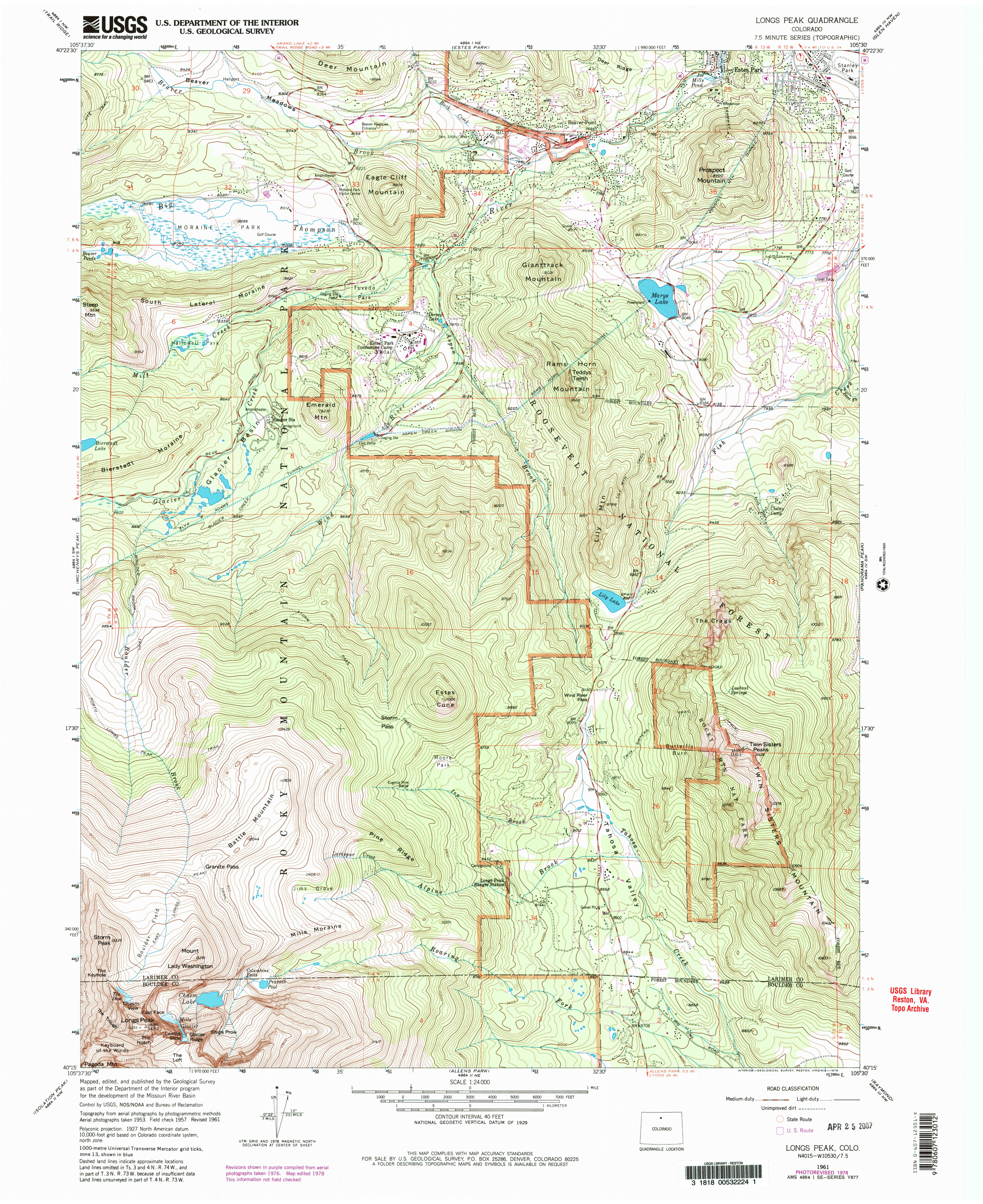
English: The Longs Peak topo map includes the summit of Longs Peak and other popular locations such as Moraine Park. Note that things may have changed since this map was last updated in 1978. |
| Date | |
| Source | U.S. National Park Service (http://npmaps.com/wp-content/uploads/longs-peak-topo-map.jpg) |
| Author | U.S. National Park Service, restoration/cleanup by Matt Holly |
Licensing
[edit]
| This image or media file contains material based on a work of a National Park Service employee, created as part of that person's official duties. As a work of the U.S. federal government, such work is in the public domain in the United States. See the NPS website and NPS copyright policy for more information. |
File history
Click on a date/time to view the file as it appeared at that time.
| Date/Time | Thumbnail | Dimensions | User | Comment | |
|---|---|---|---|---|---|
| current | 02:06, 17 May 2017 | | 4,401 × 5,390 (6.08 MB) | RKBot (talk | contribs) | =={{int:filedesc}}== {{Information |description= {{en|1=The Longs Peak topo map includes the summit of Longs Peak and other popular locations such as Moraine Park. Note that things may have changed since this map was last updated in 1978.}} |date= 2017... |
You cannot overwrite this file.
File usage on Commons
There are no pages that use this file.